
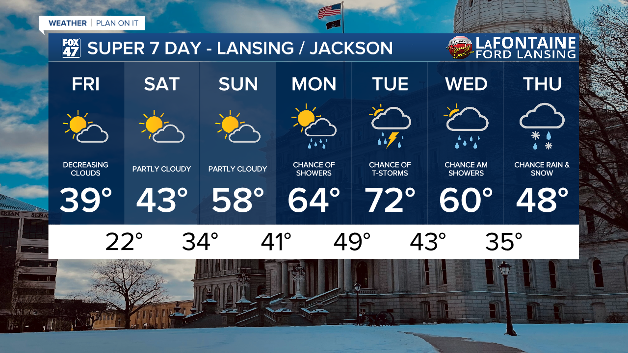
LANSING, Mich. — We missed out on Thursday's severe weather threat for southern neighborhoods, however, theses same areas of Jackson and Hillsdale were able to warm into the 70's ahead of the cold frontal passage while neighborhoods in Eaton, Ingham, and Clinton counties stayed in the mid to upper 60's.
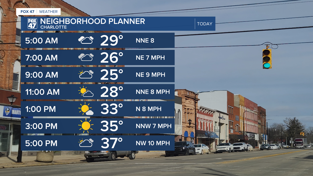
Now that the cold front has advance south, strong northerly winds have rapidly cooled our temperatures into the upper 20's/lower 30's Friday morning. Make sure to bundle up when heading out th edoor as feels like temperatures in some neighborhoods are in the mid to lower teens. We will warm today, but struggle to reach 40 degrees. This is below average for this time of year.
WATCH THE FULL FORECAST BELOW
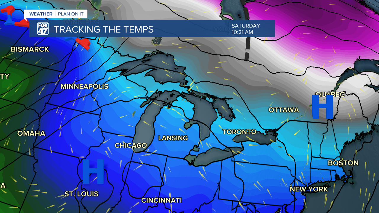
The good news is we are expecting some sunshine beginning this afternoon as high pressure at the surface starts to move in from the west. This will continue overnight into the first half of the Saturday with lots of sunshine expected.
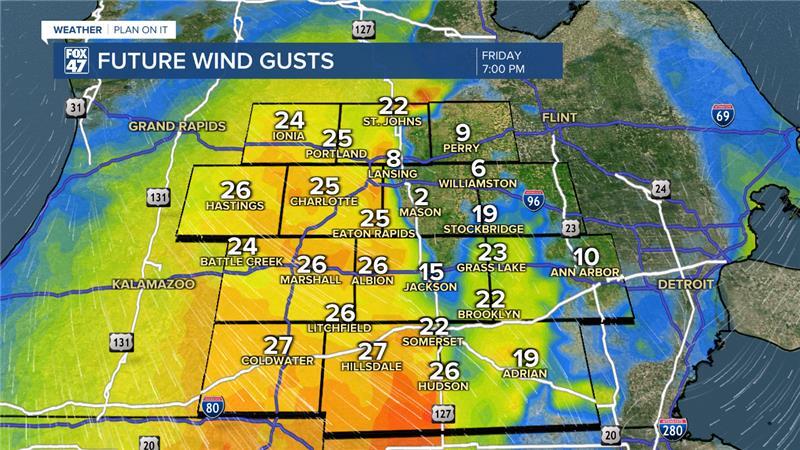
Winds shift out of the northwest later this evening where winds will pick back up with gusts up to 30 mph occurring from around 5-7PM and continuing during the overnight hours as light snow showers remain possible. No major impacts to travel are expected and any precip should wrap up by the time we start the day Saturday.
High pressure continues to track east where winds will shift out of the south allowing for another gradual warm up across the southern portion of the state. High temps should reach the mid 40's Saturday with a rapid warm up into the upper 50's on Sunday.
60 degree weather will return Monday as well as returning chances for showers and storms early next week.
We are still ironing out timing for storm potential next week as a cold frontal passage looks to advance through our neighborhoods late Thursday and possible overnight into Wednesday AM. It is too early to talk possible severe impacts, but we will be watching closely as we are tracking potential showers every day next week starting Monday.
Have a great weather picture or video to share? Send it our way and we may feature it on-air or online!

