
1:30 PM UPDATE
A Freeze Warning has been issued for Clinton, Eaton, Ingham and Jackson counties. The warning is set to begin at midnight tonight and last through 9 AM Thursday morning.
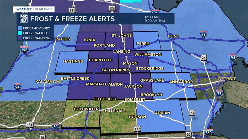
Air temperatures overnight could drop into the lower 30's/upper 20's. These conditions could kill crops and possibly affect unprotected outdoor plumbing. Clear skies and calm winds in the overnight hours are helping favor these conditions and possible impacts.
Make sure to bring in any plants or vegetation or make sure to cover them to prevent from any damage.
LEARN MORE ABOUT FROST BELOW
ORIGINAL POST
We are feeling like fall across our neighborhoods after a period of anomalous warmth to start the month of October. A cold front brought rain to much of Mid-Michigan Monday into Tuesday with some of our neighborhoods seeing over an inch of rainfall.

Any rain that we saw was much needed as we've seen agricultural impacts across the state due to the abnormally dry conditions and state of drought. We will need to see much more rainfall to see improvements in our drought conditions.
WATCH THE FULL FORECAST BELOW
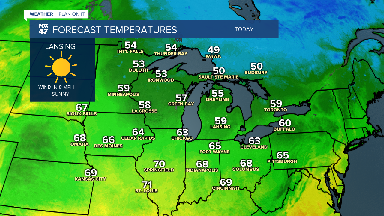
On the back end of that passing cold front, winds turning out of the north allows for much cooler conditions across the state Wednesday. High temperatures today will struggle to reach the 60's. The good news is we will stay dry with lots of sunshine once a secondary cold front advances through our neighborhoods in the morning hours.
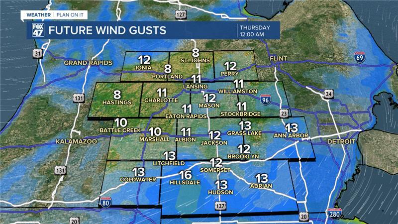
With this cooler weather pattern for the midweek period, winds out of the north will allow overnight lows to drop further into the mid 30's. With calming winds past midnight and continuing clear skies, frost across the area will be possible. Make sure to have the scraper dusted off as we will continue to see possibly patchy frost Thursday night as well.
LEARN MORE ABOUT FROST DEVELOPMENT BELOW
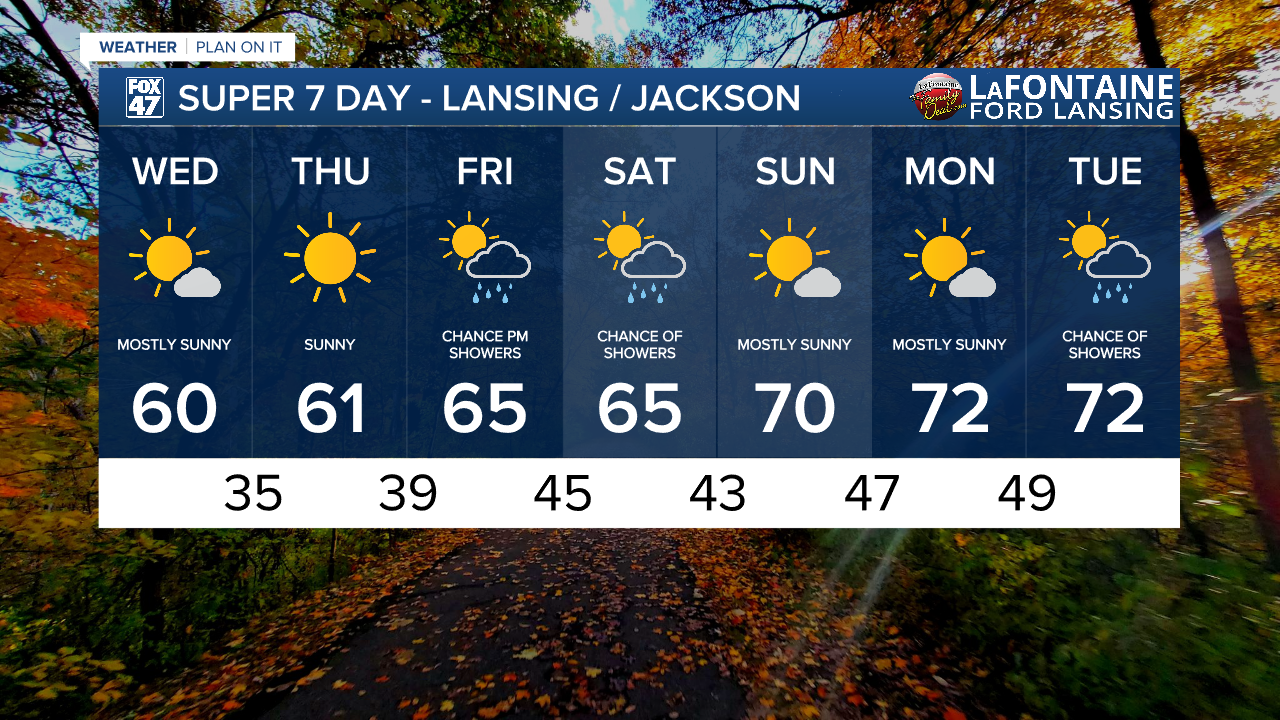
Once high pressure starts tracking east, winds will shift out of the south. This will start a gradual warming period in our neighborhoods taking temperatures back into the 70's as we enter the weekend.
A few showers are possible as an area of low pressure and a surface cold front advances through our neighborhoods. We could see tame PM rain showers Friday and possibly into Saturday. We could still see some changes to this timing and will continue to watch closely. We are not expecting any major impacts. Our next chance for showers comes as we enter next week Tuesday.
Want more FOX 47 News? Here's how you download our Roku app
You can also see the latest news from across our mid-Michigan neighborhoods by liking us on Facebook or following us on X.
