


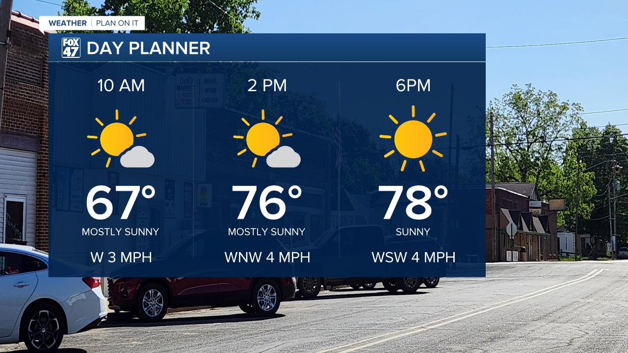
LANSING, Mich. — We have another nice day in store great for outdoor activities across Mid-Michigan. Temperatures Thursday morning have fallen into the 40's for the majority of Mid-Michigan. A hoodie or light jacket might be needed when heading out the door.
We will be warmer today compared to Wednesday with highs maxing out in the upper 70's. This is still below average for this time of year. We will return to near normal temperatures Friday where highs will warm back into the 80's.
WATCH THE FULL FORECAST BELOW
Winds will remain weak today which is an improvement from Wednesday. High pressure at the surface is allowing for this great day today so make sure to take advantage. Air quality will remain in the good range for all of the state of Michigan.
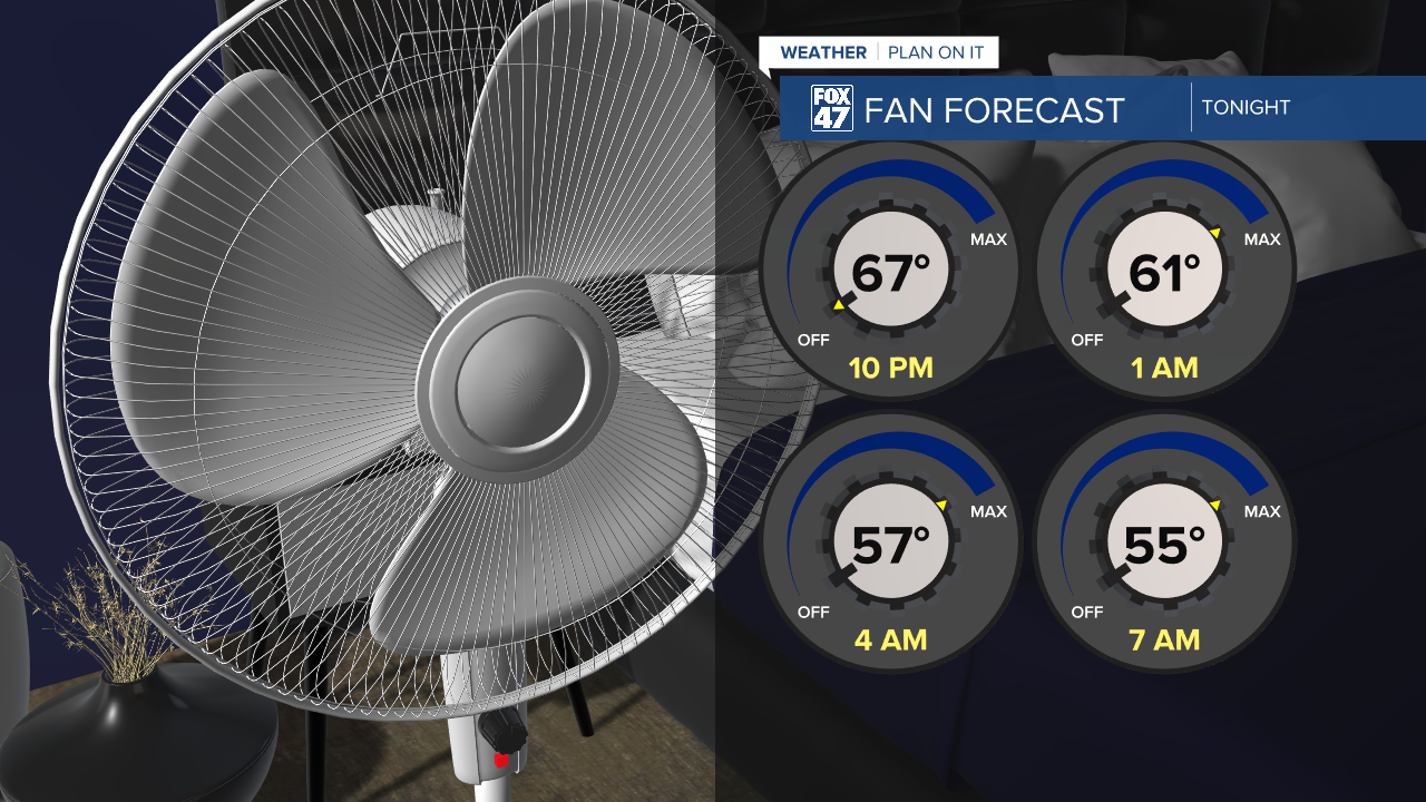
Into the overnight hours, we could see a few clouds pass by as temperatures drop into the mid 50's. This gives us another opportunity to crack the window and start the fan to give the A/C a break. This will be one of the last nights to do so as temperatures continue to warm as we head into the weekend.
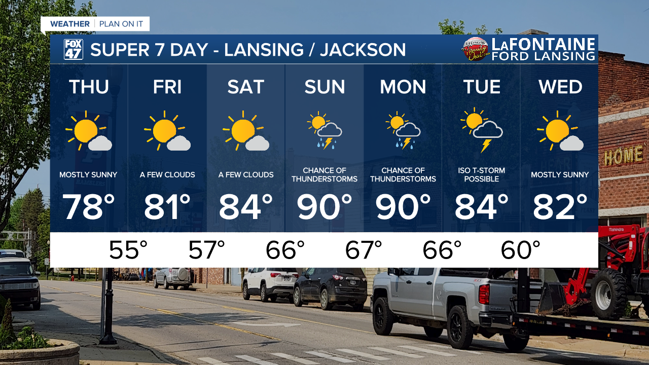
This warm up will lead to returning shower and thunderstorm chances as early as Sunday morning and taking us into Monday. Both days, high temperatures will struggle to reach 90 degrees, but definitely could top out there. We will also remain humid and uncomfortable outside. It is still a bit too early to talk severe potential, but make sure to plan for the umbrella. A lingering shower and rumble of thunder remains possible heading into Tuesday as we begin to dry up and see temperatures fall.
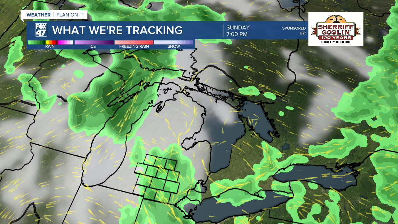
Sunshine will continue through Saturday with showers and storms back in the forecast Sunday through Tuesday. We are looking to dry up Wednesday of next week and see more sunshine across the area. Humidity will be on the rise through the rest of the week, but we will still remain comfortable Thursday. Enjoy the pleasant conditions.
Have a great weather picture or video to share? Send it our way and we may feature it on-air or online!

