


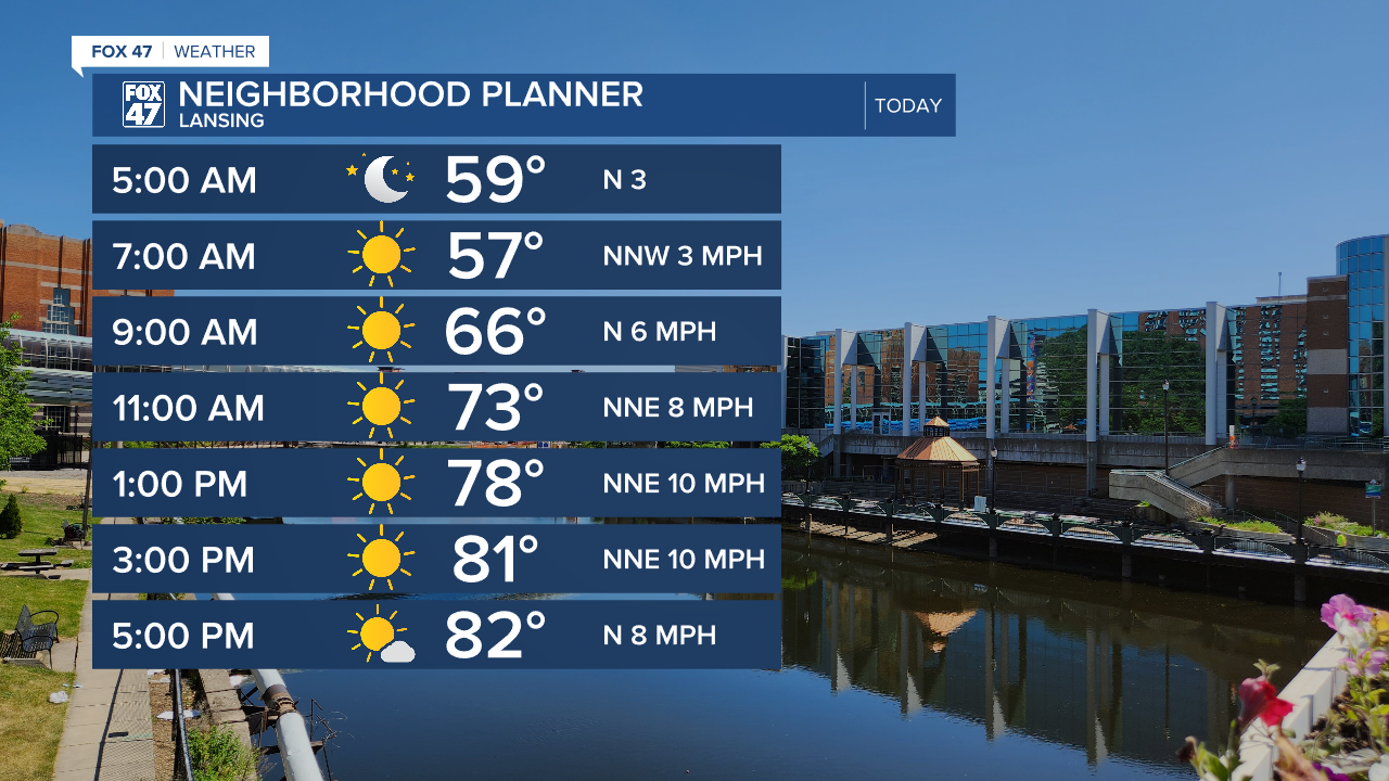
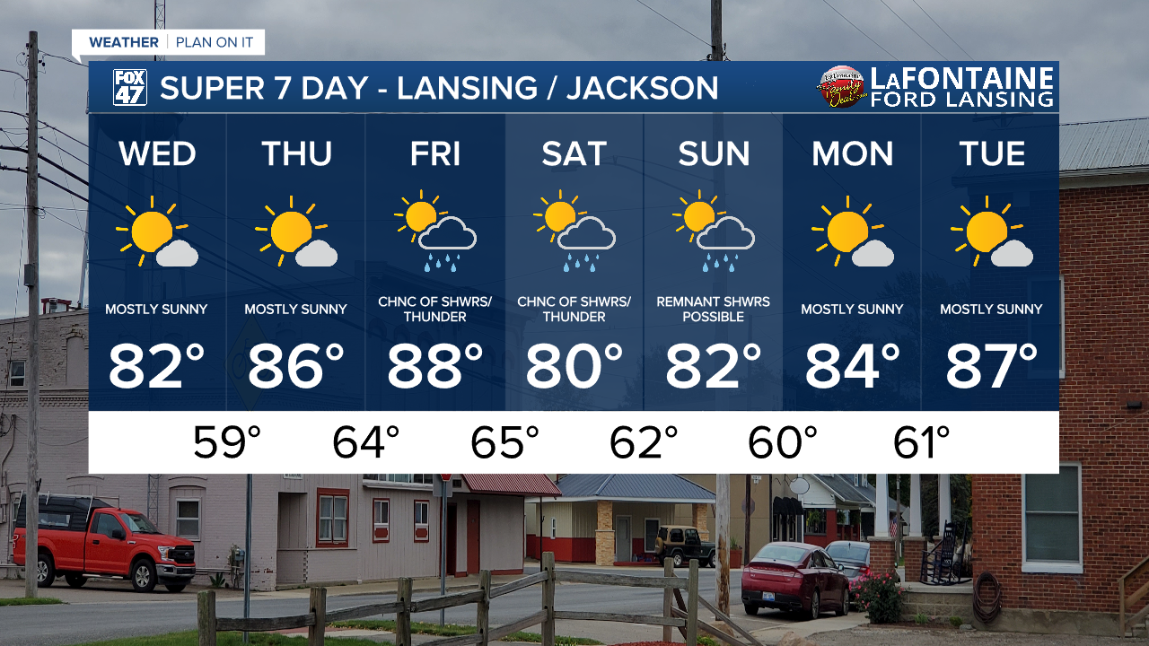
LANSING, Mich. — A lot of us were able to close Tuesday with sunshine and temperatures heading toward 80 degrees. Wednesday, we are expecting sunshine through the whole day with daytime highs expected to reach the lower 80's which is right around where highs should be for this time of year.
WATCH THE FULL FORECAST BELOW
Winds today are still oriented out of the north, but gusts should only reach up to 20 mph across our area. This will make for a good day to get outside and do some chores or activities like taking a walk. We will continue to monitor upper level smoke from wildfires off to the west in the United States, however, smoke shouldn't reach the surface today with air quality ranging good to moderate with some more colorful sunrises and sunsets expected.

We stay dry Thursday with mostly sunny skies continuing as Friday will see cloud cover increase again across the area ahead of returning evening showers. We are not working with a lot of instability with this next round of precipitation and, at the moment, any thunderstorm that develops should stay tame. We will be keeping an eye. We can expect showers late Friday and into the weekend Saturday and possibly lingering into Sunday. Bring the umbrella for any weekend outdoor activities.
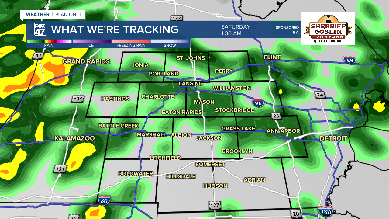
Temperatures will reach the upper 80's on Friday with returning moisture making it feel a bit more humid. We will cool back into the lower 80's for the weekend with another gradual warm up into next week where we remain dry with some potential for sunshine Monday and Tuesday.
Have a great weather picture or video to share? Send it our way and we may feature it on-air or online!

