
LANSING, Mich. — Storms on Monday brought damaging winds across our neighborhoods with Woodbury in Eaton County observing a wind gust of 90 mph. That is on par with with the strength of an EF-1 Tornado. Lots of trees and power lines have been reported down across our neighborhoods with planes overturned at the Capital Region Airport in Lansing.
Damaging winds will remain a threat with Tuesday's round of storms as temperatures will remain in the mid to lower 80's today with humid conditions also continuing with dew points in the mid to upper 60's. Make sure to keep cool today as we will see improving conditions overnight.

WATCH THE FULL FORECAST BELOW
The slight risk for severe storms from the Storm Prediction Center has shifted southeast and now only covers the most southeastern portion of Hillsdale County. The rest of the county as well as Jackson, Ingham, and portions of Eaton and Clinton counties are all under a marginal risk for severe storms today. Main impacts include damaging winds and large hail.
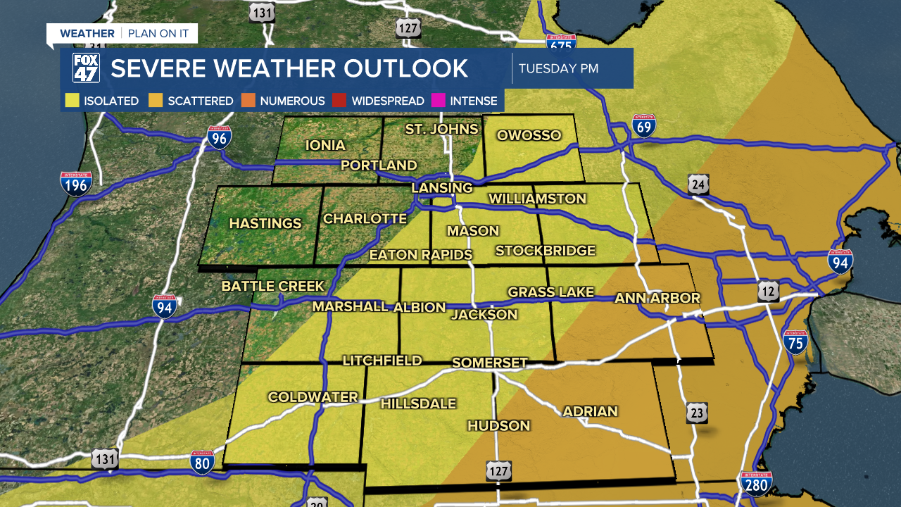
A lot of the showers and storms are tracking a bit further south and east of the state itself, but we will watch for the time frames around noon for an initial round of storms for northern neighborhoods and another round anytime past 3 PM and into the evening hours, ending around 9 PM. Make sure you have a way to receive alerts today for potential severe storms.
Once the cold front advances through our neighborhoods tonight, we will dry up with dew points plummeting allowing for more comfortable outdoor conditions for Wednesday with highs dropping into the mid to lower 60's. Lots of sunshine is still expected Wednesday as well as Thursday with another warm up expected heading into the Memorial Day weekend. However, shower and storm chance to increase and we will be watching closely to see if any storm potential turns strong or severe.

Have a great weather picture or video to share? Send it our way and we may feature it on-air or online!

