
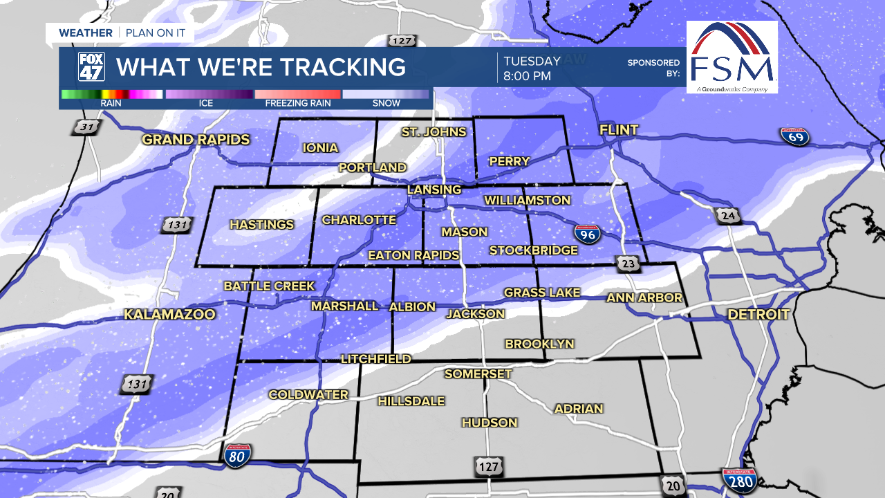
LANSING, Mich. — More snowfall is on the way Tuesday across Mid-Michigan as an incoming clipper system tracks east towards the region. An affiliated weakening frontal passage will advances through our neighborhoods tonight drive snow showers just out ahead.
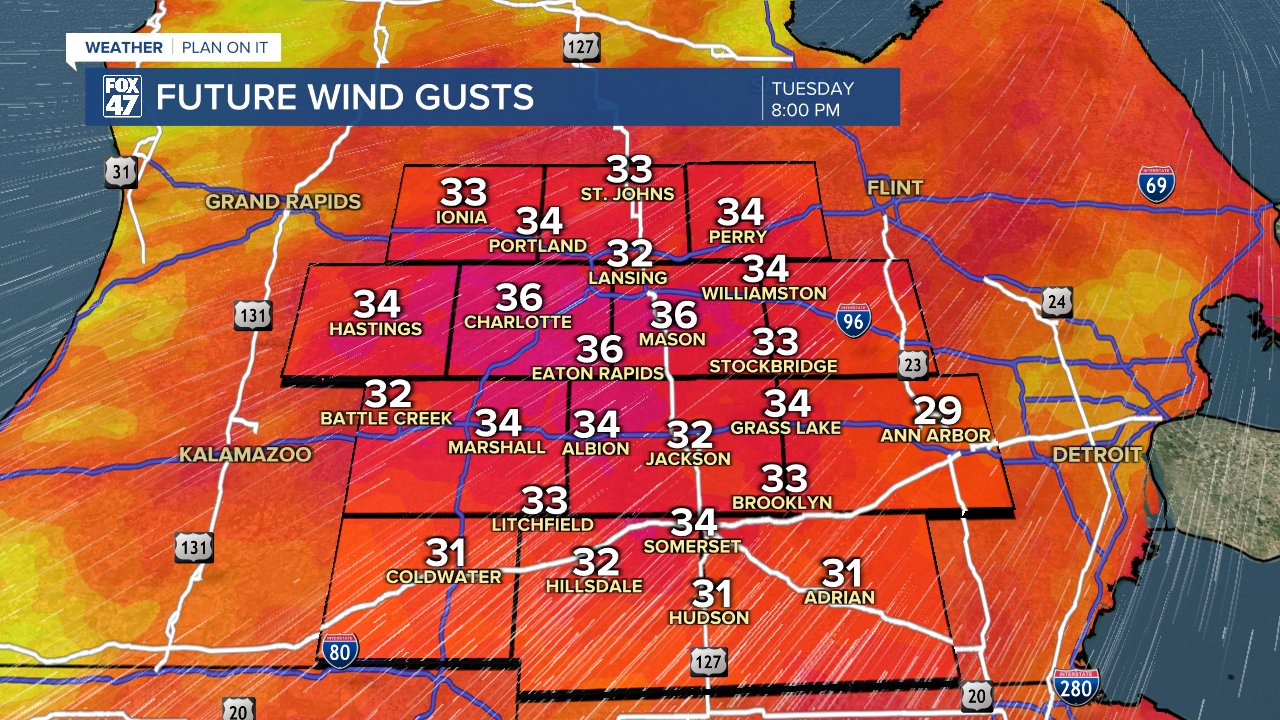
Temperatures today will be a bit warmer than yesterday as winds turn out of the south today and strengthen. We can expect high temperatures to reach the mid 30's today late in the afternoon with strong winds making it feel like the mid to lower 20's. Make sure to still bundle up when heading out the door.

WATCH THE FULL FORECAST BELOW
We stay dry for the majority of the daytime hours today with increasing cloud cover this afternoon. At the same time, winds will strengthen gradually with gusts reaching a max of up to 40 mph today. Paired these strong winds with returning snow, we could see visibility reduced if heading out on the roads past 6 PM.
Snowfall arrives as early as 6 PM with the brunt of accumulating snowfall lasting through midnight tonight. As the frontal passage advances through, we could still see scattered lake effect snow through the first half of the day Wednesday which could bring some light additional accumulations to our neighborhoods as well as renewed slick spots and limited visibility for the morning commute.
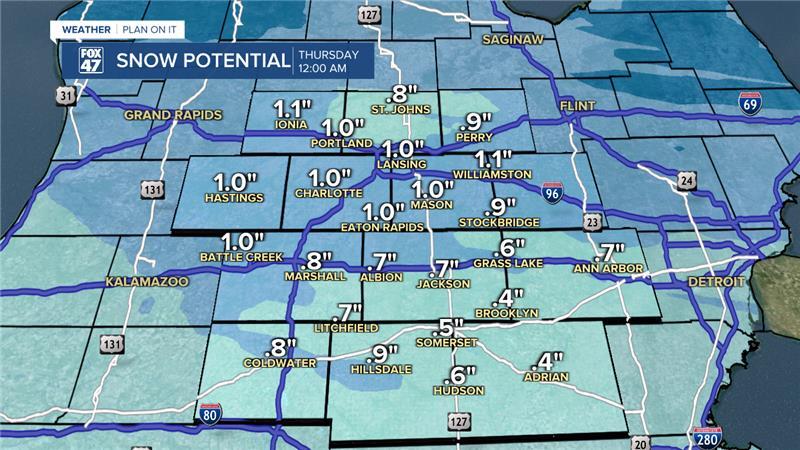
A lot of us could see up to 1.5" of snowfall for the entire event Tuesday through Wednesday. We have been behind in snowfall this month and this system won't aid in improving our total due to these lighter accumulations.
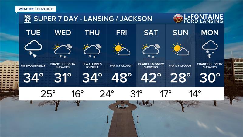
Snow chances continue into Thursday with a few flurries possible. However, there is still a chance we could dry out Thursday. No major impacts are expected either way and we will continue to monitor. We will see temperatures warm sharply heading into Friday with highs in the upper 40's. We will keep highs in the 40's into Saturday where we will be watching for more snowfall to advance through. We will sharply cool down again heading into Sunday with highs in the upper 20's/lower 30's.
Want more FOX 47 News? Here's how you download our Roku app
You can also see the latest news from across our mid-Michigan neighborhoods by liking us on Facebook or following us on X.
