
LANSING, Mich. — You might need a few extra minutes to brush snow off your car before getting on the roads Wednesday morning as the first round of snowfall comes to an end. Untreated roadways could be dicey with slick spots with more major roadways and freeways seeing better conditions.
we will see more snow today as a cold front behind the advancing clipper system tracks south across our neighborhoods. Snowfall will be more focused in the afternoon hours beginning as early as 1 PM with heavier snowfall rates beginning after 2 PM.

WATCH THE FULL FORECAST BELOW
Snowfall with heavier rates occur after 2 PM Wednesday with snow coming to an end in our neighborhoods by 9 PM. During this time, we could see limited visibility and slick spots for the evening commute. We can expect light snow totals ranging from 1 - 2".

This snowfall is brought to us from a cold front that is advancing south on the back end of the clipper system that brought the first round of snow overnight last night. This cold front will allow our winds to pick up with gusts ranging from 35-40 mph during the afternoon to evening hours. Make sure to watch out for any light outdoor decorations.

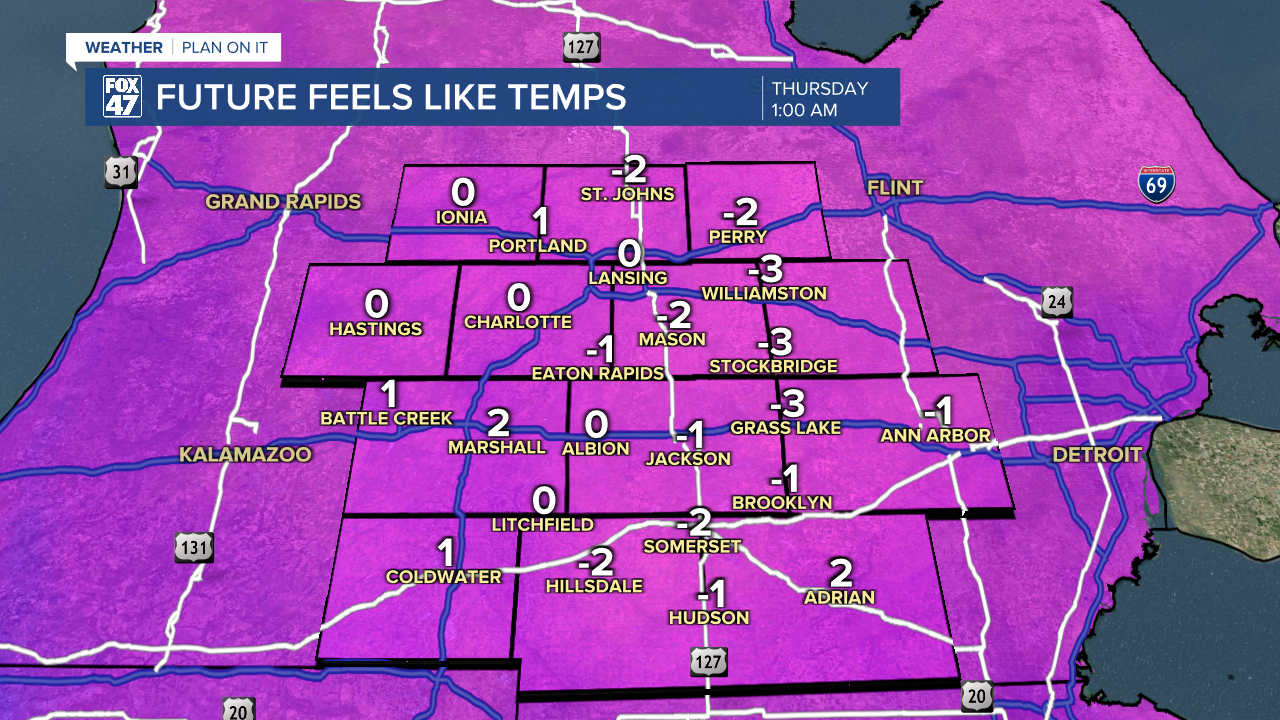
Once the cold front advances through, feels like temperatures will drop near and below zero degrees. These chilly conditions will occur from 10 PM Wednesday night and past midnight into the new year. For any New Year's Eve plans, make sure you are bundling up and watching out for any leftover slick spots on roadways from the snowfall.
High pressure builds in heading into the new year with tame weather conditions favored through the weekend. We can expect partly to mostly cloudy skies with a small chance for a flurry on Friday morning with no major accumulations to note. We will track gradually warming temperatures heading into next week where we could potentially see some snowfall and rain.

Want more FOX 47 News? Here's how you download our Roku app
You can also see the latest news from across our mid-Michigan neighborhoods by liking us on Facebook or following us on X.
