
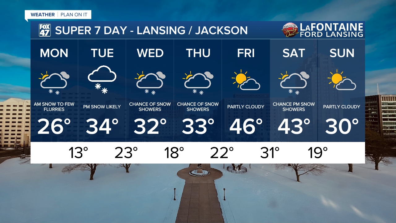
LANSING, Mich. — Last week brought sunshine and temperatures into the 60's across our neighborhoods, but false spring has come and gone and we start a new week with a blanket of snow on the ground and continued flurries for Monday.
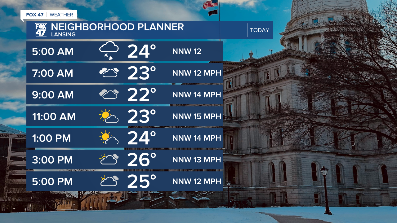
Snowfall will continue during the AM hours as winds turn out of the north, keeping most of the lake effect snow along the lake shore. A weak cold front will sag south today advancing through our neighborhoods. We will be drying up as we continue into the afternoon hours with temperatures warming into the mid 20's with gradually weakening winds and a chance to see some sunshine.
WATCH THE FULL FORECAST BELOW
If heading out on the roads this morning, watch out for slick spots, especially on untreated roadways. Snow is expected to come to an end late this morning, with a small chance to see some flurries as the cold front advances through later today. However, additional accumulations should remain trace across our neighborhoods.
Winds turn out of the south as surface high pressure briefly influences the forecast. Cloud cover will increase overnight tonight with winds picking up and possibly reaching gusts of 40 mph during the afternoon/evening hours.

This is all ahead of an incoming shortwave that will drive more snowfall across our neighborhoods beginning Tuesday PM. Snow is looking to begin at 7 PM Tuesday as a frontal passage advances through. On the back end, we could see lake effect snow continue into Wednesday morning.

Accumulations of snow should remain light ranging from .5" to 1.5" across the majority of our neighborhoods Tuesday through Wednesday.

Temperatures will begin to warm again heading into the latter half of the week with a chance for snow showers on Thursday with a trend a little bit further south of our neighborhoods at the moment. We will be watching for Thursday's chances closely.
We are looking to dry up Friday as we see quite a warm up in our neighborhoods with highs jumping into the mid 40's. We will stay in the 40's heading into Saturday before another cool down with chances for snow.
Want more FOX 47 News? Here's how you download our Roku app
You can also see the latest news from across our mid-Michigan neighborhoods by liking us on Facebook or following us on X.
