
LANSING, Mich. — Over the weekend, our neighborhoods were hit with a blast of winter weather with snowfall accumulations ranging up to 8". Below are some of the heaviest snowfall reports from the event across our neighborhoods.

WATCH THE FULL FORECAST BELOW
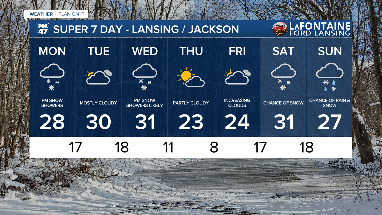
Entering a new week, road conditions are improving as we remain dry across our neighborhoods with mostly cloudy skies continuing. We will see daytime highs reach the upper 20's today with weak winds out of the south.
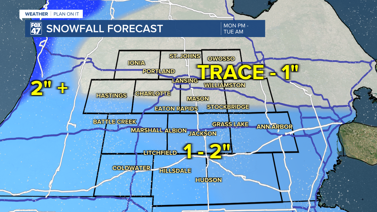
A shortwave will track through the region Monday evening aiding in the return of snowfall to our neighborhoods this evening. We could see snowfall return as early as 9 PM and last through the overnight hours around 2 AM. This snowfall could produce some slick spots on roadways for Tuesday AM travel.
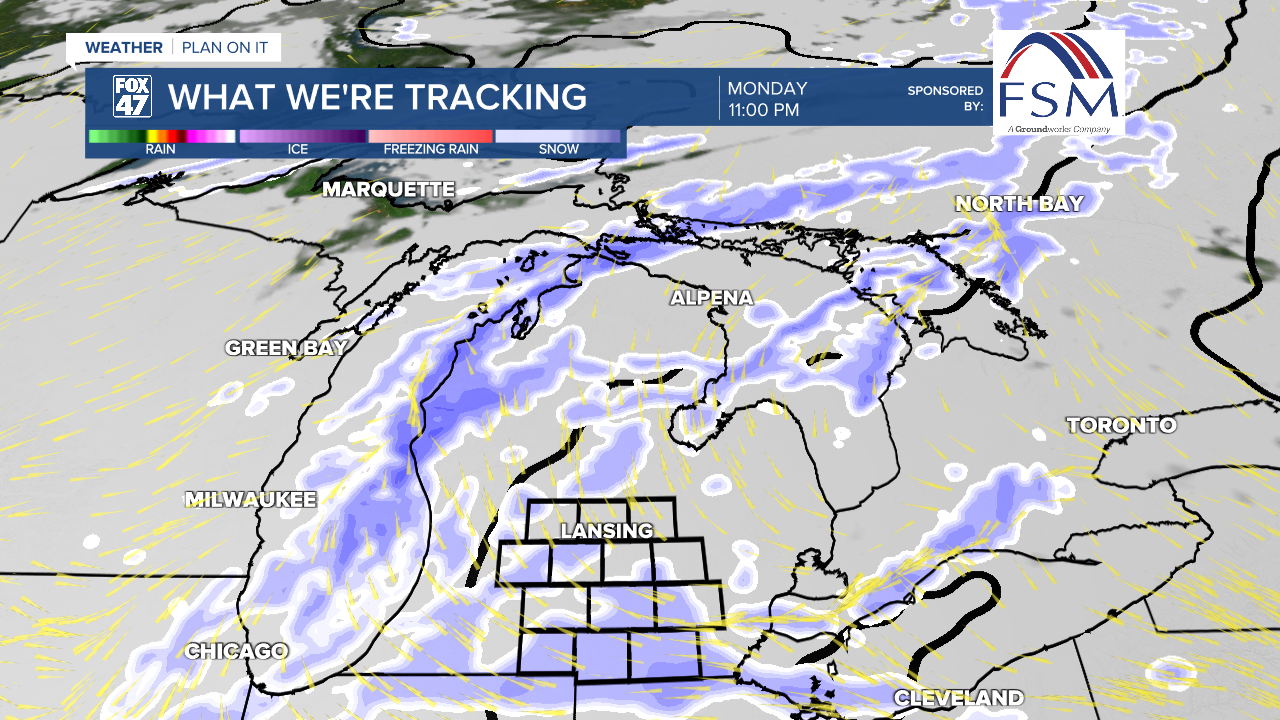
Heaviest accumulations of snow will be off to the west, right off the lake. These areas could see similar impacts to the winter storm that we witnessed over the weekend. Inland neighborhoods are expected to see much less with accumulations ranging from 1 - 2" in southern neighborhoods like Jackson and Hillsdale.
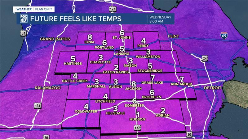
Wednesday brings a cold front to our neighborhoods with renewed snowfall beginning in the afternoon hours. We could see some additional accumulations of snow with this system as ahead of the frontal passage, winds will pick up.
During the first half of the day, we could see wind gusts up to 30 mph. These strong winds will last through the PM hours Wednesday ahead and along of the cold frontal passage. This will impact our feels like temperatures as we could wake up Wednesday morning with feels like temperatures in the single digits.
We will stay dry and cool down following the cold frontal passage Wednesday with lows in the single digits and daytime highs in the mid 20's. We are tracking returning winter weather chances for this weekend.
Want more FOX 47 News? Here's how you download our Roku app
You can also see the latest news from across our mid-Michigan neighborhoods by liking us on Facebook or following us on X.
