
LANSING, Mich. — We are continuing to track precipitation in our neighborhoods today as a stalled frontal passage acts as the driver of rain showers today.
High temperatures are still seasonably average in the md to upper 70's today. This trend will continue through the weekend.

We're staying dry for the morning hours on Friday with mostly cloudy skies. Showers are expected to creep into southern Hillsdale County at around Noon. Showers will continue to track north as we progress through the afternoon hours and impacts Jackson County and the most southern portions of Eaton and Ingham counties.
WATCH THE FULL FORECAST BELOW
The stalled frontal passage is expected to stay a bit further south than initially expected which will keep these showers focused in our southern neighborhoods. We will also be diminishing our t-storm chances as we lose instability, a key ingredient to t-storm development. We do still have a chance to hear a rumble of thunder today into tomorrow morning, but no major impacts are expected.

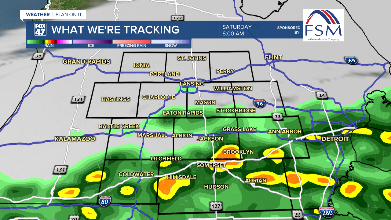
Showers continue in Jackson and Hillsdale counties through the Saturday morning hours with showers ending Saturday in the late afternoon hours. The good news is that we are expecting to stay dry on Father's Day Sunday as high pressure builds in to start the new week.
We are expecting to stay dry on Monday with storm potential returning midweek next week Tuesday through Thursday. During this period, our air temperatures also are expected to climb into the 80's with present moisture making it feel a bit more humid outside than what we've been dealing with so far this month.

Temperatures start to cool off again once we enter Thursday of next week with a renewed chance for t-storms.

Want to learn more about the Weather? Visit the FOX47News Website.
Stay in touch with us anytime, anywhere.
Sign up for newsletters emailed to your inbox.
Select from these options: Breaking News, Severe Weather, School Closings, Daily Headlines and Daily Forecasts.
