
LANSING, Mich. — Temperatures this morning are much warmer than yesterday morning ranging in the mid to upper 20's. This is due to winds out of the south bringing warmer air back to our neighborhoods today ahead of an incoming clipper.
High temperatures today are expected to flirt with 40 degrees with some neighborhoods possible reaching that milestone which we haven't seen in Lansing since January 14th 2026. Mostly cloudy skies will continue on today with no precipitation expected.

WATCH THE FULL FORECAST BELOW
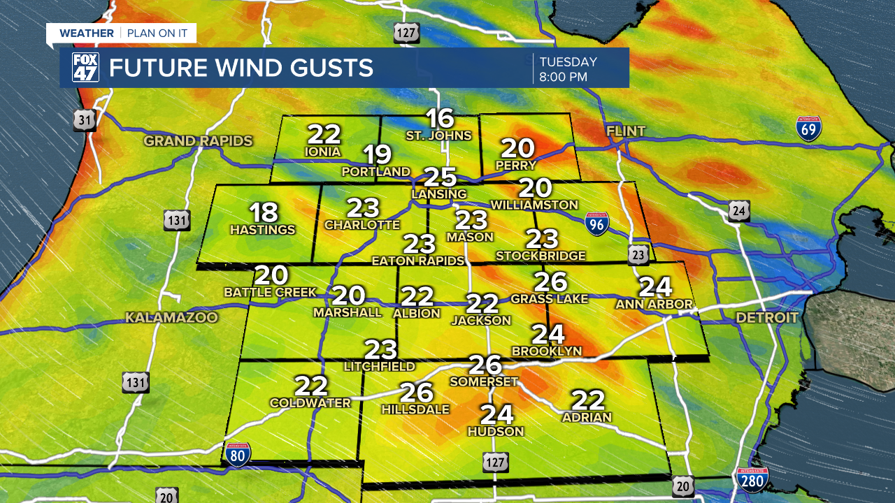
Winds will pick up today with gusts possibly reaching 30 mph both this morning as winds begin to veer out of the west and later on this evening with winds turning out of the northwest. Once we see our winds out of the north, temperatures will begin to cool. This wind trend will continue through the overnight hours tonight and into Wednesday where high temps will range in the upper 20's/lower 30's. This is still right around where we should be, however.
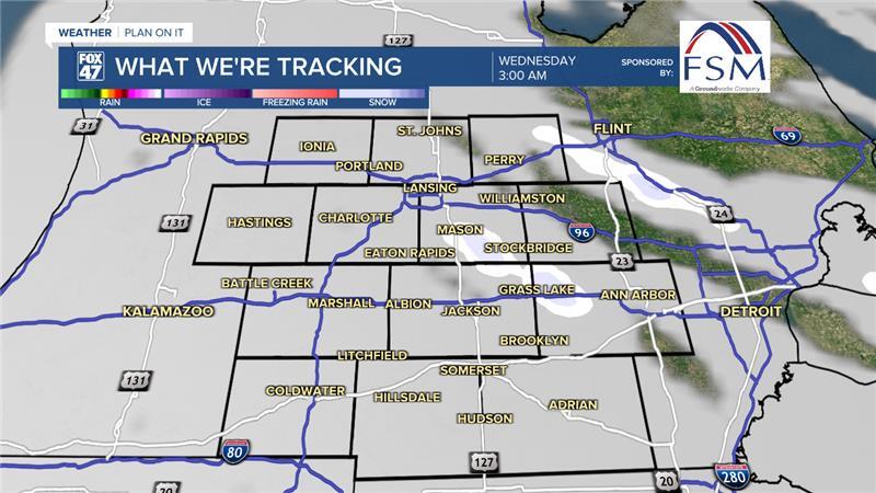
Cloud cover will continue through Wednesday as well with the possibility to see a few flurries during the overnight hours and during the AM hours Wednesday. We are not expecting any large accumulations of snow and shouldn't see too many problems with road conditions. We can't rule out the possibility to observe some light freezing drizzle during this time as well. We will be watching closely Wednesday morning.
Wednesday will be the only day with precip chances until the weekend as high pressure at the surface builds in allowing temperatures to rise late this week and for some more potential sunshine just in time for Valentine's Day where temps will warm back into the mid to upper 30's.
Sunday's chances for wintry mix are still present, but have dropped in likelihood as the system has been trending south. We still have time to see some changes with this late in the weekend system. Temperatures by Monday could reach 40 degrees yet again.

Want more FOX 47 News? Here's how you download our Roku app
You can also see the latest news from across our mid-Michigan neighborhoods by liking us on Facebook or following us on X.
