
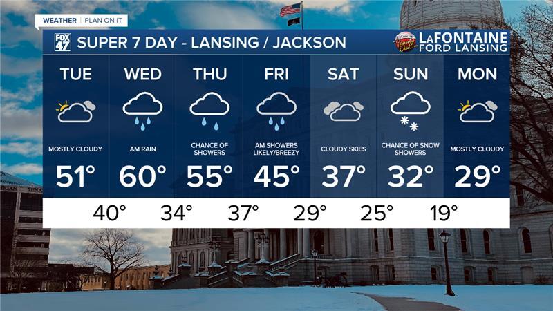
LANSING, Mich. — Mild temperatures are expected to continue today, however, a bit cooler than what we observed yesterday. Most of our neighborhoods saw highs in the mid to lower 50's like Lansing reaching a high of 56 degrees. Today, high temperatures will range mainly in the lower 50's across most of our neighborhoods.
Today, a cold frontal passage will sag south through our neighborhoods during the morning hours and stall out around the Michigan/Indiana/Ohio border. This is all ahead of an incoming shortwave which will drive our next round of showers beginning tonight.
WATCH THE FULL FORECAST BELOW
Temperatures today will remain mild in the lower 50's with mostly cloudy skies during the daytime hours today. With warmer air expected even into the overnight hours, rainfall will be our primary precipitation type with moderate rainfall possible and a few rumbles of thunder with building instability. This all occurs as that stalled out front advances north across our neighborhoods aiding in warming our temperatures.
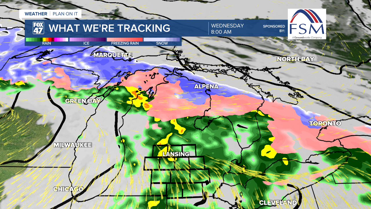
On and off again rain showers will continue from midnight tonight through around noon Wednesday with drier air filtering into our neighborhoods as the front tracks further north. If we do see any moisture regain after the frontal passage, we could see an afternoon isolated thunderstorm, however, these chances remain low. Rainfall totals across our neighborhoods will range from a quarter to half an inch.
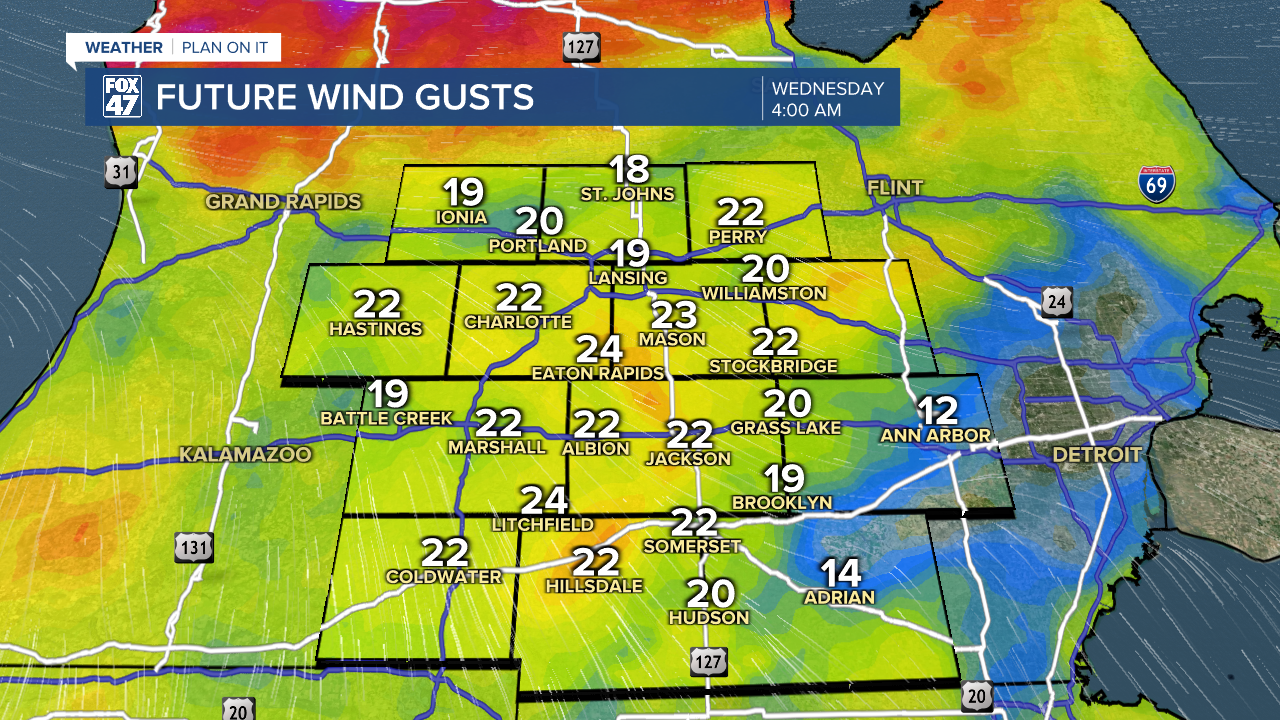
Winds during tomorrow morning's rainfall will remain non-severe with gusts ranging from 25-30 mph.
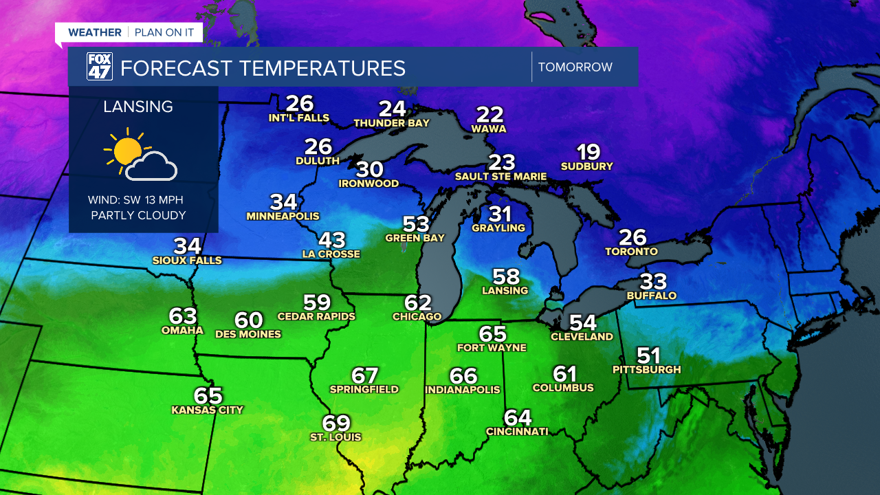
Wednesday afternoon brings drier air that will aid in parting our clouds allowing for some potential sun and temperatures warming into the lower 60's. This could potentially be the 2nd day of 2026 in Lansing where temperatures reached the 60's following January 9th.
Following Wednesday, temperatures will gradually cool as another system will bring rain to our neighborhoods as early as Thursday evening and lasting overnight into Friday morning with breezy conditions expected. We remain dry Saturday with potential for back end snow to return to our neighborhoods Sunday as temperatures cool back to freezing. This is around where daytime highs should be for this time of year. We will continue to cool into a new week Monday with high temperatures below 30 degrees.
Want more FOX 47 News? Here's how you download our Roku app
You can also see the latest news from across our mid-Michigan neighborhoods by liking us on Facebook or following us on X.
