
LANSING, Mich. — Snow totals will be higher the further off to the north you go. Southern areas will be mostly in a wintry mix until the precipitation turns over to rain. Slow downs will be mostly likely Thursday morning.
Expect the snow to come down moderate to heavy at times north of I-94 Thursday morning by 6-7am. Areas south of I-94 could have some icing if temperatures fall to 32 degrees. Most areas should stay around 33 though, thankfully. Snow will come down pretty hard at times for Lansing northward. Snowfall rates could briefly hit 1-2" per hour between 6-9am. By lunchtime, most of the precip leaves the area with a strong northwest wind kicking in. Winds could be sustained around 15-25mph with gusts as high as 40mph.
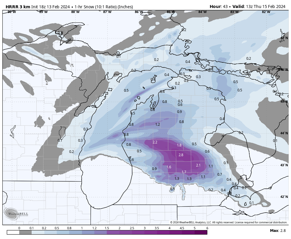
The image below highlights inches of snow per hour at 8am.
With temperatures largely in the middle 30s while the snow falls we will see some melting. Ground temperatures are around the freezing mark near the surface and up to 37 degrees a bit lower in the soil. Snow falling at 1-2" per hour will overpower the chance of the ground melting it and will overall accumulate on the roads causing slowdowns.
Temperatures will fall into the lower 20s overnight into Friday morning so we'll have to watch for some slick spots and refreezing. Salt treatments will still be effective.
Want to learn more about the Weather? Visit the FOX47News Website.
Stay in touch with us anytime, anywhere.
Sign up for newsletters emailed to your inbox.
Select from these options: Breaking News, Severe Weather, School Closings, Daily Headlines and Daily Forecasts.
