
LANSING, Mich. — Across the state, the Northern Lights were visible overnight due to the clearing skies that we saw early in the day Wednesday. We were able to view them due to impacts from a strong geomagnetic storm. Chances wane going forward for viewing the Northern Lights, but we will be watching for any further viewings.
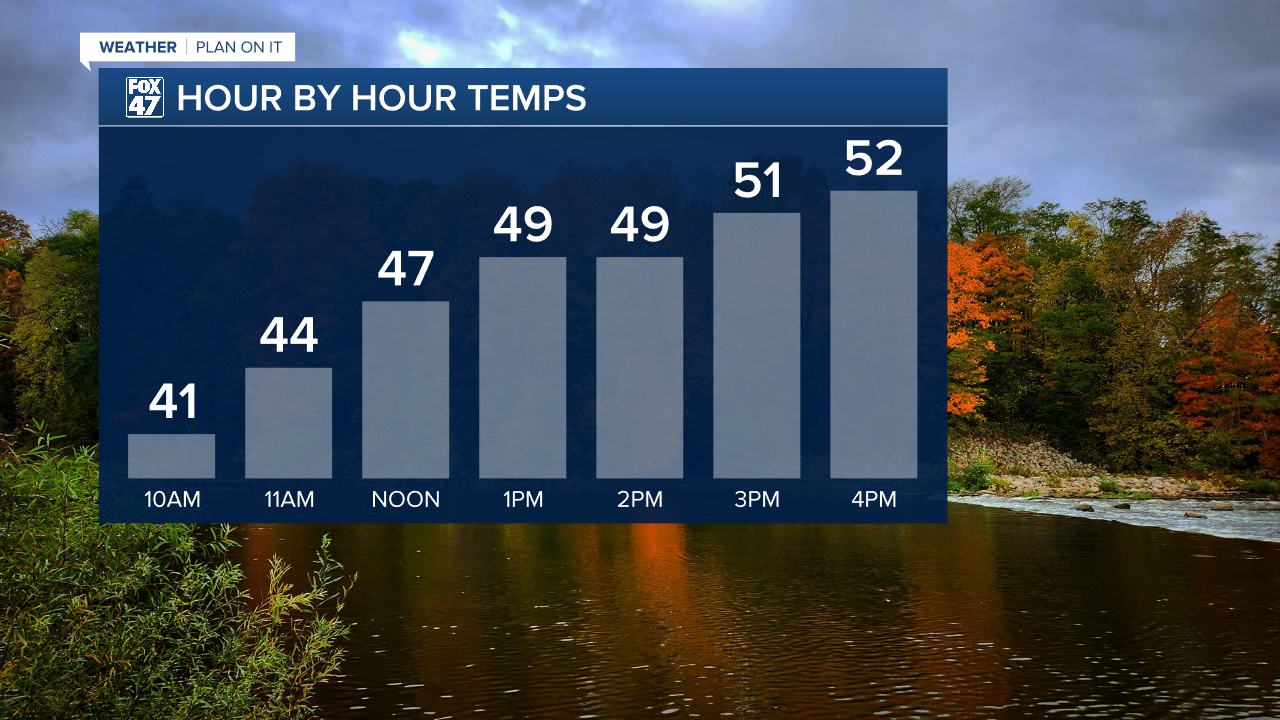
Heading into Thursday, clear skies continue as we start the day chilly with calm winds. This allows temperatures this morning to fall a bit quicker with temperatures in the mid to lower 30's as we start the 6 AM hour and feels like temperatures below freezing across the board.
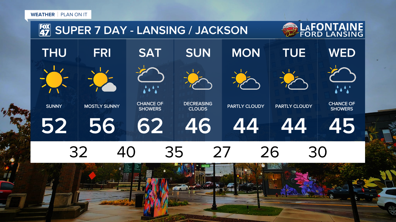
We will warm into the lower 50's today as we gradually warm now that high pressure from the south builds into the region. This will aid in keeping our skies clear today and tomorrow.
WATCH THE FULL FORECAST BELOW
The rest of our work week will bring nice fall conditions as we warm into the mid 50's for Friday with a few passing clouds in the morning hours.
Our next best chance for showers arrives this weekend as a warm front advances through early Saturday morning with showers developing ahead of an incoming cold front during the daytime hours. We are forecasting the cold front to advance through our neighborhoods in the early to mid afternoon hours, however, we could still see some changes to this timing.
No major impacts are expected as these showers pass by Saturday and should stay tame. Winds will strengthen, however, with gusts along the front maxing out up to 40mph.

Temperatures continue to warm ahead of the cold front on Saturday with highs reaching the lower 60's. Once the front advances through, temps will cool into the 40's on Sunday with partly cloudy skies expected to start the new week. We are tracking the chance to see showers return during the midweek period next week.
Want more FOX 47 News? Here's how you download our Roku app
You can also see the latest news from across our mid-Michigan neighborhoods by liking us on Facebook or following us on X.
