
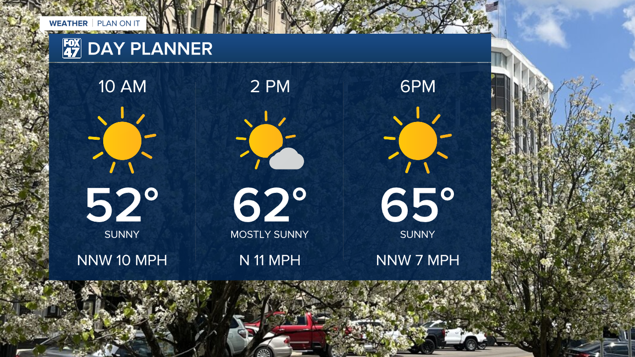
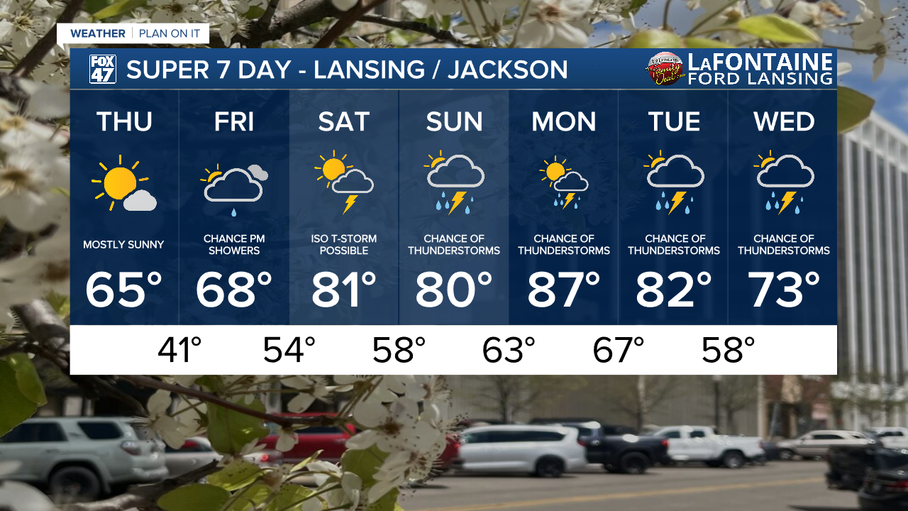
LANSING, Mich. — Wednesday felt chilly across our neighborhoods with feels like temperatures in the upper 30's at times making it feel more like early spring than a mid May day. Fortunately, surface high pressure builds over the state of Michigan today clearing our skies. Expect an abundance of sunshine through the day today with more comfortable temperatures warming into the mid 60's.
WATCH THE FULL FORECAST BELOW
Winds will remain present in the AM hours Thursday out of the north with gusts up to 20 mph through 1 PM. This could drop feels like temps a bit during the AM hours, but by the afternoon, wind will gradually weaken and we will feel a lot more comfortable compared to Wednesday.
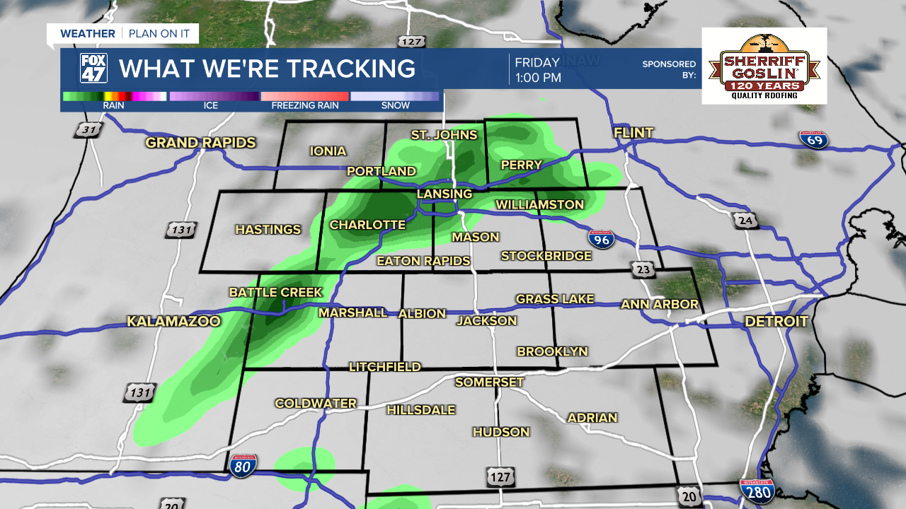
As high pressure exits overnight, cloud cover will increase as winds shift out of the south. This will aid in a warm up with warm moist air back in our neighborhoods. We can expect highs in the upper 60's with a few showers possible during the afternoon and evening hours. These showers will remain scattered with no major impacts expected.
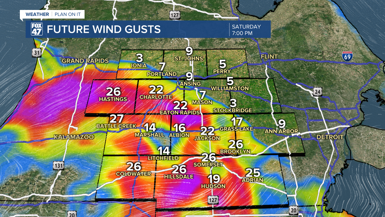
Heading into the weekend, our neighborhoods will tap into some ample moisture aiding a returning thunderstorm threat during the Saturday evening hours around 7 PM for southern neighborhoods including Jackson and Hillsdale counties. Severe potential has started to inch into far southwestern Michigan according to the Storm Prediction Center's Severe Weather Outlook. However, none of our neighborhoods are included in the threat.
Looking ahead at these storms, however, we will be watching the time frames of 7 PM to midnight Saturday night. Winds gusts for far southern neighborhoods could exceed 40 mph and possibly become isolated severe. We will be watching closely. Some sunshine is still expected during the daytime hours Saturday.
Chances for storms continue Sunday with high temperatures well above average in the lower 80's, similar to Saturday's forecast high.
Our best chances for thunderstorms arrive early next week Monday into Tuesday. We could still see a lot of changes to the evolution of this system ahead of the new week and we will continue to monitor closely, but if you have any weekend plans or plans heading into the first half of next week, prepare the umbrellas and be ready for temperatures back in the 80's. We will start to cool down Wednesday with highs back in the mid 70's.
Have a great weather picture or video to share? Send it our way and we may feature it on-air or online!

