


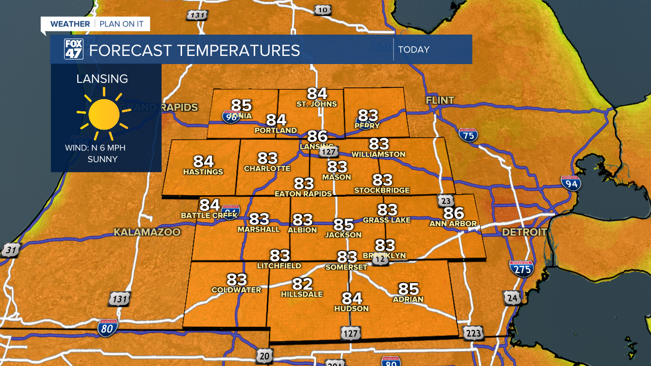
LANSING, Mich. — We have more sunshine in the forecast today as surface high pressure settles into the state. We will be dealing with weak winds out of the north as temperatures to start the day have been refreshing in the mid to upper 50's. High temperatures today are expected to reach the mid 80's which is still a bit above average, but we will continue to see temps rise as we progress through the 7-Day.
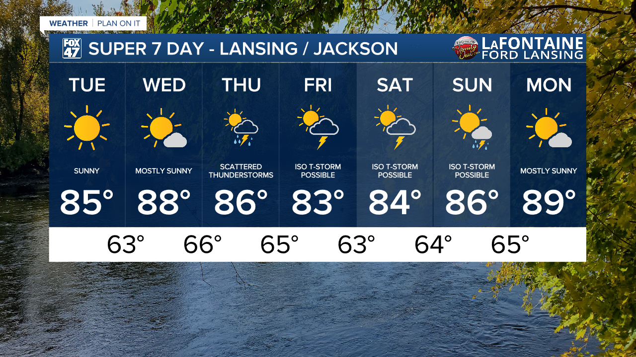
Wednesday, temperatures continue to rise with highs expected in the upper 80's and more mostly sunny skies. Winds will turn out of the southwest, however, where we will be tapping into moisture that will make conditions humid again across southern Michigan. This is all ahead of returning scattered thunderstorms Thursday.

Arrival of showers and storms could begin as early as the 5 AM hour as the surface frontal passage sags south across the area. Storms look to continue into the afternoon hours with leftover showers and isolated storms possible beginning overnight Thursday and into Friday morning.

At the moment, no severe impacts are expected with this round of storms on Thursday and we could continue to see isolated thunderstorms through the weekend mixed with sunshine. We could still see changes to this forecast for the weekend as we progress through the week. We will see temperatures rebound into the upper 80's late in the weekend with highs potentially reaching 90 degrees on Monday with returning sunshine.
Have a great weather picture or video to share? Send it our way and we may feature it on-air or online!

