
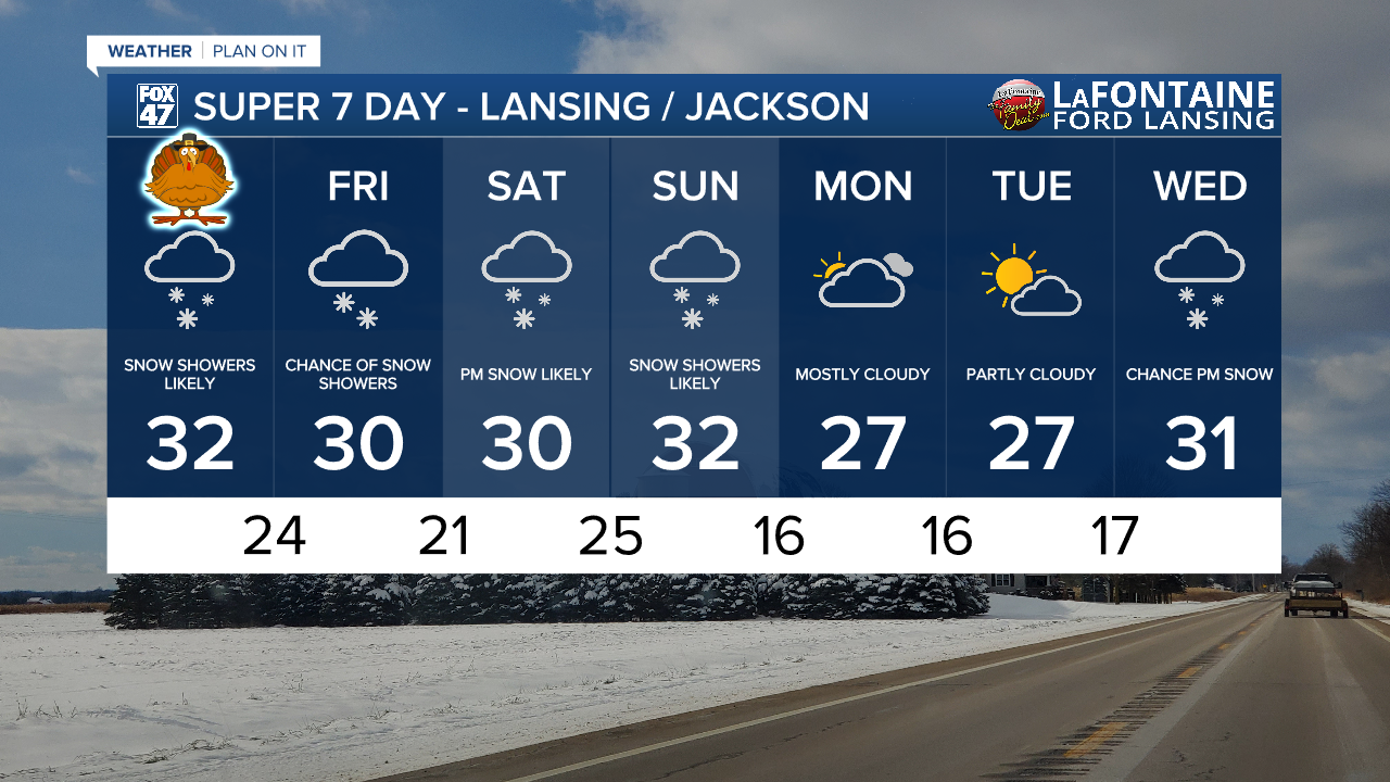
LANSING, Mich. — Yesterday afternoon and evening brought snowfall across our neighborhoods with limited visibility and a few slick spots on roadways. If heading out the door Thanksgiving morning, areas south of I-96 are seeing continued lake effect snow which is limiting visibility down to 3 miles. Make sure to stay weather aware and leave extra time for travel this morning.
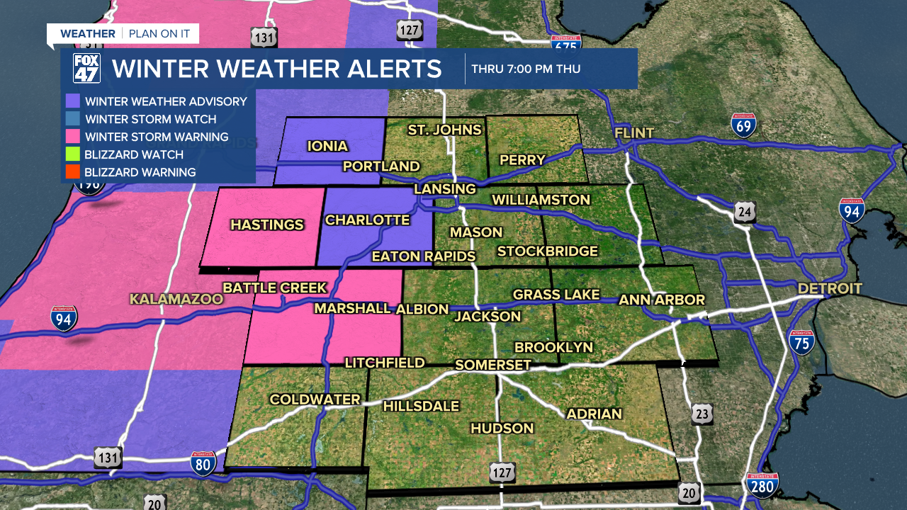
The Winter Weather Advisory in Jackson has been canceled as we can only expect up to an inch of additional accumulations today. The advisory continues, however, in Eaton and Ionia counties today through 7 PM with up to 2" of additional accumulations possible. We could still see impacts such as limited visibility on roadways and a few slick spots.
WATCH THE FULL FORECAST BELOW
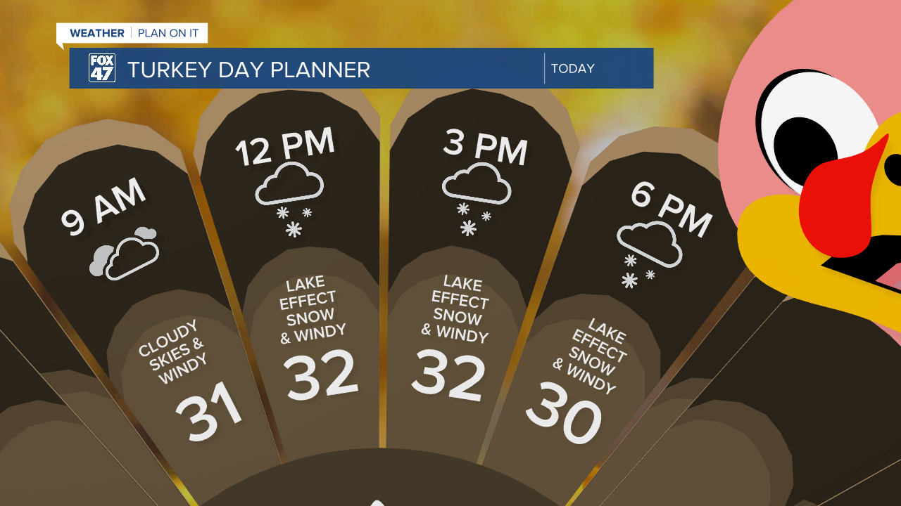
Turkey Day brings chilly conditions to our neighborhoods with high air temperatures hovering right around freezing as we continue to track lake effect snowfall through the daytime hours today and dwindling heading into the first half of Friday. By Friday afternoon/evening, we could see some parting in cloud cover as high pressure briefly returns.
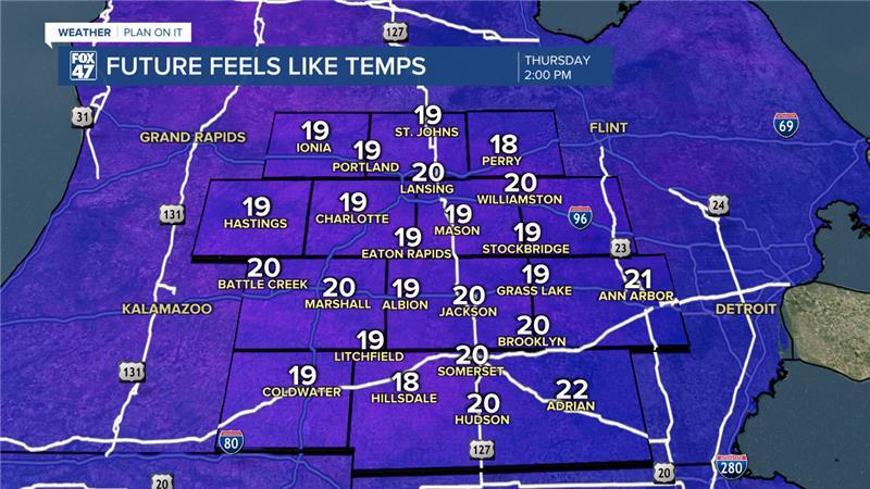
The Wind Advisory has been canceled across all of our neighborhoods, but strong winds continue on throughout the day today. We could still see gusts this afternoon from 35-40 mph. These winds are expected to drop our feels like temperatures throughout the day into the upper teens/lower 20's. Make sure you are bundling up when heading out the door as these conditions will remain throughout the day Friday as well with winds gradually weakening.
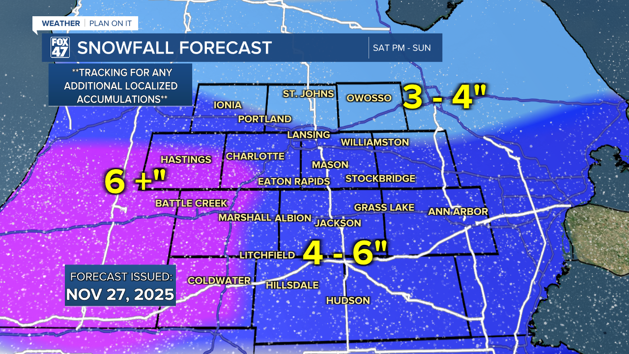
Even though snowfall is dwindling to close the week, we are tracking round 2 with renewed impacts and accumulations. Beginning as early as Saturday afternoon, snow showers are expected to return to our neighborhoods ahead of an incoming low pressure system tracking northeast. We are watching closely for the Saturday evening and Sunday morning commute for travel hazards as heavier snowfall rates look to track through during the overnight hours.
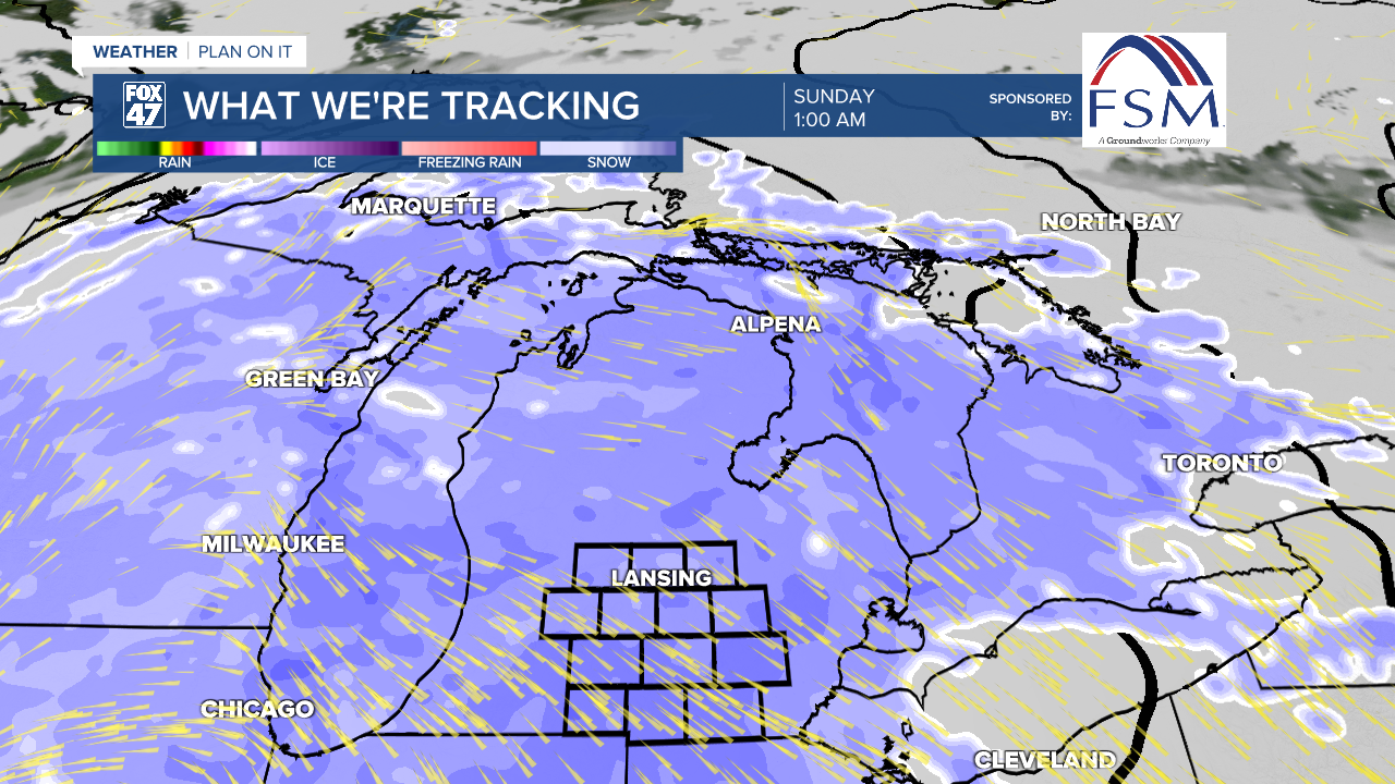
Due to warm air transfer from this low pressure system, we could see higher snowfall accumulations this weekend. The initial snow map below shows a possible 4 - 6" of snowfall across most of our neighborhoods with heavier accumulations off west. We could still see a lot of changes to these numbers ahead of Saturday afternoon. Make sure to keep checking the forecast for updates.
As we continue into the weekend, temperatures take a slight warming trend into Sunday with highs around freezing. However, we are looking at another cool down following this weekend's system with high temps falling into the mid to upper 20's and overnight lows dipping into the teens without wind chill factored in. Make sure to have all the snow geared prep as well as winter weather attire for the weekend and into next week.
Want more FOX 47 News? Here's how you download our Roku app
You can also see the latest news from across our mid-Michigan neighborhoods by liking us on Facebook or following us on X.
