
LANSING, Mich. — We may be into March, but winter weather is sticking around across our neighborhoods as lake enhanced snow showers continue across the west side of the state Tuesday morning. These snow showers will have a chance to impact our neighborhoods through the early afternoon hours today.
This St. Patrick's Day brings temperatures that are well below average back to our neighborhoods. High temperatures will only warm into the mid to upper 20's.

WATCH THE FULL FORECAST BELOW
Winds will remain present today with gusts up to 25-30mph today. These breezy conditions through the daytime hours will allow feels like temperatures to only reach the mid teens today. Even though, we will begin to warm our temperatures starting Wednesday, feels like temperatures will remain on the chilly side due to continued winds.

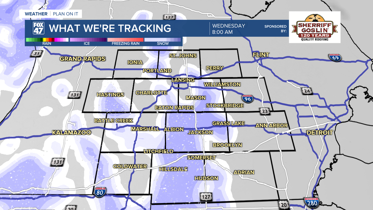
Other than bundling up this St. Patrick's Day, make sure to also watch out for flying snowflakes. So far, a lot of our neighborhoods have observed up to 2" of snowfall in March. This is right around where we should be as average March snowfall in Lansing is at around 5". We could see up to another inch of snow tomorrow morning through early afternoon as a round advances through our neighborhoods ahead of the arrival of a warmer air mass that will gradually warm our temperatures.
Road conditions for the morning commute could possibly be impacted with dropped visibility and light accumulations. However, timing for this event has shifted to the mid to late morning to early afternoon hours, possibly missing the brunt of the morning commute.
We will gradually warm through the rest of the work week with temperatures returning to the 50's by Friday. We will have a few more rounds of possible showers in the form of rain Thursday and Friday as we look to dry up on Saturday with highs continuing in the upper 50's. Temperatures fall late this weekend into early next week with highs only in the lower 40's Monday.

It is also Severe Weather Awareness Week across the state of Michigan and below you can learn more on how Hail forms, a severe weather impact that has already been seen this season with severe storms from earlier this month.
Make sure to have a way to stay safe if severe weather strikes throughout the warmer months across our neighborhoods.
Want more FOX 47 News? Here's how you download our Roku app
You can also see the latest news from across our mid-Michigan neighborhoods by liking us on Facebook or following us on X.
