
LANSING, Mich. — Lansing was 2 degrees shy from meeting the 1910 daytime high temperature record of 97 degrees Wednesday. However, extreme heat continues to impact Mid-Michigan with more highs in the mid 90's today across much of the area with heat index values in the triple digits. It is best to continue limiting time outside as we will begin to gradually cool starting Friday.

WATCH THE FULL FORECAST BELOW
The Extreme Heat Warning will continue through the majority of the day today and come to an end at 8 PM Thursday night. Even though this warning ends today, we will still see daytime highs in the 90's Friday with heat index values nearing the triple digits allowing for continued uncomfortable conditions. It would still be best to limit time outside if you can on Friday.

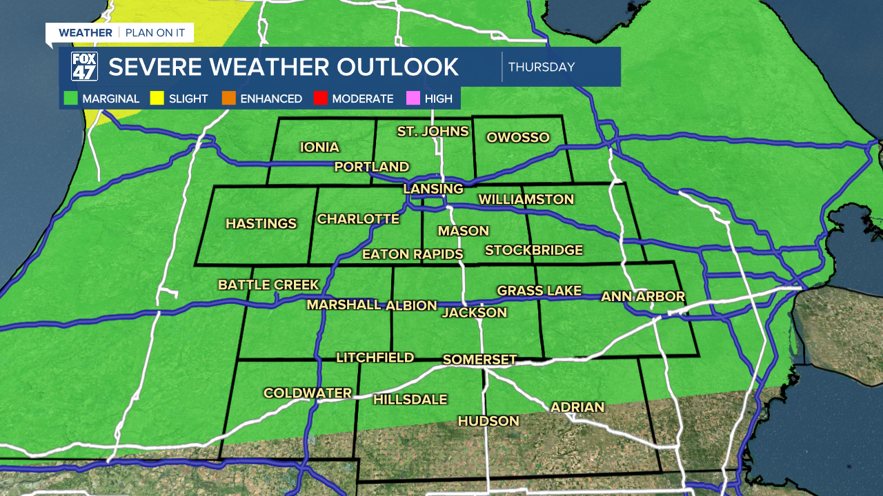
Thursday also marks the return of thunderstorm chances across southern Mid-Michigan. Confidence on severe storm as we head into the weekend remains low as strong ridging pattern aloft starts to break down. Isolated thunderstorms today could turn severe across much of the area with damaging wind gusts, hail, and heavy rainfall rates as main impacts. We could see thunderstorms develop as early as 10 AM to 2 PM in the state with continued thunderstorm potential arriving past 8 PM tonight and continuing into the overnight hours.

Taking us into Friday evening, we will be tracking another disturbance that will bring showers and thunderstorms back to Mid-Michigan with a focus on southern areas like Hillsdale and Jackson counties under a slight risk for scattered severe storms. Main impact to watch out for would be damaging winds.

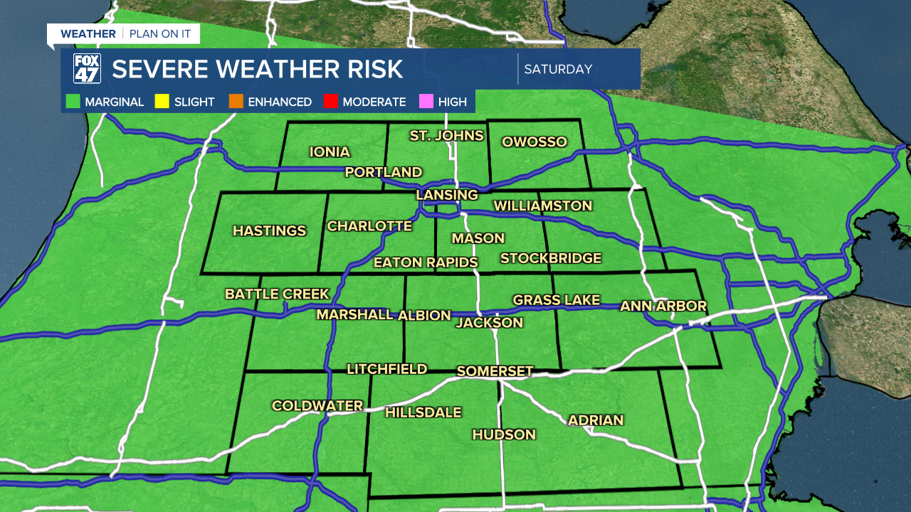
The severe threat isn't over though as we head into the Fourth of July as all of our area is under a marginal risk for isolated severe storms with heavy rainfall, damaging winds, and potential hail as impacts for storms that develop. This could bring some issues for outdoor holiday activities, but confidence still remains low as we iron out timing.
We cool into the lower 90's Friday and head back into the 80's this weekend. New week shows the end of thunderstorm chances as we begin to see temps warm again into the upper 80's.

Have a great weather picture or video to share? Send it our way and we may feature it on-air or online!

