



LANSING, Mich. — The weather will turn much more active to end the weekend as multiple rounds of thunderstorms become possible across Mid-Michigan. While not everyone will see rain, any storms that do develop could become severe with damaging winds and large hail. Cooler, quieter weather returns by the middle of the week.
Sunday Brings the First Chance for Strong Storms.
Sunday will start off warm and partly sunny with highs climbing into the lower 90s, but attention quickly turns to the afternoon and evening hours.As a disturbance moves into Lower Michigan, the atmosphere will become increasingly unstable, especially east of US-127. While there remains uncertainty on exactly where storms will develop, any thunderstorm that forms could quickly become strong to severe.
The primary threats Sunday afternoon include: Damaging wind gusts, large hail, frequent lightning, and heavy downpours.
Forecast confidence remains moderate because a layer of warm air aloft may prevent storms from forming altogether in some locations. Even so, residents should remain weather aware through the afternoon and evening.
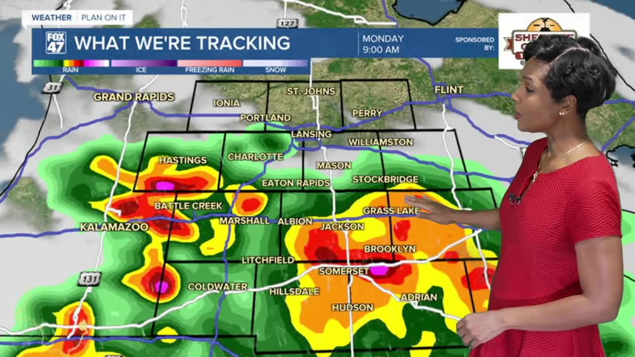
Another Round of Storms Possible Sunday Night. Forecast models continue to suggest another cluster of thunderstorms could develop Sunday night into early Monday morning. This setup is commonly known as a "Ring of Fire" pattern, where thunderstorms develop along the northern edge of a summertime heat dome. These events are notoriously difficult to forecast because storm clusters can rapidly develop and change direction. If storms move across Mid-Michigan overnight, they could once again produce damaging winds and large hail.
Monday Has the Greatest Severe Weather Potential.
Monday currently appears to offer the highest risk for organized severe weather.A cold front moving through the Great Lakes during the afternoon and evening will provide additional lift for thunderstorm development. At the same time, strengthening winds several thousand feet above the ground will increase wind shear, creating an environment favorable for severe storms. The greatest threat appears to be across the southern two-thirds of Mid-Michigan, including the Lansing and Jackson areas. The main hazards include: Damaging straight-line winds, Large hail, Torrential rainfall, and frequent lightning.
While damaging winds appear to be the greatest concern, all types of severe weather remain possible if storms are able to fully develop. One important factor will be whether morning thunderstorms develop first. If widespread morning clouds and rain occur, they could limit afternoon instability and reduce the overall severe weather threat.
Cooler and Drier Weather Returns.
Once the cold front pushes east Monday night, a much quieter weather pattern settles into Lower Michigan. High pressure and an upper-level trough will bring several days of sunshine, lower humidity, and more comfortable temperatures from Tuesday through Thursday. Highs will fall back into the lower 80s, offering a refreshing break after Sunday's heat. Rain chances remain low through Thursday before another disturbance brings the possibility of showers by Friday.
7-Day Forecast
Sunday: Chance of thunderstorms. High 91°.
Monday: Scattered thunderstorms, some possibly severe. High 89°.
Tuesday: Partly sunny with a few lingering showers early. High 83°.
Wednesday: Sunny and comfortable. High 82°.
Thursday: Sunny. High 84°.
Friday: Mostly sunny with a slight chance of showers late. High 86°.
Saturday: Mostly sunny. High 86°.
Looking Ahead:
The first half of the week begins on an active note with the potential for strong to severe thunderstorms Sunday and again Monday. Because the exact timing and placement of storm development remains uncertain, not everyone will experience severe weather. However, if storms develop, the atmosphere will be capable of producing damaging winds and large hail. Once the cold front moves through, expect a welcome stretch of cooler temperatures, lower humidity, and dry weather through much of the second half of the week.
Have a great weather picture or video to share? Send it our way and we may feature it on-air or online!

