
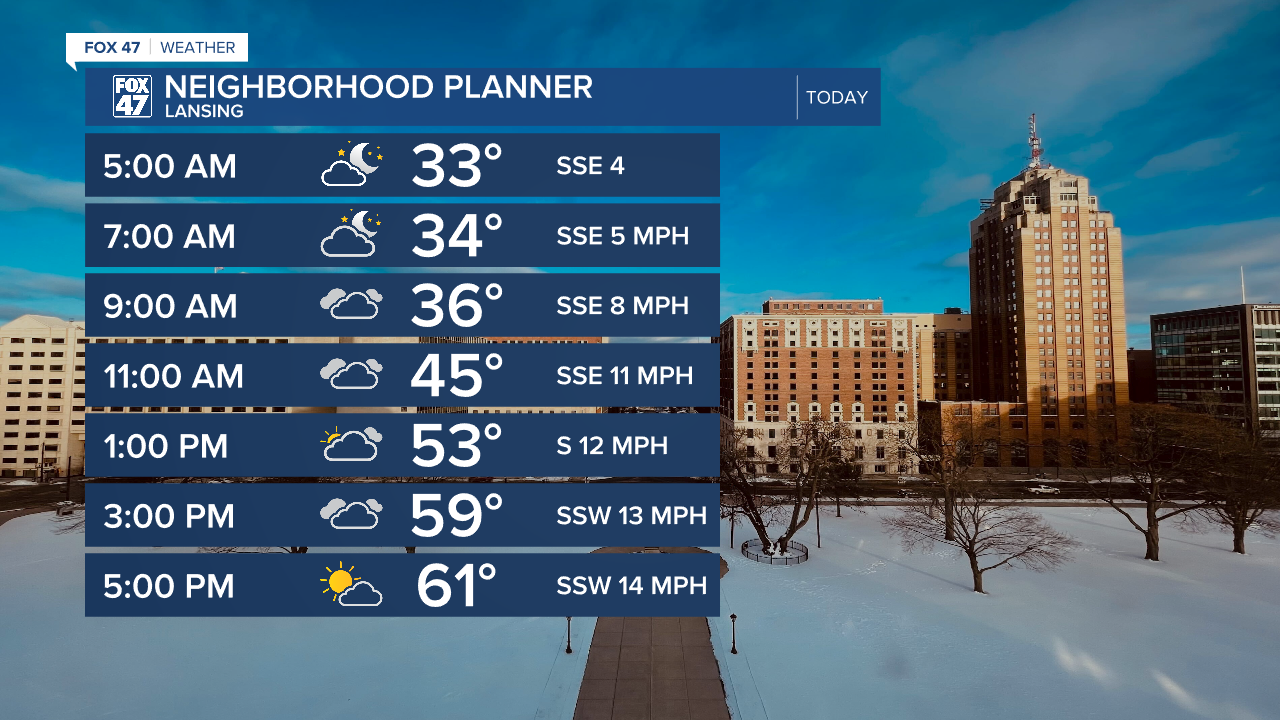
LANSING, Mich. — We are observing another cool start to the day with air temperatures in the mid to lower 30's across our neighborhoods with feels like temperatures also hovering around freezing. Make sure to still grab that jacket when heading out the door.
We will continue to warm today across southern Michigan with high temperatures possibly reaching the mid to lower 60's. This is above average for this time of year. We will see variably cloudy skies, especially during the first half of the day. Around 4 PM, we could see more sunshine to wrap up the day.
WATCH THE FULL FORECAST BELOW
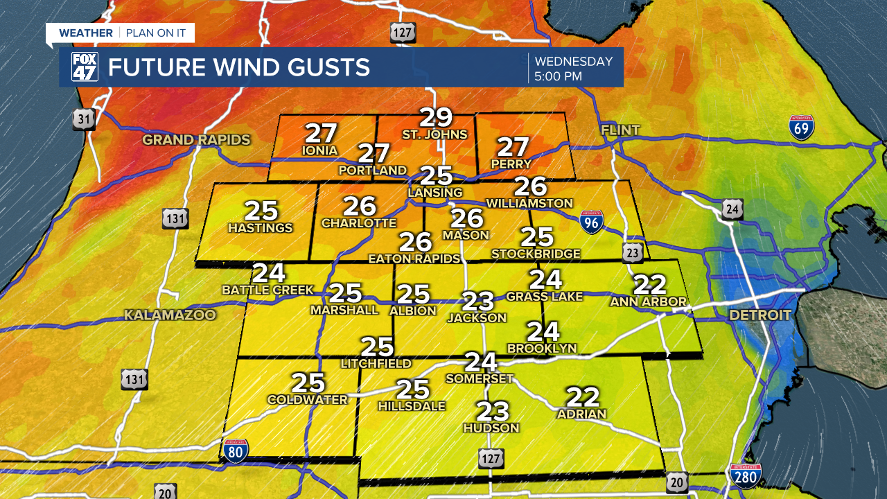
Winds today will strengthen during the late afternoon hours with gusts ranging from 25-30 mph. 30 mph gusts will be favored for more northern neighborhoods. The good news is that feels like temperatures won't be impacted. If you want to get out side, wait for the later afternoon hours with winds being the only primary impact.
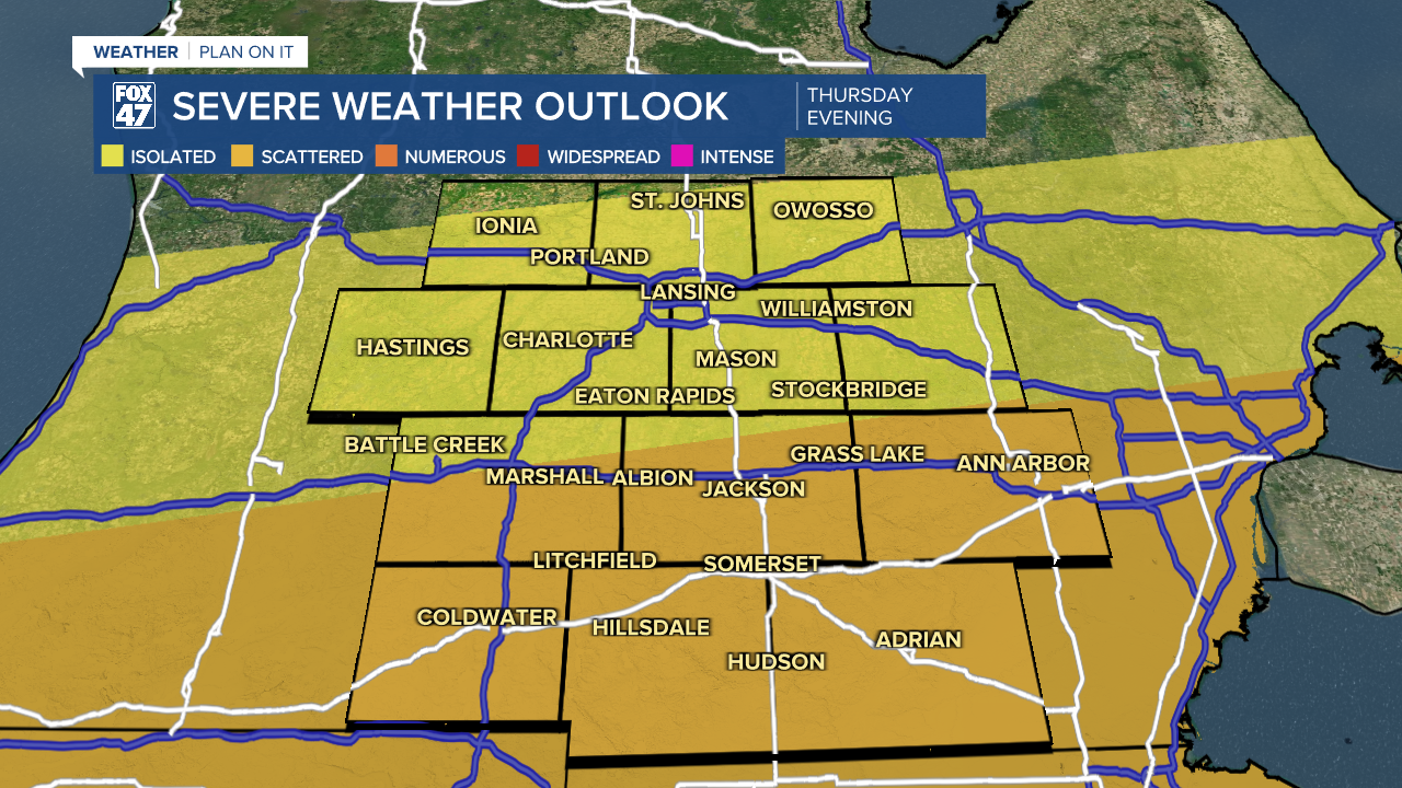
Thunderstorms return to our neighborhoods Thursday afternoon and evening. The Storm Prediction Center has extended the slight risk into our southern neighborhoods along and south of the I-94 corridor. The marginal risk still exists for all other neighborhoods to the north.
All impacts are on the table with a primary hail threat with possible 2" in diameter hail or greater. A few tornadoes and damaging wind gusts are also possible.
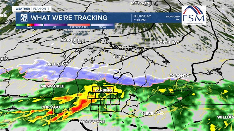
Showers and storms arrive during the afternoon hours and track south along with the passing cold front with severe impacts primarily occurring after the 5 PM hour. We should see storms exit the state around 11 PM with some possible wintry mix on the back end during the rest of the overnight hours Thursday into Friday.
Some guidance limits surface based instability into Michigan which is a key ingredient for thunderstorms development. If we see showers and clouds during the first half of the day, we could see some changes to the forecast as well as severe impacts. Have a way to get alerts and stay updated on the forecast.
Temperatures fall Friday into the lower 40's with decreasing cloud cover. Lots of sunshine remains possible through the weekend as temperatures gradually warm back into the mid to upper 50's. Monday and Tuesday brings returning chances to showers with storms possible on Tuesday as well. It's too early to talk potential for severe weather next week, but we will continue to monitor.

Want more FOX 47 News? Here's how you download our Roku app
You can also see the latest news from across our mid-Michigan neighborhoods by liking us on Facebook or following us on X.
