

LANSING, Mich. — Following showers and storms from last night with reports of large hail up to an inch and a quarter in places across our area, we will continue to track potential severe impacts with more storms today. High temperatures should only reach the mid to lower 70's today ahead of returning showers. These temperatures are below average for this time of year. This trend will continue into next week.
A Flood Watch has been issued for most of Mid-Michigan minus our most northern row of counties. This watch will go into effect this afternoon as showers begin as early as 1 PM. Steady rainfall rates paired with incoming storms during the evening hours could lead to 2-4 inches of rainfall through Thursday morning.

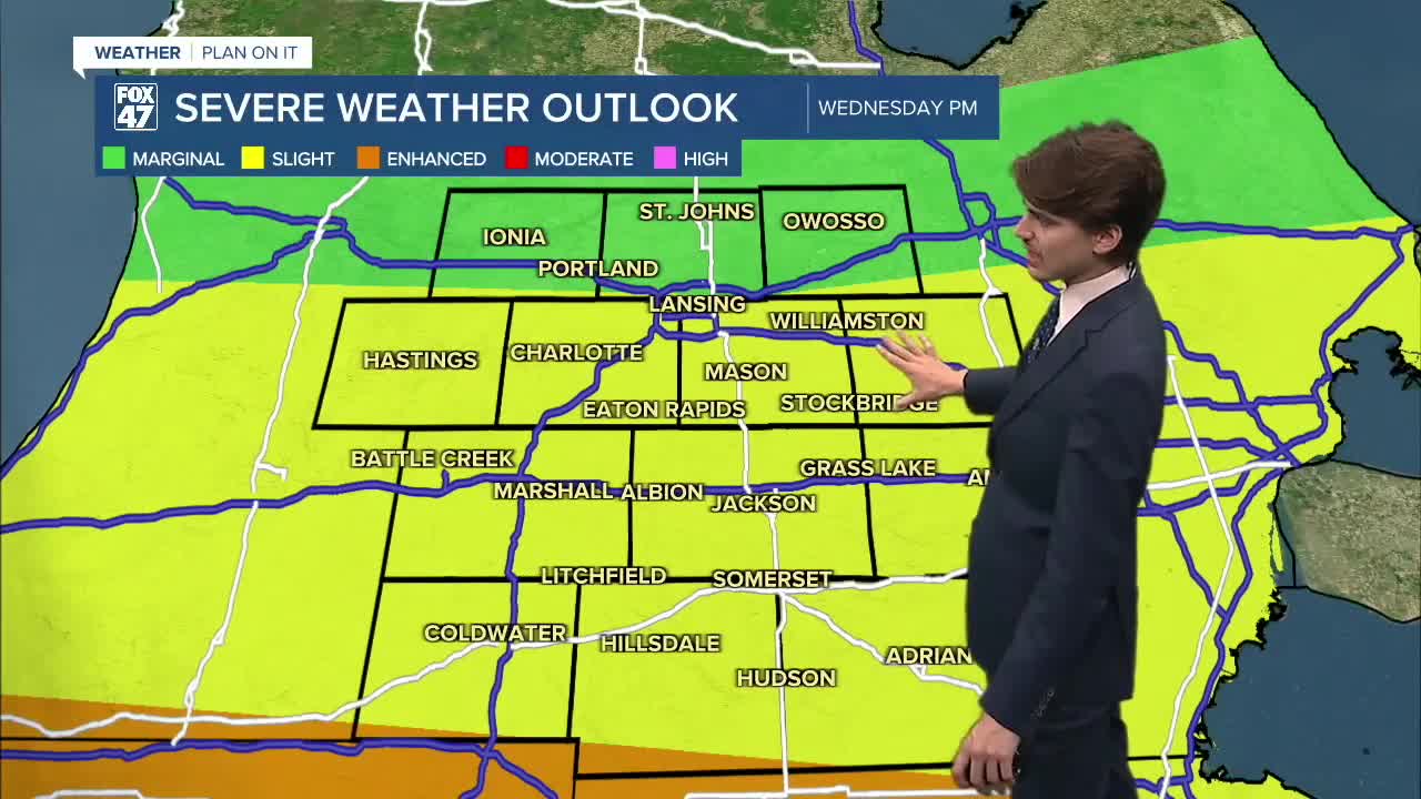
The severe weather outlook has been upgraded with the slight risk for scattered severe storms being extended into Eaton and Ingham counties as damaging wind gusts and heavy rainfall rates remaining as main impacts for these areas. The tornado threat will remain for most southern areas including Hillsdale and even possibly Jackson counties. Hail will also remain a threat for the area.

Steadier rainfall rates arrive during the mid-afternoon hours around 4 PM which will aid in the flood risk for the evening hours as storms with the potential for additional severe impacts arriving during the evening hours around 6 PM and lasting through around midnight tonight. Make sure to have ways to receive weather alerts tonight and also pay attention when commuting for possible ponding and flooding on roadways.


We will see temperatures drop into the upper 50's tonight with highs struggling to reach 70 tomorrow with a few showers possible remaining tame on the back end of this passing system. We will remain dry for Juneteenth with more sunshine and temperatures staying below average. This temp trend takes us into next week as well with more chances for storms, including Father's Day.

Have a great weather picture or video to share? Send it our way and we may feature it on-air or online!

