
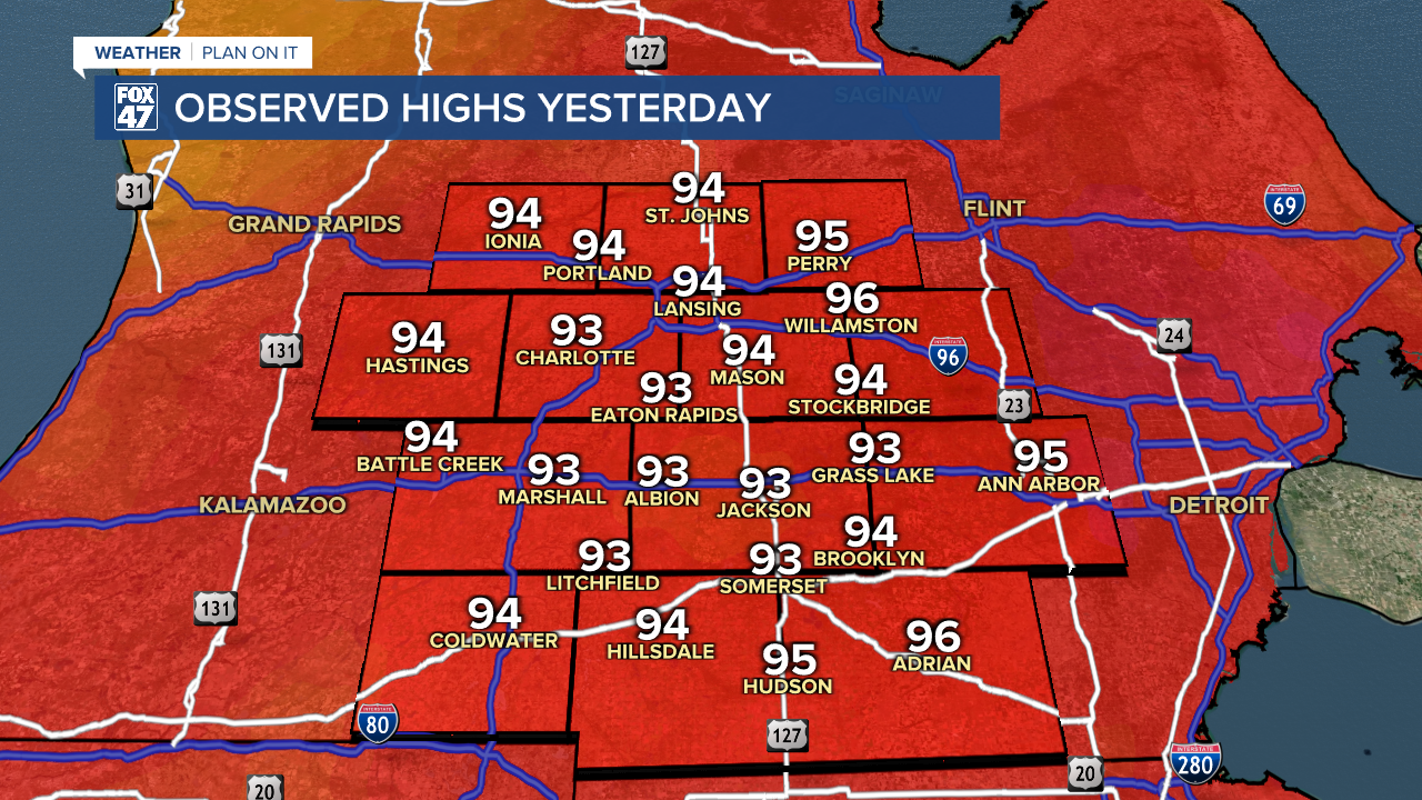
LANSING, Mich. — Air temperatures were able to reach the mid to lower 90's across all of our neighborhoods Thursday. Heat index values in Lansing were able to exceed triple digits ahead of showers and storms that brought damaging winds across the state of Michigan.
WATCH THE FULL FORECAST BELOW
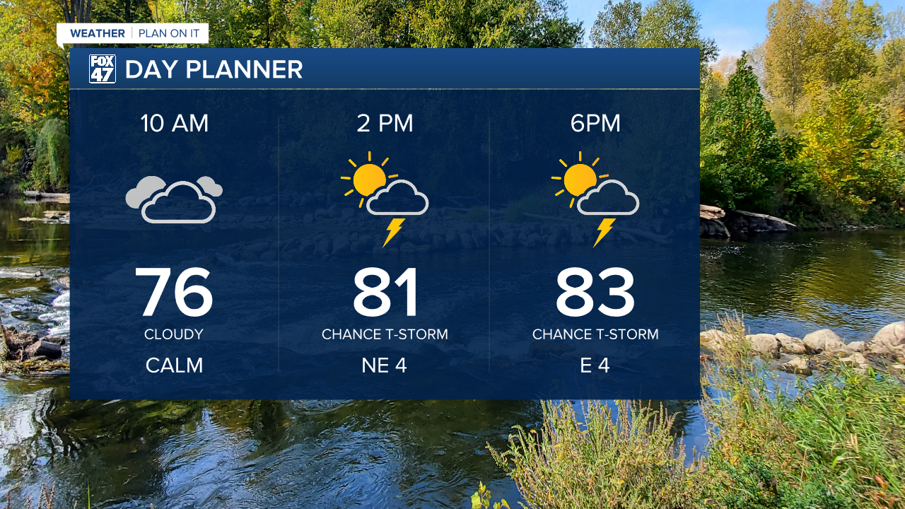
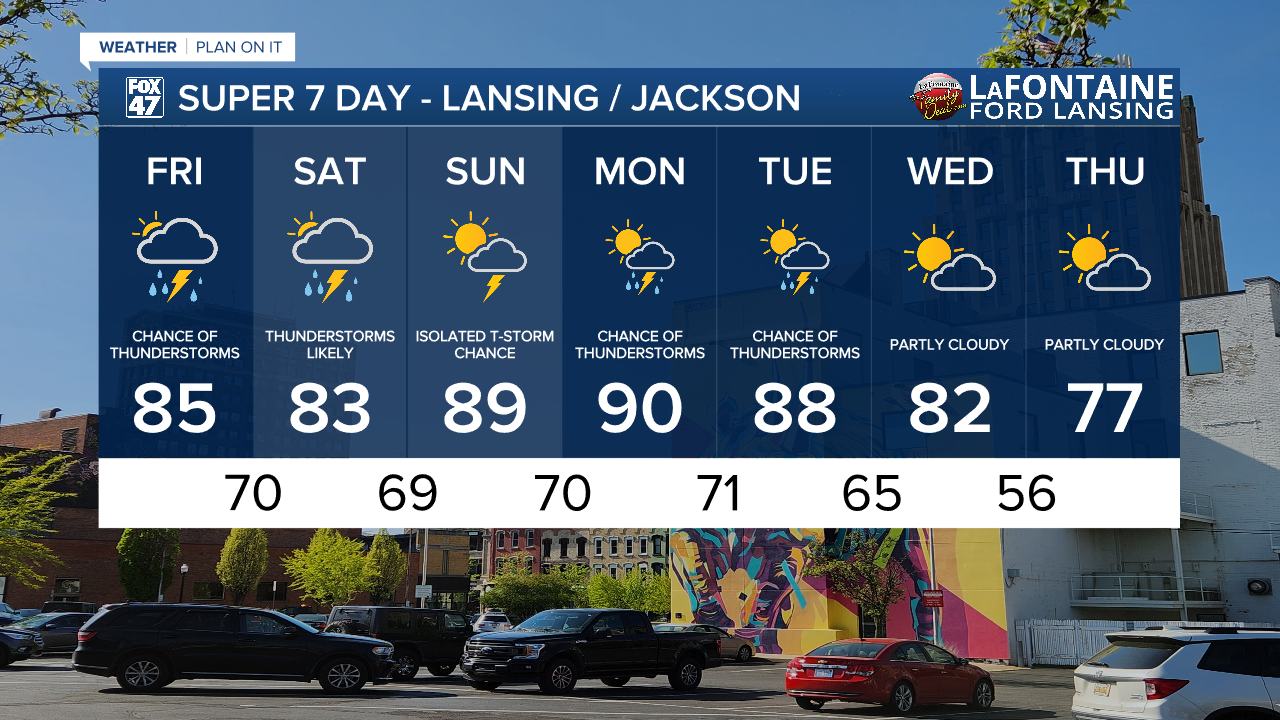
The frontal passage continues across our state this morning and is expected to stall out this afternoon. This will allow for renewed thunderstorm potential this afternoon. Heat will back off compared to yesterday with high temps in the mid 80's and weak winds out of the north.
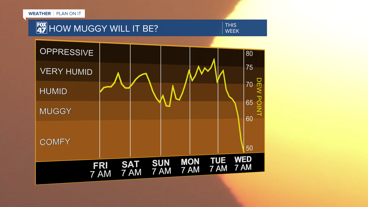
Even though air temperatures will drop today, humidity will be sticking around due to the continued presence of moisture in the atmosphere. Dew points will continue to range in the upper 60's and lower 70's through the weekend and into early next week. This will allow for uncomfortable conditions when stepping out the door in all of our neighborhoods.
Storms today should stay tame across our neighborhoods as an area of low pressure tracking northeast will drive a warm frontal passage through our neighborhoods tomorrow morning driving renewed chances for showers and storms late overnight into the first half of Saturday.
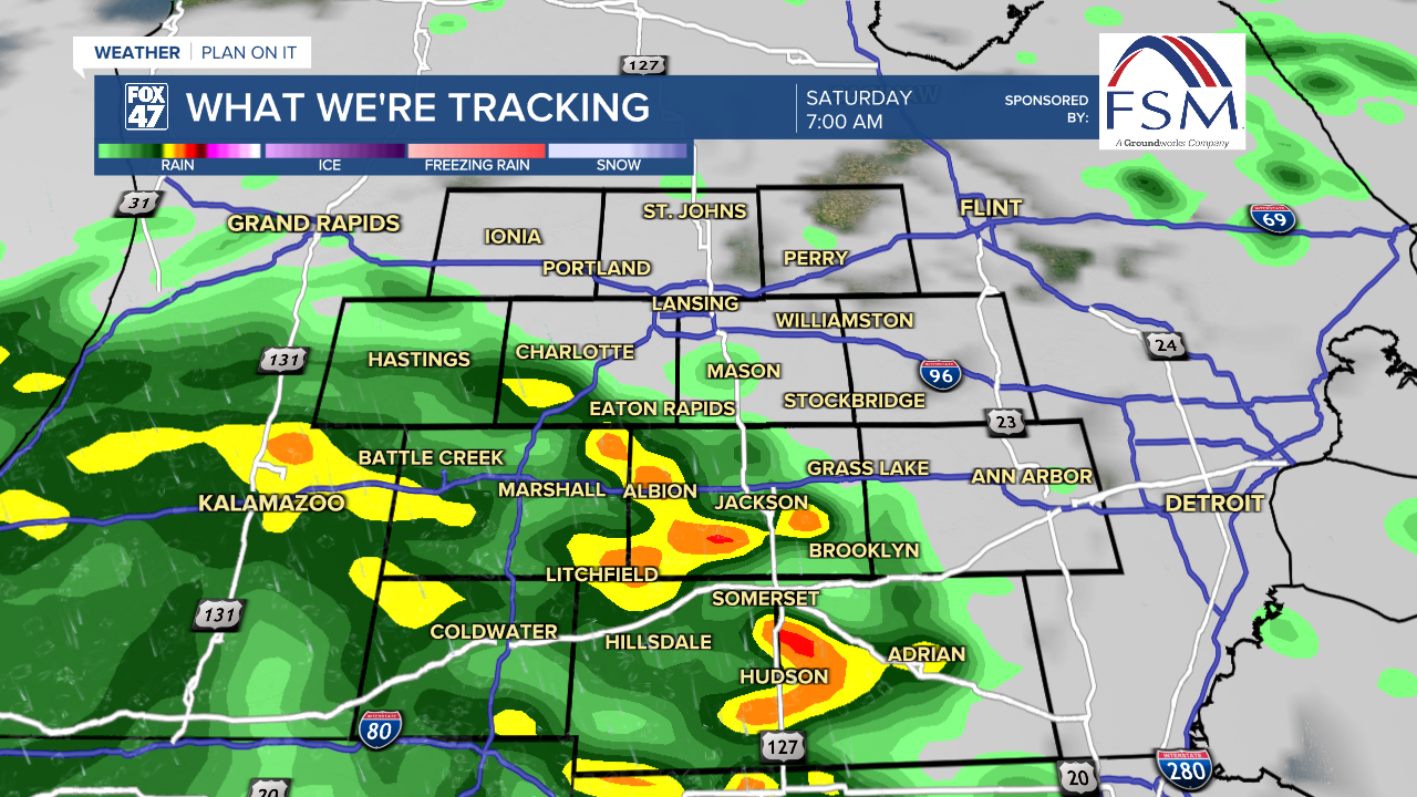
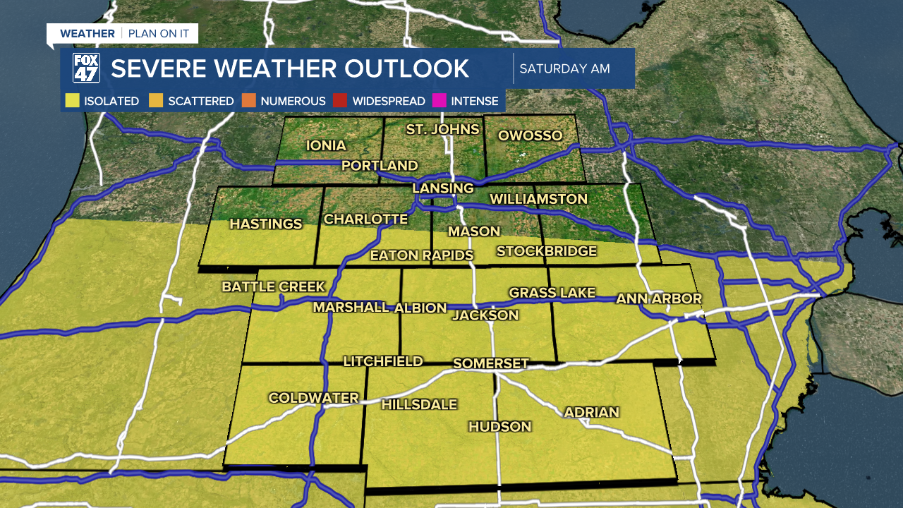
There is a marginal risk for isolated severe thunderstorms across our southern neighborhoods Saturday morning with main impacts including damaging winds. We could continue to see tame thunderstorms throughout the afternoon hours of Saturday behind the warm front.
We are seeing relief in the 7-Day forecast from this humidity. After a few more rounds of showers and thunderstorms possible for Monday and Tuesday, high pressure will build into our neighborhoods midweek allowing for dry conditions and chances to see the sun.
Want more FOX 47 News? Here's how you download our Roku app
You can also see the latest news from across our mid-Michigan neighborhoods by liking us on Facebook or following us on X.
