
LANSING, Mich. — Starting a new week, hot and humid conditions continue with an end in sight. Northern neighborhoods in Ingham and Clinton counties were able to see daytime highs into the 90's on Sunday. This trend will continue today. High temperatures across our neighborhoods are expected to range in the lower 90's with heat index values in the upper 90's, possibly reaching triple digits.
A heat advisory has been issued for all of our neighborhoods Monday. This advisory will go into effect at noon and last through 9 PM Monday evening.

WATCH THE FULL FORECAST BELOW
The Heat Dome's center of high pressure is located south of the state of Michigan with a few mid level disturbances following the pattern of this setup. These disturbances will allow for small thunderstorm chances across our neighborhoods to start the week.
Past 2PM this afternoon, a shortwave trough will advance through the eastern portion of the state of Michigan driving widely scattered showers and thunderstorms. We could see these showers and storms across our neighborhoods from 3 PM Monday through Monday evening. We are not expecting to see any severe impacts, but heavy precipitation rates are possible.

As we progress through the week, a weak frontal passage will shift southward across our neighborhoods Tuesday, driving more shower and thunderstorm chances through Wednesday with shower chances into Thursday morning. No severe impacts are expected with any of these rounds of thunderstorms. However, heavy rainfall rates do remain possible. We will watch carefully for any change in evolution or timing.
Once the frontal passage sinks south of the state, high pressure will begin to build into the Great Lakes region, allowing for drier, clear conditions. Dew points will take a drop during this time with more comfortable conditions expected.

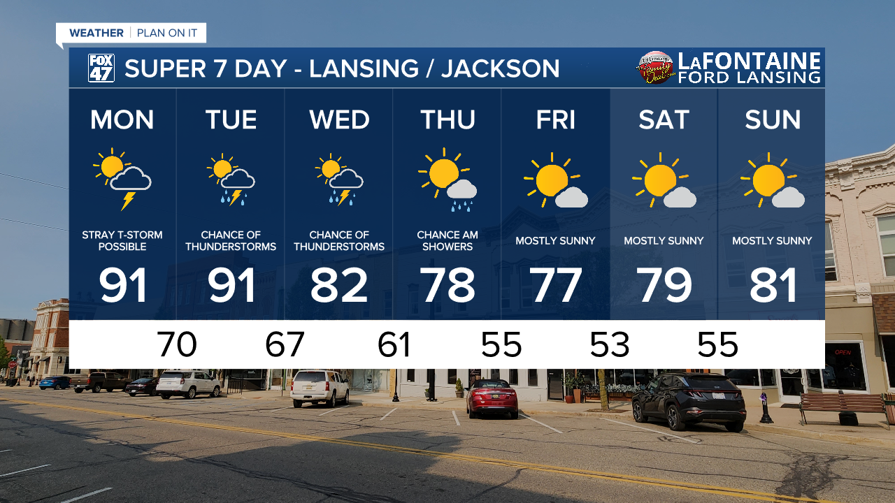
Temps will range in the lower 90's today and Tuesday across our neighborhoods. We will drop into the lower 80's on Wednesday with upper 70's favored for Thursday, Friday, and Saturday. During the late week and into the weekend, more sunshine will make it in to the forecast with lots of opportunity to get outside.
Want more FOX 47 News? Here's how you download our Roku app
You can also see the latest news from across our mid-Michigan neighborhoods by liking us on Facebook or following us on X.
