
12 PM UPDATE
A Frost Advisory has been issued for Clinton, Eaton, Ingham, and Jackson from Midnight tonight through 9 AM Friday morning.
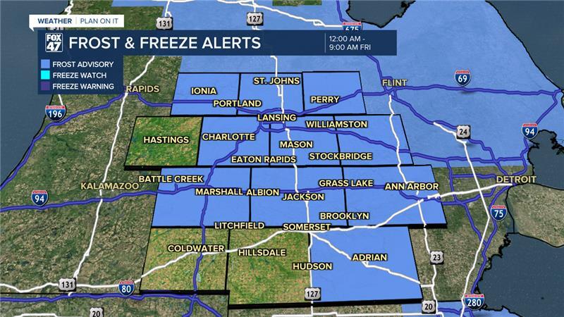
Temperatures at the surface could reach 32 degrees overnight tonight. However, winds will be present as well as increasing cloud cover starting around 4 AM ahead of an incoming cold front which could hinder some of the development.
Make sure to cover up any outdoor vegetation or bring it on inside for the overnight hours.
ORIGINAL POST
We're starting the day cold with temperatures in the lower 30's and feeling below freezing with areas of frost expected when heading out the door. Frost and freeze alerts continue on throughout the majority of southern Michigan through 9 AM Thursday morning.

Frost is known to harm outdoor plants and vegetation. If you brought in your plants or covered them up, you might want to continue to do so overnight tonight as patch frost is still possible barring a few hindrances.
When tracking frost, favorable conditions for development include temperatures forecast in the mid to upper 30's with calm winds and clear skies. Overnight tonight, skies will remain clear with cloud cover beginning to increase at around 3-4AM with present winds possibly gusting up to 15 mph. Air temperatures are also ranging at around 39 to 40 degrees overnight. These conditions could produce these patchy areas overnight.
WATCH THE FULL FORECAST BELOW
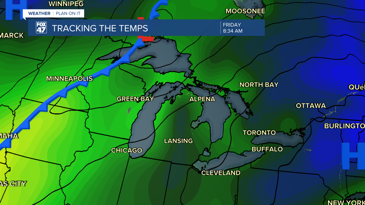
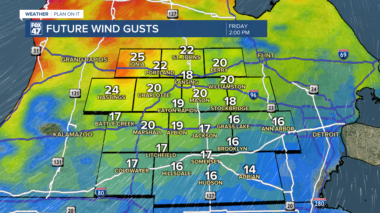
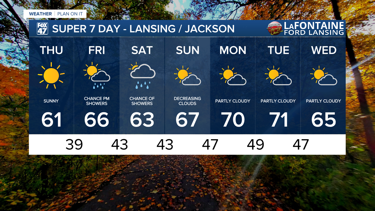
We will start to warm once we reach Friday as winds turn out of the south with possibly gusts up to 30 mph. These gusts are located ahead of an incoming cold front that could also bring showers back to our neighborhoods. We could see scattered rain showers develop anytime after 12 PM Friday and last through the overnight hours into Saturday with cloudy skies through the day Saturday.
Any showers we do see Friday and Saturday are not looking to produce any major impacts are large rainfall totals. Make sure to grab the umbrella when heading out the door.

Showers will come to an end with a brief cool down in daytime highs Saturday. We will see temps back into the 70's once we start a brand new week Monday with partly cloudy skies.
Want more FOX 47 News? Here's how you download our Roku app
You can also see the latest news from across our mid-Michigan neighborhoods by liking us on Facebook or following us on X.
