
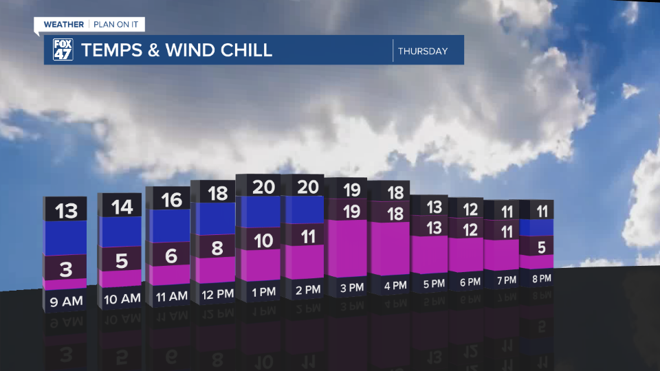
LANSING, Mich. — Road conditions are improving following freezing drizzle and snow from yesterday afternoon across southern Michigan. Now that the cold front has advances through, winds have shifted out of the northwest with gusts up to 20 mph during the mid morning hours.
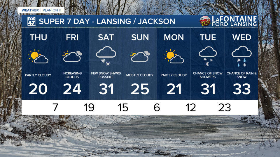
Winds will gradually weaken heading into the afternoon hours and becoming calm by 3 PM. This means feels like temperatures will not be impacted. High air temperatures, however, are only expected to reach the upper teens/lower 20's today across our neighborhoods.
WATCH THE FULL FORECAST BELOW
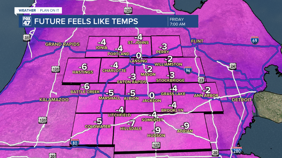
We will only have a brief reprieve from present winds as the overnight hours brings wind gusts back up to 20-25 mph. This will aid in dropping our feels like temperatures below zero. Air temps are expected to drop into the single digits for an overnight low tonight. Some areas to the south like Hillsdale could see feels like temps drop close to 10 below Friday morning. Make sure to bundle up and gear up when heading out the door Friday morning.
We stay dry Thursday and Friday as our next best snow chances arrive Saturday. A clipper system tracking east bring a sweeping cold front across our neighborhoods Saturday morning where we could see a few snow showers pop up during the first half of the day with light accumulations possible. This system is lacking moisture, hence, uniform snowfall remains not likely.

Better chances for accumulating snowfall arrives next week Tuesday and Wednesday. Temperatures will rebound Saturday around freezing. Following the cold front, temperatures will drop yet again into the mid to lower 20's and overnight lows back in the single digits. We are finally tracking above freezing temperatures for mid week next week as those snow and rain shower chances arrive.
Want more FOX 47 News? Here's how you download our Roku app
You can also see the latest news from across our mid-Michigan neighborhoods by liking us on Facebook or following us on X.
