
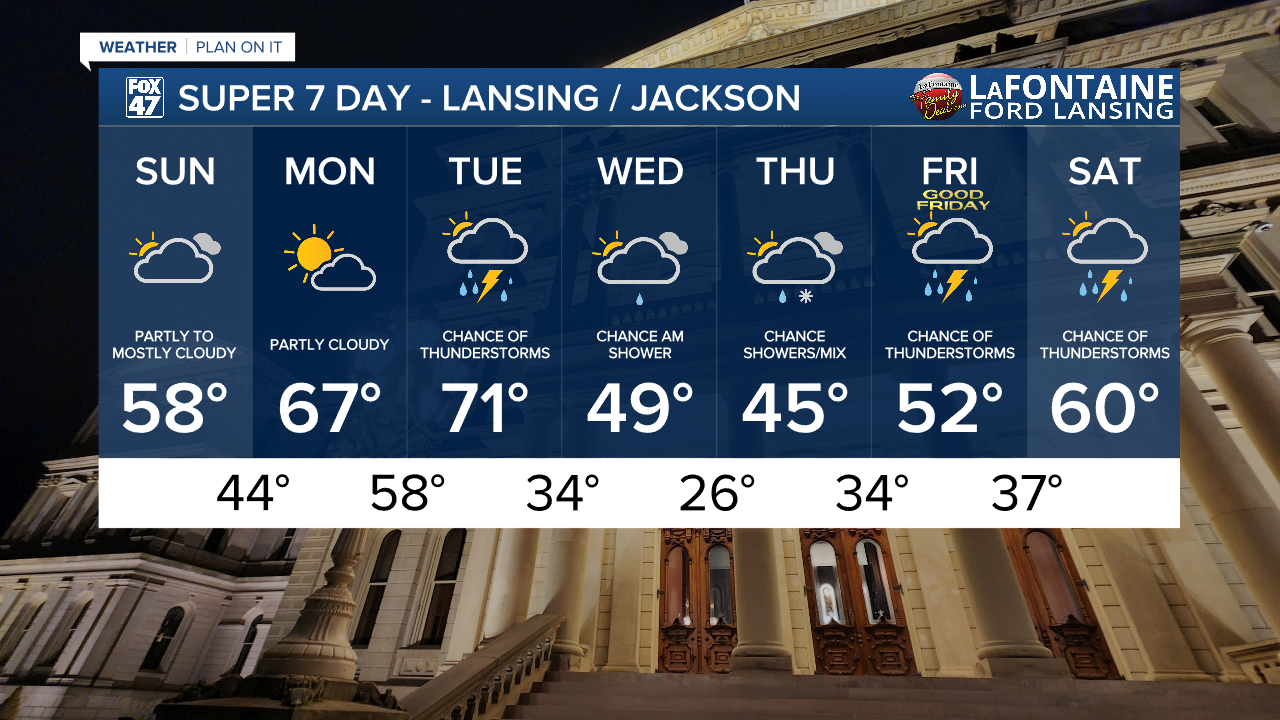
LANSING, Mich. — Saturday brought lots of sunshine to our neighborhoods, however, temperatures remained on the chilly side. Sunday brings warmer temperatures with more cloud cover as surface high pressure exits the region allowing winds to turn out of the south.
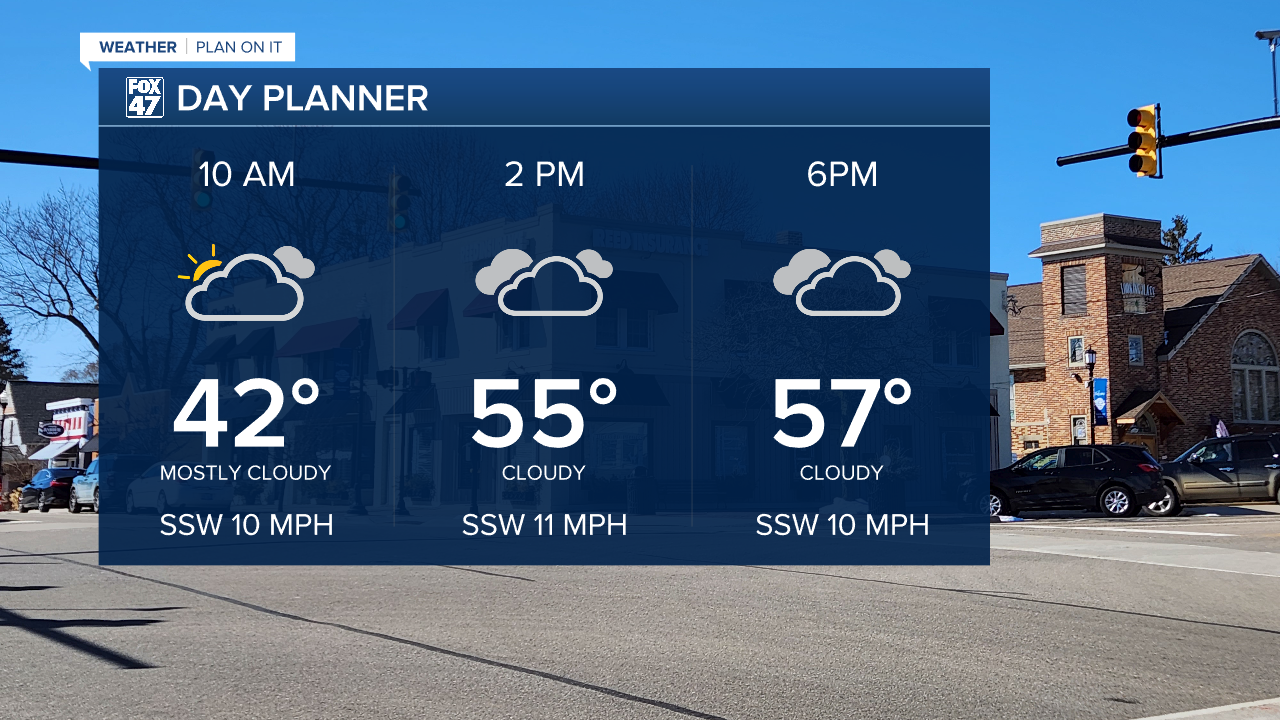
Temperatures will warm into the upper 50's today with a few peaks of sunshine still possible allowing for the chance to see temperatures reach the lower 60's for some.
WATCH THE FULL FORECAST BELOW
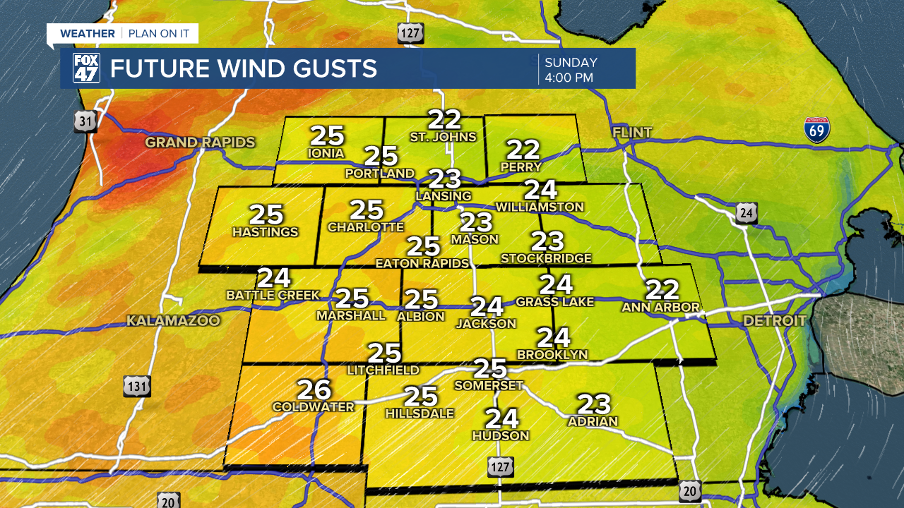
Wind speeds today pick up with gusts ranging from 20-25 mph and isolated gusts up to 30 mph. Feels like temperatures won't be impacted too badly heading into the afternoon hours, but a jacket might be needed when first stepping out the door during the AM hours.
We will continue to see strong winds and warming temperatures to start the new week. Monday bring partly cloudy skies with more sunshine chances and high temps into the mid to upper 60's. This will be another good day to get outside and enjoy the warmer weather as shower and storm potential returns Tuesday.
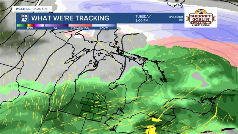
A frontal passage will sag south through our neighborhoods Tuesday paired with an incoming low pressure system to aid in storm development primarily during the evening hours. We could even see a few isolated showers across our neighborhoods as early as 11 AM. Heavy rainfall remains possible. We could still see a few changes to the evolution of this system and will continue to monitor closely for additional severe impacts.
Temperatures fall following Tuesday's round of precipitation with lows back below freezing and highs in the 40's. A few shower chances remain Wednesday and Thursday even a possible mix on Thursday. We will gradually warm by the end of the week with more thunderstorm potential heading into the holiday weekend. We will monitor closely heading into next week for potential Easter impacts.
Have a great weather picture or video to share? Send it our way and we may feature it on-air or online!

