
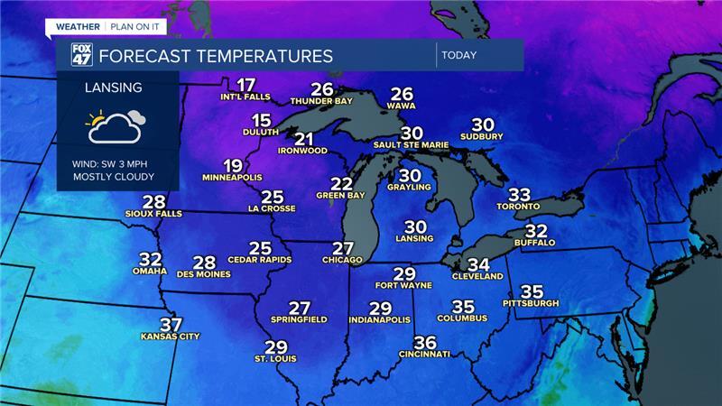
LANSING, Mich. — Snow is moving off to the east this morning with cloudy skies being left over across our neighborhoods. If heading out the door, you could still run into some slick spots on surface roads and back roads. Stay weather aware when driving through areas of snow.
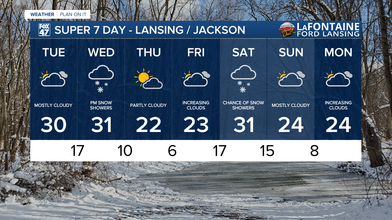
We will see dry conditions remain for the rest of the day Tuesday with mostly cloudy skies. High temperatures will remain just under freezing with weak winds.
WATCH THE FULL FORECAST BELOW
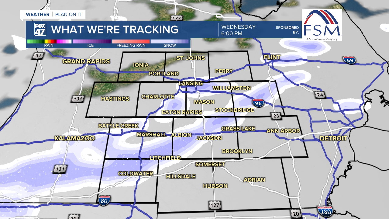
We have a chance to see some clearing in the early afternoon as a ridging pattern impacts the region. However, this will be short lived as an incoming cold front Wednesday will bring more snowfall and a cool down in our temperatures.
Ahead of this next system, winds will pick up during the overnight hours into tomorrow morning. We could see gusts from 25-30 mph as early as 8 AM Wednesday morning. Snowfall ahead of the cold front could begin as early as 2 PM Wednesday and track south across our neighborhoods, exiting by 10 PM Wednesday. We are not looking at any major accumulations of snowfall. A half an inch and up to an inch of snow is possible during the afternoon hours Wednesday.
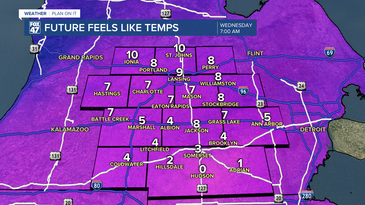
These strong winds will aid in dropping our feels like temperatures into the single digits beginning tonight and into the morning hours. Even once the cold front advances through Wednesday evening, strong winds will continue out of the north. This will aid in a cool down for our air temperatures. Highs Thursday and Friday only range in the mid to lower 20's. This is well below average as we should be seeing highs in the upper 30's/lower 40's for this time of year. Overnight lows will drop into the single digits overnight Thursday into Friday.
Temps will warm back around freezing Saturday as we track returning snowfall affiliated with a few disturbances that will advance through the region. It is still a bit too early to talk details as we could still see some changes to the evolution. Temperatures trends are looking to cool again on the back end of that weekend system. Temps are not expected to rise above freezing during the 7-Day period.
Want more FOX 47 News? Here's how you download our Roku app
You can also see the latest news from across our mid-Michigan neighborhoods by liking us on Facebook or following us on X.
