


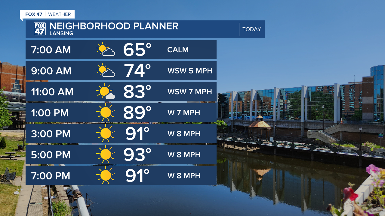
LANSING, Mich. — We are heading into a new week with well above average temperatures that will carry through the majority of the work week. Highs today should reach the mid 90's for northern areas and upper 80's/lower 90's for southern areas. Heat index values are expected to possibly range from the mid to upper 90's.
A line of showers and storms tracking south in the lower peninsula is weakening ahead of it's arrival in our area. These showers should fizzle, leaving us with a few passing clouds through the rest of the morning hours. Other than that, lots of sunshine is expected through the rest of the day.
WATCH THE FULL FORECAST BELOW
An Extreme Heat Watch will go into effect Tuesday at noon and last through Tuesday at 8 PM for Clinton, Ingham and Jackson counties as temperatures warm into the upper 90's and heat index values have a good shot of reaching the triple digits. We will also be a bit more humid during the day Tuesday compared to today which will make conditions uncomfortable. Avoid time outside and make sure to drink plenty of water, even if not thirsty.
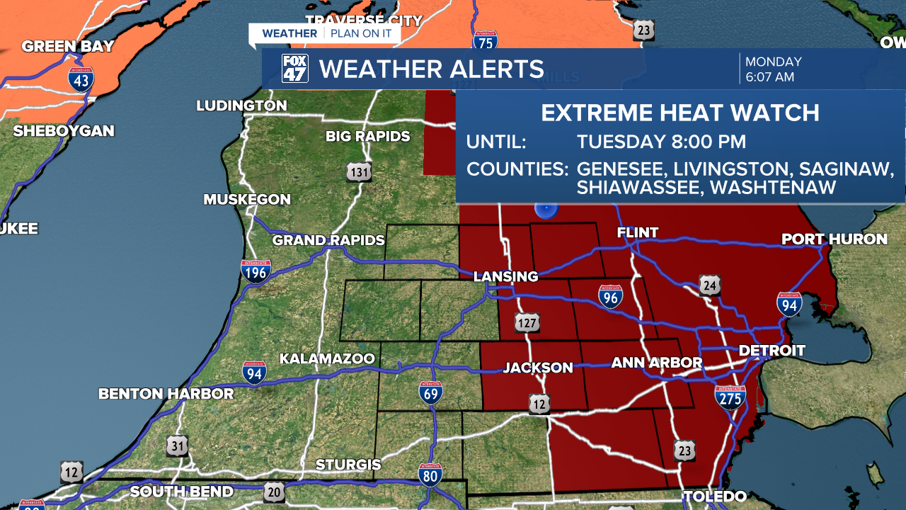
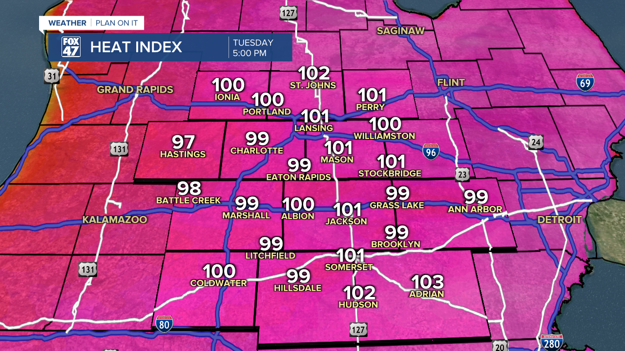
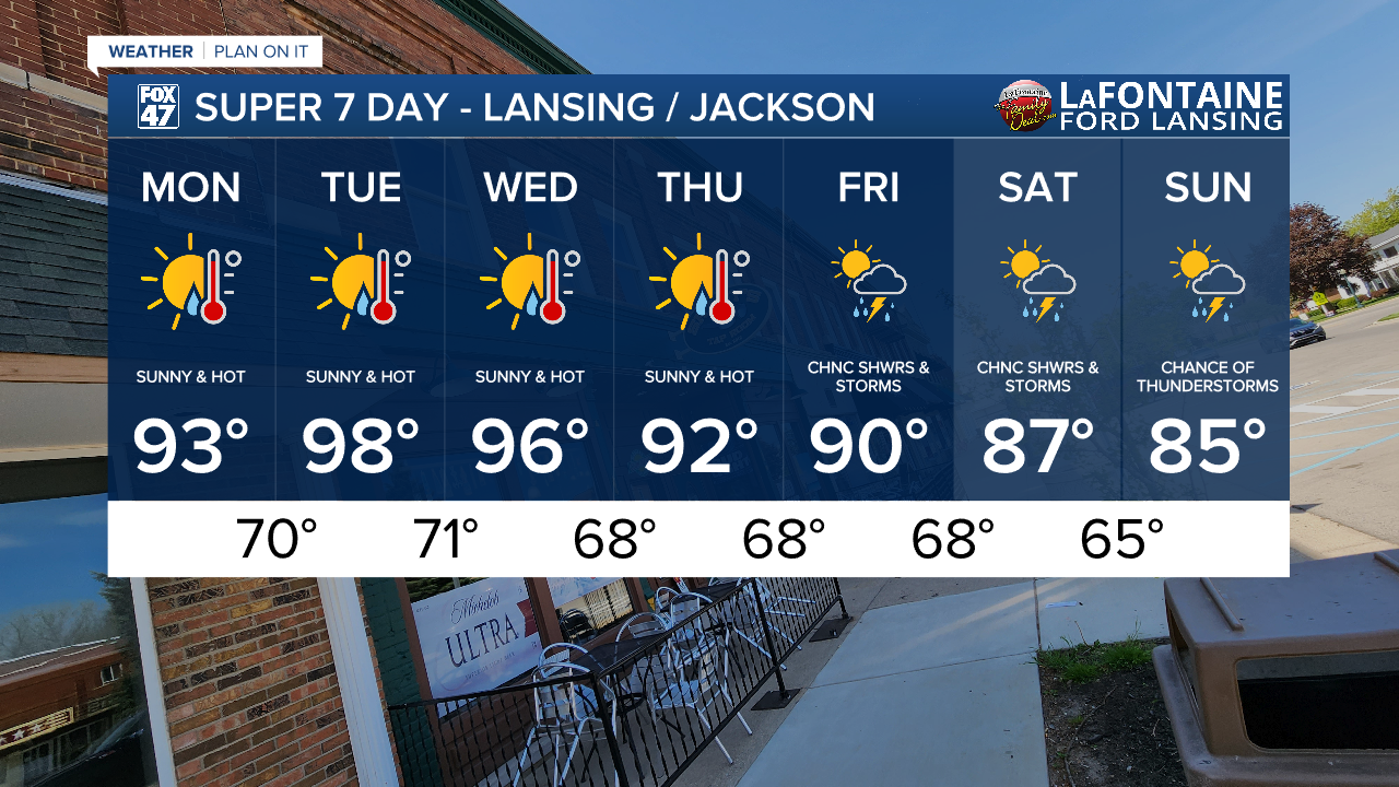
Wednesday has a shot of bringing triple digit heat index values to our neighborhoods an we will be watching for any other alerts that might be issued as air temps cool to the mid 90's again. We can still expect lots of sunshine as we fall to the lower 90's Thursday with possible returning showers and storms Friday and taking us into the weekend where highs will drop back into the 80's.
Have a great weather picture or video to share? Send it our way and we may feature it on-air or online!

