
LANSING, Mich. — Extreme heat arrives in our neighborhoods today with high temps expected to reach the mid 90's. We are starting Thursday morning with dry, clear, conditions. Temps this morning are already into the 70's and will continue to warm as we progress through the day with uncomfortable conditions favored.
Cloud cover will begin to move in this afternoon as the cold front inches closer to our neighborhoods driving showers and storms Thursday evening.

WATCH THE FULL FORECAST BELOW
A Heat Advisory will go into effect at 11 AM Thursday morning across all of our neighborhoods. This advisory will expire at 8 PM this evening.

You will want to limit time outside today, especially in the afternoon hours during peak heating, as heat index values could reach the triple digits with dew points into the 70's allowing for humid conditions.
Heat index values tell us how our bodies react to heat by factoring both air temperatures as well as humidity. These values can typically range 10-15 degrees above the forecast air temperatures.

LEARN MORE ABOUT THE HEAT INDEX BELOW
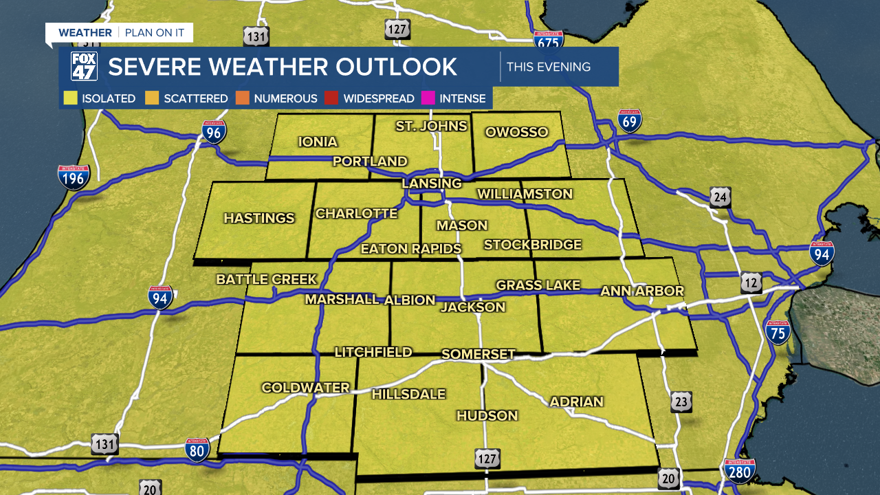
Once we reach the afternoon hours, showers and storms will begin as the cold front begins to advance through the state. The Storm Prediction Center has continued the Marginal risk for severe storms for Thursday late afternoon and into the evening hours. Main impacts today include damaging winds and heavy rainfall rates which could lead to some localized flooding.
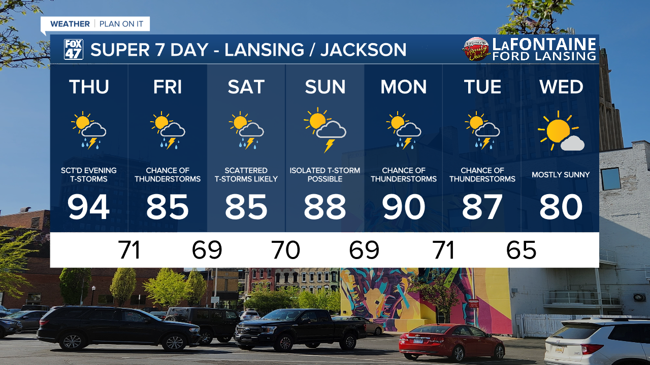
Timing of showers today starts as early as 2 PM with a pop up shower possible. The brunt of showers and storms arrives in the evening hours at 6 PM and lasts through past midnight. A few showers are possible waking up Friday morning with no severe impacts expected.

Temps will cool into the mid 80's for Friday and Saturday. However, we will hold onto moisture in our atmosphere. This means humid conditions will continue into the weekend and even into early next week. Storm chances continue this weekend with scattered storms possible on Saturday and Monday.
Want more FOX 47 News? Here's how you download our Roku app
You can also see the latest news from across our mid-Michigan neighborhoods by liking us on Facebook or following us on X.
