
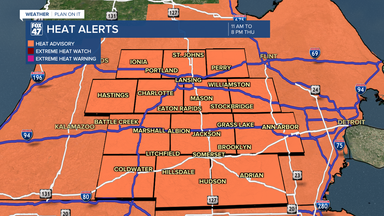
LANSING, Mich. — A Heat Advisory has been issued for all of our neighborhoods this morning for extreme heat that will begin to ramp up today in southern Michigan. The Heat Advisory goes into effect Thursday morning at 11 AM and will last through 8 PM Thursday with heat index values flirting or possibly meeting triple digits.
WATCH THE FULL FORECAST BELOW
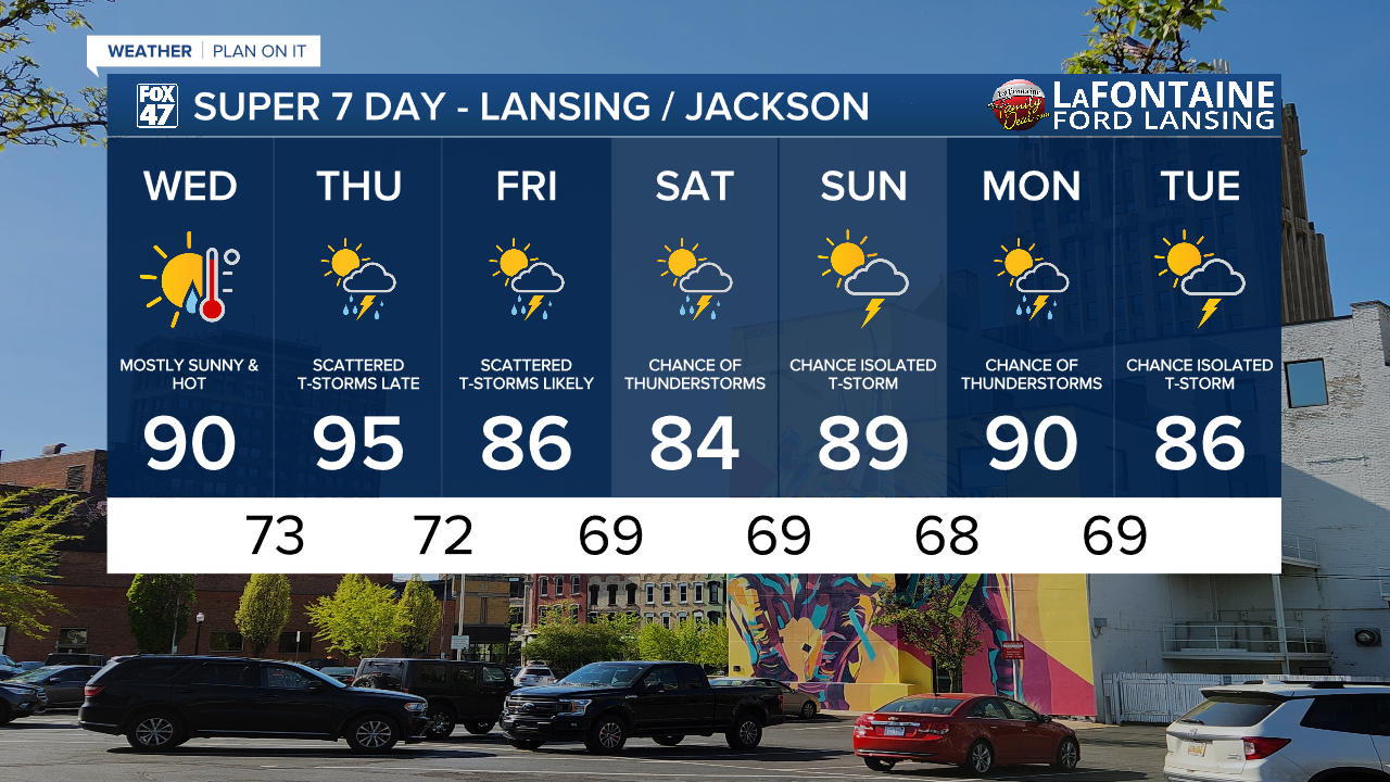
This extreme heat arrives in Michigan today as winds out of the south allows for warm and moist air to move into our neighborhoods. Today, high temps could reach 90 degrees due to mostly sunny skies as we hold onto the influence of high pressure. Heat index values will range into the upper 80's today with humidity gradually rising throughout the day.
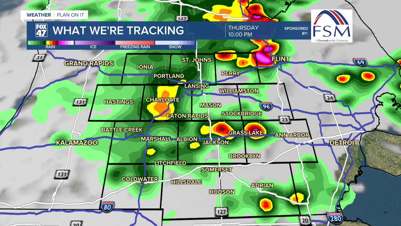
An incoming cold front will drive showers and storms in our neighborhoods beginning Thursday afternoon. Cloud cover ahead of this front could hinder our heating throughout the afternoon. We will watch our temps closely.
Showers and storms could bring some severe impacts with a marginal risk for isolated severe storms during the evening hours.
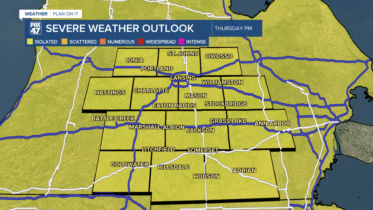
We could see pop up showers and storms develop as early as 2 PM in our northern neighborhoods with the brunt of precipitation focused in on the evening hours where the severe impacts are more favored. This evening round is expected to last from 9 PM to about 1 AM Thursday night.
As the cold front advances through, temps will drop back into the mid to upper 80's for Friday and Saturday. Showers and storms will remain possible as we hold onto moisture in the atmosphere. This means humidity will stay elevated through the weekend and into next week. Make sure you have a way to stay cool during this extreme heat.
LEARN MORE ABOUT THE HEAT INDEX BELOW
Want more FOX 47 News? Here's how you download our Roku app
You can also see the latest news from across our mid-Michigan neighborhoods by liking us on Facebook or following us on X.
