


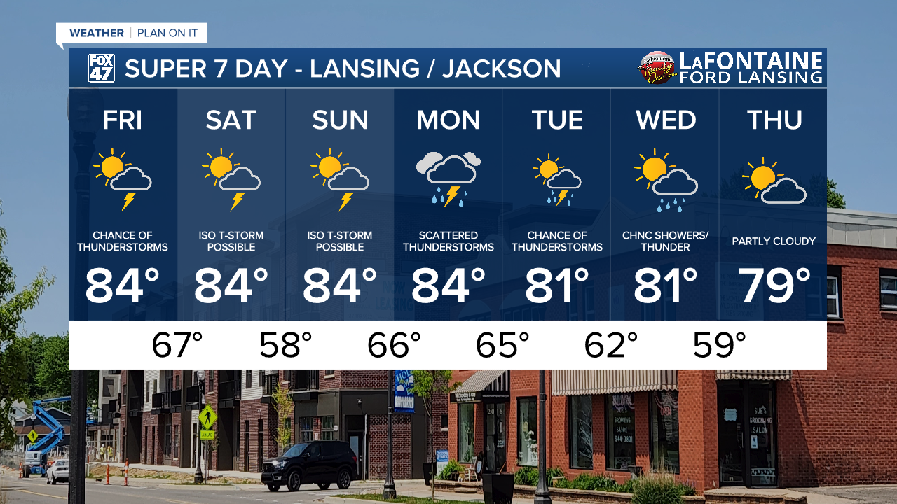
LANSING, Mich. — Temperatures are expected to warm back into the mid 80's today across northern Mid-Michigan including Lansing with some areas possibly only hitting the lower 80's, similar to Thursday.
We still have some chances for thunderstorms focused for later this evening with no severe impacts expected. It might be a good option to keep that umbrella handy and that goes for our weekend as well.
Visibility is down less than a mile in areas this morning. Stay weather aware when heading out on the roads. A Dense Fog Advisory is in effect for Hillsdale County through 9 AM Friday morning.
WATCH THE FULL FORECAST BELOW
During the day, we will be watching for weak winds and mostly cloudy skies with some opportunity to see a peak of sunshine. Smaller scale features will allow for thunderstorm chances focused primarily in the evening hours from around 6 PM to 10 PM tonight. These storms should stay tame with heavy rainfall rates and isolated stronger wind gusts as main impacts.
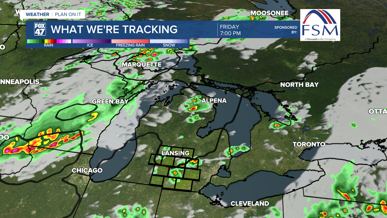
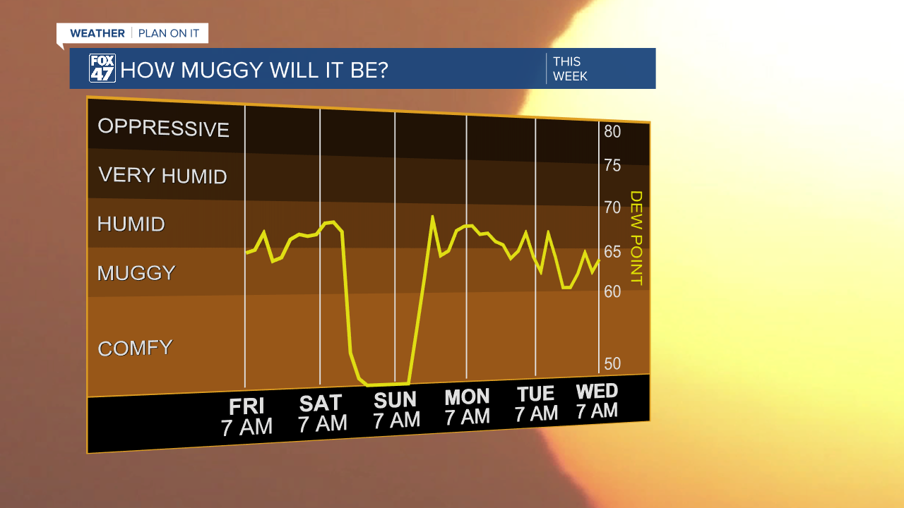
Isolated storm chances takes us into the weekend as another cold front advances through the area Saturday. We will stay humid today and tomorrow ahead of the cold front with winds out of the south. However, depending on arrival of the cold front, we could see a period of drier air reach our area late Saturday with clear skies overnight Saturday into Sunday. This will be a brief reprieve from the uncomfortable conditions.
However, it won't last long as showers, storms, and moisture return as early as Sunday and continues into the new week.
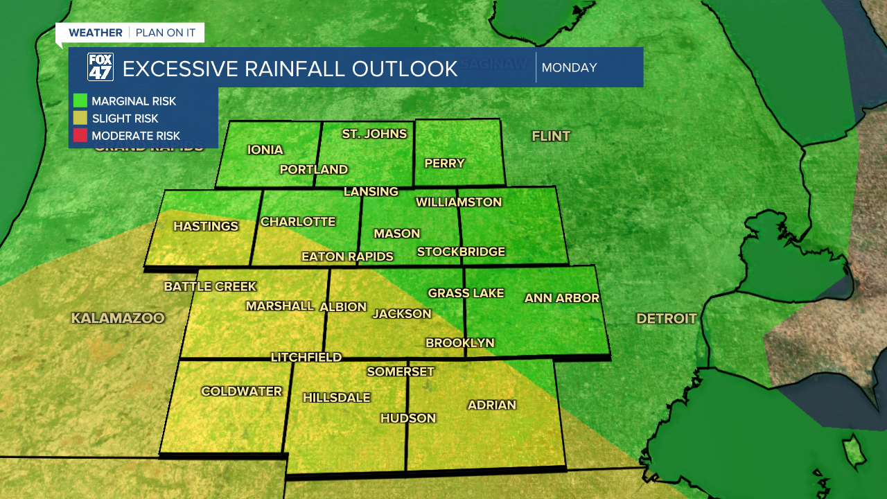
Shower and storm chances from Sunday night into Monday could bring some heavy rainfall with flood concerns as as slight risk for excessive rainfall has been issued for parts of Mid-Michigan. Paired with heavy rainfall, we could also see some severe wind gusts with early next week's round of storms. We will keep you updated as we head into the weekend.
Temperatures stay in the mid 80's through Monday with a gradual cooling trend through next week. We could finally see the end of this wet period late next week. Thursday could bring some dry conditions to the are, but it is still a bit too far out to be sure. We will be watching closely.
Have a great weather picture or video to share? Send it our way and we may feature it on-air or online!

