
LANSING, Mich. — We end the work week dry with lots of sunshine and a few afternoon clouds possible. Temperatures are expected to return to the mid to lower 70's today following an upper 60's trend for both Wednesday and Thursday. Our only main impacts will continue to be high winds. Gusts could reach up to 25-30 mph today.
This trend will continue into Saturday as we have a chance for an isolated storm and a few showers, especially during the morning hours.

WATCH THE FULL FORECAST BELOW
Rain showers begin as early as 2 AM and end around 6 AM. These showers should remain tame as we could see some breezy conditions and steady rainfall rates as main impacts. The afternoon brings the potential for a tame isolated thunderstorm with no severe impacts expected. High winds and heavy rainfall rates would be the main impact if we do run into a storm. Expect some more sun Saturday once the morning showers clear.
We stay dry to start Sunday with increasing clouds throughout the afternoon hours ahead of another round of showers and returning storms. At the moment, showers arrive late on Sunday at around 8 PM and advance through Mid-Michigan, especially southern areas like Hillsdale and Jackson, during the overnight hours into early Monday morning.

These storms don't look to carry severe potential at the moment, but heavy rainfall rates will be the main impact for southern areas where a slight risk for excessive rainfall exists for much of Hillsdale County and a marginal risk extending north through Jackson, Eaton, and Ingham counties. Make sure to pack the umbrella if you have late plans for Father's Day and expect a wet start to the new week.

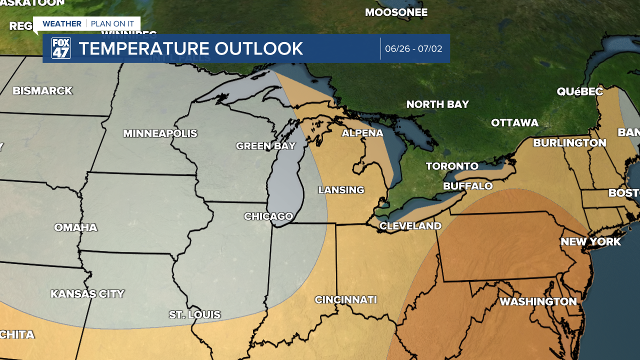
We'll dry up for the second half of the day Monday with partly cloudy skies Tuesday and high temperatures remaining below average for this time of year in the mid 70's and overnight lows sticking in the mid to lower 50's. This trend lasts through the 7-Day period as a look at our 8-14 Day Temperatures Outlook from the Climate Prediction Center shows a chance for returning above average warmth for Mid-Michigan during late June and into early July.
More storm potential exists midweek next week Wednesday and Thursday. It is still a bit too early to talk details, but we will keep you updated. Have the umbrella handy throughout the 7-Day.

Have a great weather picture or video to share? Send it our way and we may feature it on-air or online!

