
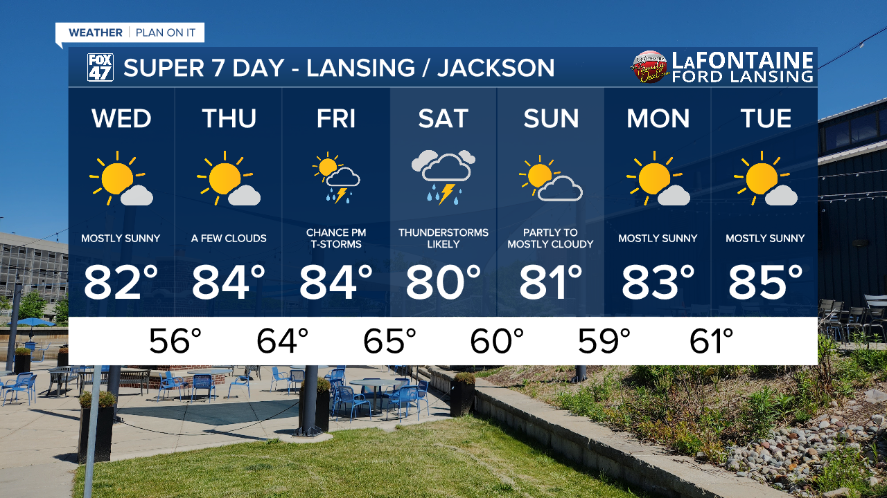
LANSING, Mich. — We have a better chance of reaching at least 80 degrees as a high temperature Wednesday across Mid-Michigan. Plenty of sunshine remains in the forecast today allowing for no major impacts when it comes to travel or outdoor plans. Winds will remain weak today.

WATCH THE FULL FORECAST BELOW
We will continue with more clear skies in the overnight hours as temperatures warm a bit into the mid 50's overnight. We will see more uncomfortable overnight lows as we head into Thursday night and through early next week with lows in the 60's. Winds out of the southwest allows for these warming temperatures as well as returning moisture which will make conditions a bit muggy outdoors beginning Thursday during the day and continuing Friday and Saturday as precipitation returns to the area.

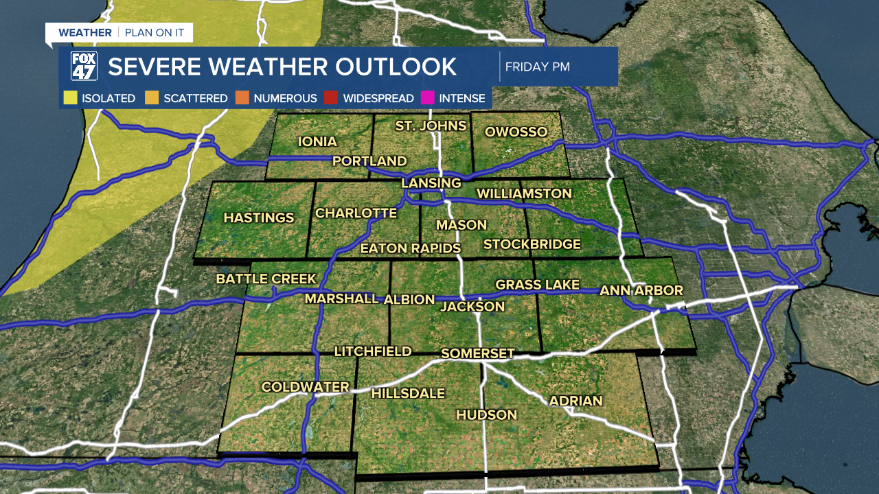
We are primarily tracking showers and storms during the evening hours for mainly our northern areas of Ingham, Clinton, and Eaton counties. Storms will remain scattered Friday evening with severe impacts tracking a bit further northwest of our area. We will keep monitoring for any changes to severe weather chances.

During the overnight hours Friday into Saturday, we will be tracking more widespread showers across the area with better chances for isolated severe storms Saturday. Make sure to pack the umbrella Friday and Saturday as the cold front advancing through will clear Michigan by Sunday allowing for a dry end to the weekend with warm temperatures in the 80's continuing into the new week.
Have a great weather picture or video to share? Send it our way and we may feature it on-air or online!

