
LANSING, Mich. — A cold front advances through our neighborhoods Friday morning with a stray shower still possible along this front and some limited visibility when headed out the door. As of 6 AM, we've seen visibility drop around a mile and just below a mile.
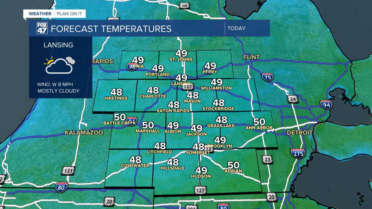
High temperatures will range in the mid to upper 40's today with some sunshine possibly able to peak through in the early afternoon hours following the cold front.
WATCH THE FULL FORECAST BELOW
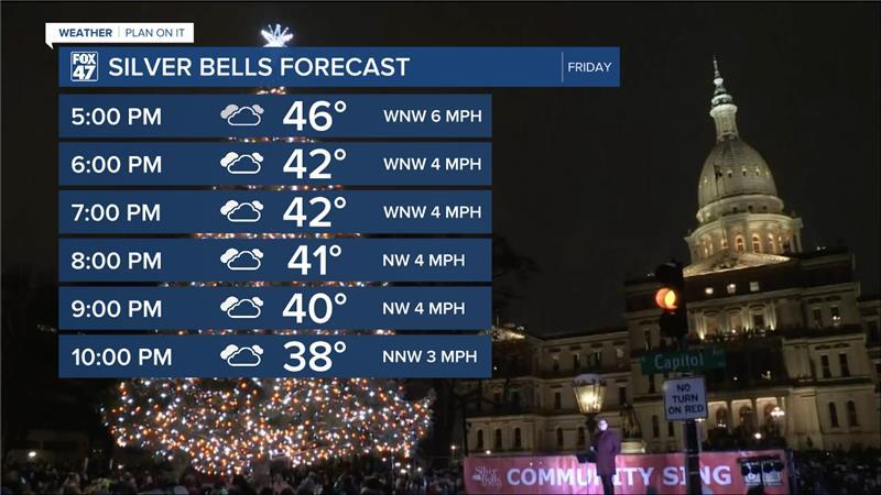
Heading into the evening hours Friday, temps will drop into the lower 40's with weak winds. If headed out to Silver Bells in Lansing, make sure to bundle up as it will still be on the cooler side, but with weak winds, we won't have to worry too much about wind chill. Cloudy skies will remain through the evening hours.
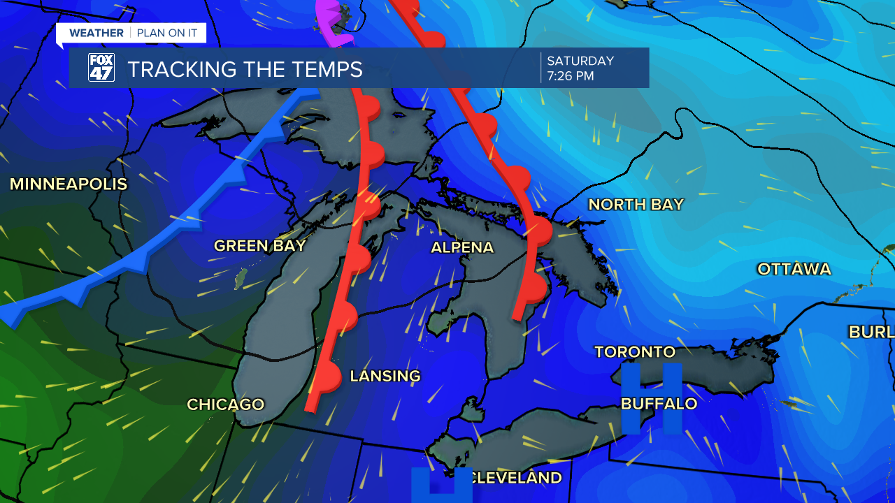
Highs return to normal in the mid 40's Saturday with partly cloudy skies as an incoming shortwave trough advances through the region Saturday night into Sunday morning. As of now, this system will bring showers north of our neighborhoods with a few passing clouds as a warm front advances through our neighborhoods Saturday night.
We will continue to stay dry through the weekend with a better chance to see some sunshine Sunday with highs warming above average in the lower 50's. We will stay dry heading into a new week, but precipitation is expected to return in the form of rain late Monday night and throughout the day Tuesday. We could see some remnant showers Wednesday and temperatures plummet. This could mean some rain and snow possible.
Early Thanksgiving predictions show a chance for some snow showers as high temps drop into the mid 30's and overnight lows below freezing. We could still see a lot of changes to our forecast prior to the holiday so make sure to stay updated as we head into the holiday week.

Want more FOX 47 News? Here's how you download our Roku app
You can also see the latest news from across our mid-Michigan neighborhoods by liking us on Facebook or following us on X.
