
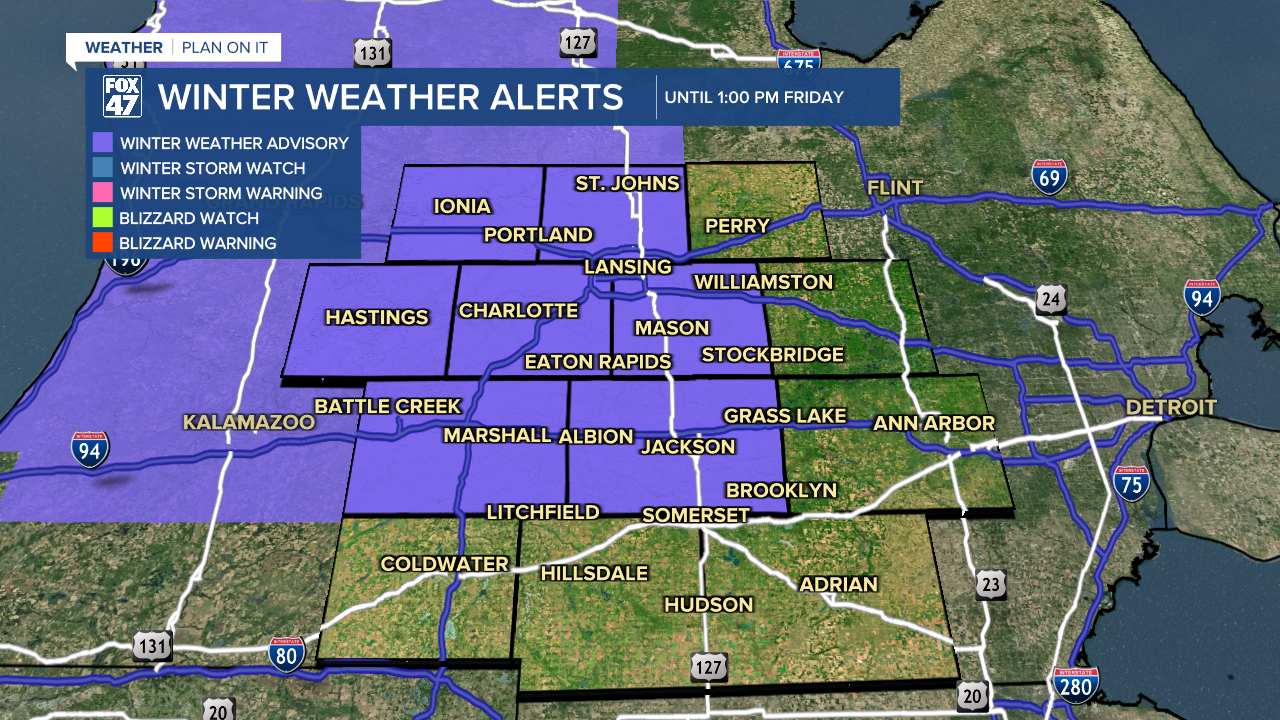
LANSING, Mich. — The Winter Weather Advisory has been extended into portions of our neighborhoods this morning including Clinton, Ingham, Eaton, and Jackson counties. This advisory is currently in effect as widespread snowfall continues during the morning commute hours allowing for limited visibility and slick spots on roadways. We will see the end of this advisory at 1 PM Friday.
WATCH THE FULL FORECAST BELOW
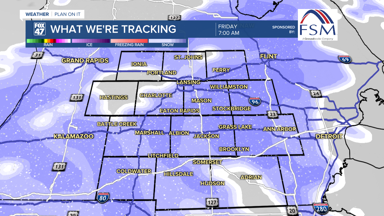
In the overnight hours, light freezing drizzle was observed across some of our neighborhoods allowing for slick spots on roadways as well as a possible few minutes this morning to scrape your windshield and windows of ice.
Temperatures today will warm into the mid to lower 30's, possibly reaching highs above freezing which hasn't been seen in our neighborhoods since January.
Widespread snow comes to an end around 10 AM with additional remnant scattered snow showers possible into the afternoon hours. Through this evening, we can expect an additional 1-2" of snowfall.
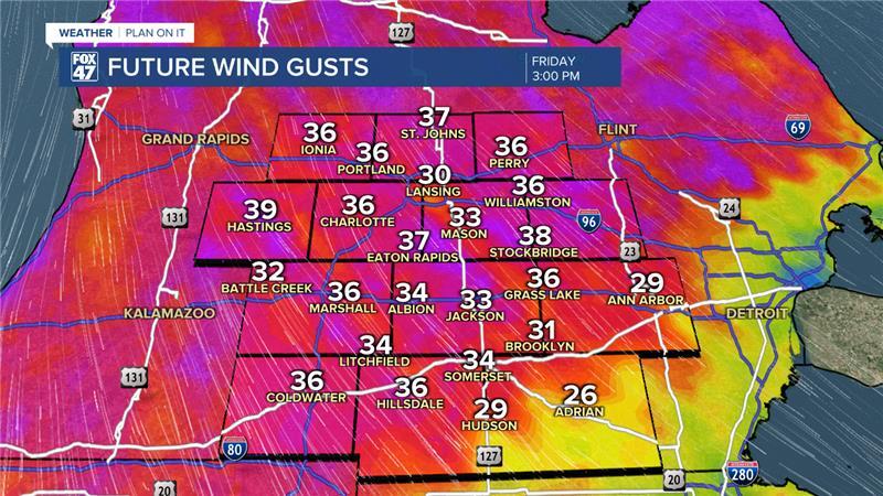
As the frontal passage advances through our neighborhoods later today, winds will strengthen out of the north with gusts up to 40 mph. This will aid in dropping out temperatures through the afternoon hours as well as drop feels like temperatures gradually into the evening hours in the single digits.
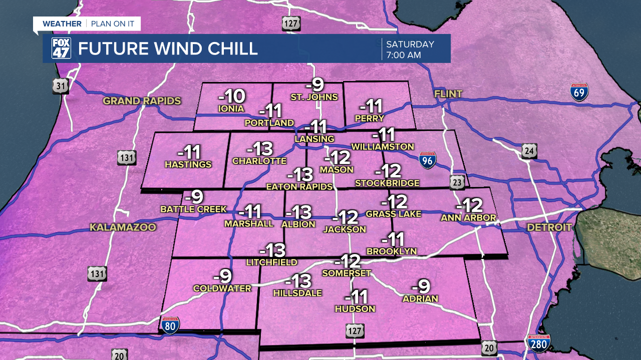
Present winds continue into the overnight hours which could drop feels like temperatures to -10 to -15 degrees Saturday morning. Make sure to bundle up when heading out the door Saturday morning with high temps only reaching the mid teens.
We do have a chance for some snow on Sunday during the first half of the day with light accumulations possible. We will gradually warm our temperatures back into the 30's by the time we reach Monday with highs in the mid 30's during the midweek period where we could see some potential mixed precipitation.

Want more FOX 47 News? Here's how you download our Roku app
You can also see the latest news from across our mid-Michigan neighborhoods by liking us on Facebook or following us on X.
