
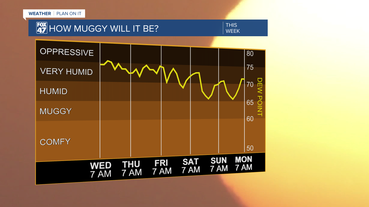
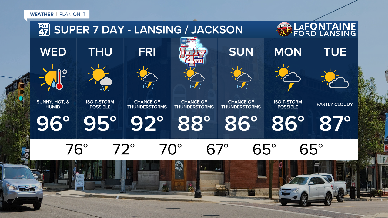
LANSING, Mich. — The Extreme Heat Warning continues across southern Michigan through Thursday evening as we are looking at highs in the mid 90's today. In Lansing, forecast highs sit at 96 degrees, just a degree shy from the 1910 record high of 97 degrees. High humidity will make it uncomfortable outside with heat index values expecting to top out in the triple digits again today.

WATCH THE FULL FORECAST BELOW
We will continue to see highs in the 90's through Friday with continued uncomfortable conditions. This trend takes us into the holiday weekend regardless of the cooling air temperatures. Returning thunderstorm chances keeps moisture around which will still allow for high humidity.
Multiple atmospheric disturbances allows for returning chances for showers and storms. We remain dry Wednesday with sunny skies, but Thursday brings isolated thunderstorm chances back to the area. The SPC Severe Weather Outlook issued a marginal risk for isolated severe storms Thursday which could occur late in the evening past sunset. Main impacts include damaging wind gusts and potential hail. Early afternoon thunderstorm development with strong winds also exists Thursday given the unstable environment due to this heat and moisture.

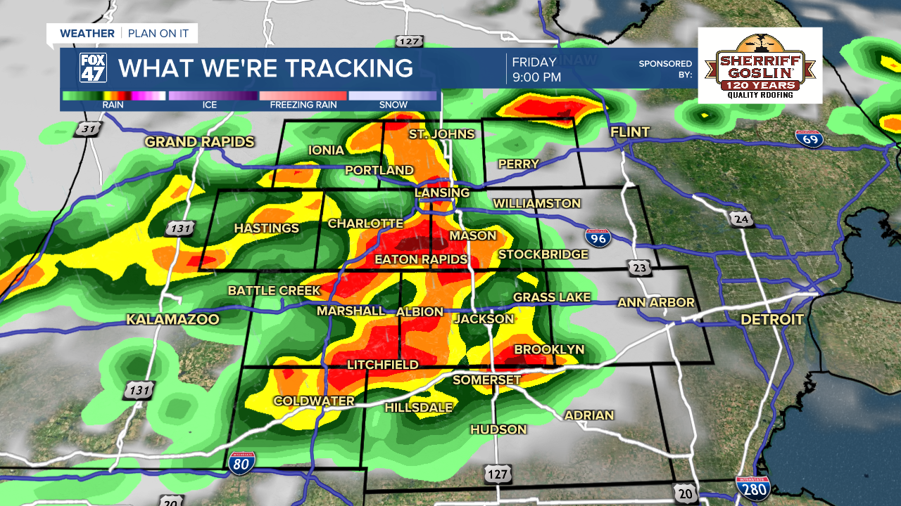
Next best chances for scattered thunderstorms arrives Friday during the evening hours. Some of these storms could turn severe with another marginal risk for isolated severe storms across all of southern Michigan.

Chances for thunderstorms takes us into the holiday weekend and even into the new week Monday. Make sure the umbrella is nearby if you have any outdoor plans this weekend. We are looking to dry up by the time we reach Tuesday of next week.
Have a great weather picture or video to share? Send it our way and we may feature it on-air or online!

