
LANSING, Mich. — We are starting our Tuesday with extreme cold across our neighborhoods. The Cold Weather Advisory is still in affect across all of our neighborhoods through 9 AM Tuesday morning with winds chills as cold as 20 below zero.
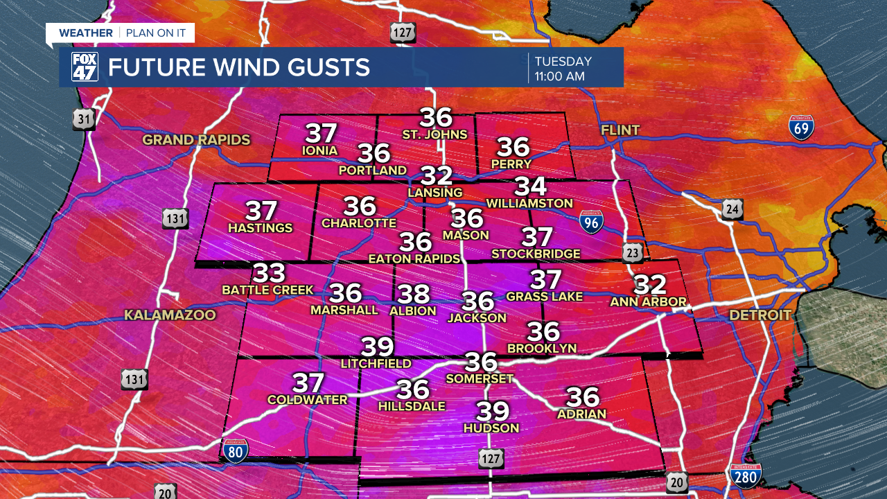
However, strong winds out of the southwest are aiding in warming our temperatures gradually this morning ahead of a frontal passage that is bringing snow to neighborhoods a bit further northwest. We could see wind gusts reach 40 mph throughout the morning hours as the frontal passage advances through.
WATCH THE FULL FORECAST BELOW
We will see this snow make its way into our neighborhoods as the morning continues on with scattered snow expected to bring issues to your commute. Accumulations should stay minimal however, as snow showers should remain scattered into the afternoon hours. Up to 2 inches of snow is possible through Wednesday evening as this clipper exits the region.

Even light accumulations of snow could cause issues as temperatures remain below 20 degrees. Slick spots on roadways as well as blowing snow remains a concern today when heading out on the roads. Make sure to stay weather aware when driving in winter weather.
Chilly conditions continue on even after the exiting clipper with small improvements to our overnight wind chills. We are expecting feels like temperatures to drop to 15 below zero overnight tonight. We are seeing these conditions a bit warmer because winds will be dying down into the overnight hours.

These conditions can still cause concerns to your health if not taking the proper precautions. Make sure to bundle up and cover skin most likely to be affected by frostbite including fingers, toes, and your face.
Temperatures remain chilly as single digit highs are expected Friday with overnight lows dropping below zero degrees starting Wednesday night and lasting into the weekend. Snow showers dwindle into Thursday as we stay dry for the weekend.

Want more FOX 47 News? Here's how you download our Roku app
You can also see the latest news from across our mid-Michigan neighborhoods by liking us on Facebook or following us on X.
