
9 AM UPDATE:
The Air Quality Advisory has been extended to the entire state of Michigan currently in effect through Thursday evening at midnight.

Following a cold frontal passage switching up our weather pattern, winds out of the north will allow for particulate matter from Canadian wildfire smoke to make its way into our neighborhoods. We can expect to see air quality range in the Unhealthy for Sensitive Groups range in southern Michigan with possible Unhealthy range in more northern Michigan.

Make sure to limit time outside today, especially for those with respiratory issues. We will continue to see similar conditions with cooler air returning to the state Thursday.
Turning to rounds of showers and storms this evening, the Severe Weather Outlook has extended a severe wind threat for our southern neighborhoods of Jackson and Hillsdale counties.
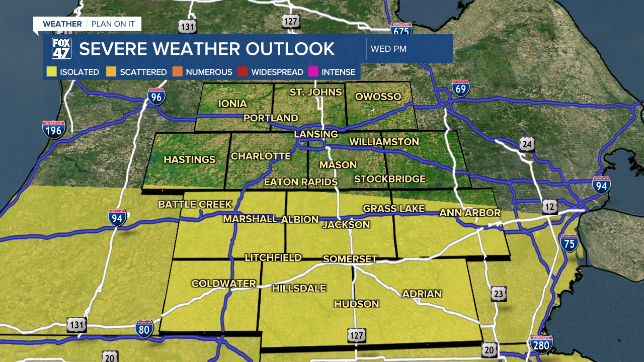
Timing stays the same with scattered showers and storms arriving around 5 PM this evening with heavier rainfall continuing through the overnight hours into Thursday.
We will still be watching for flooding concerns from heavy rainfall rates for our main impact today into tonight..
ORIGINAL POST:
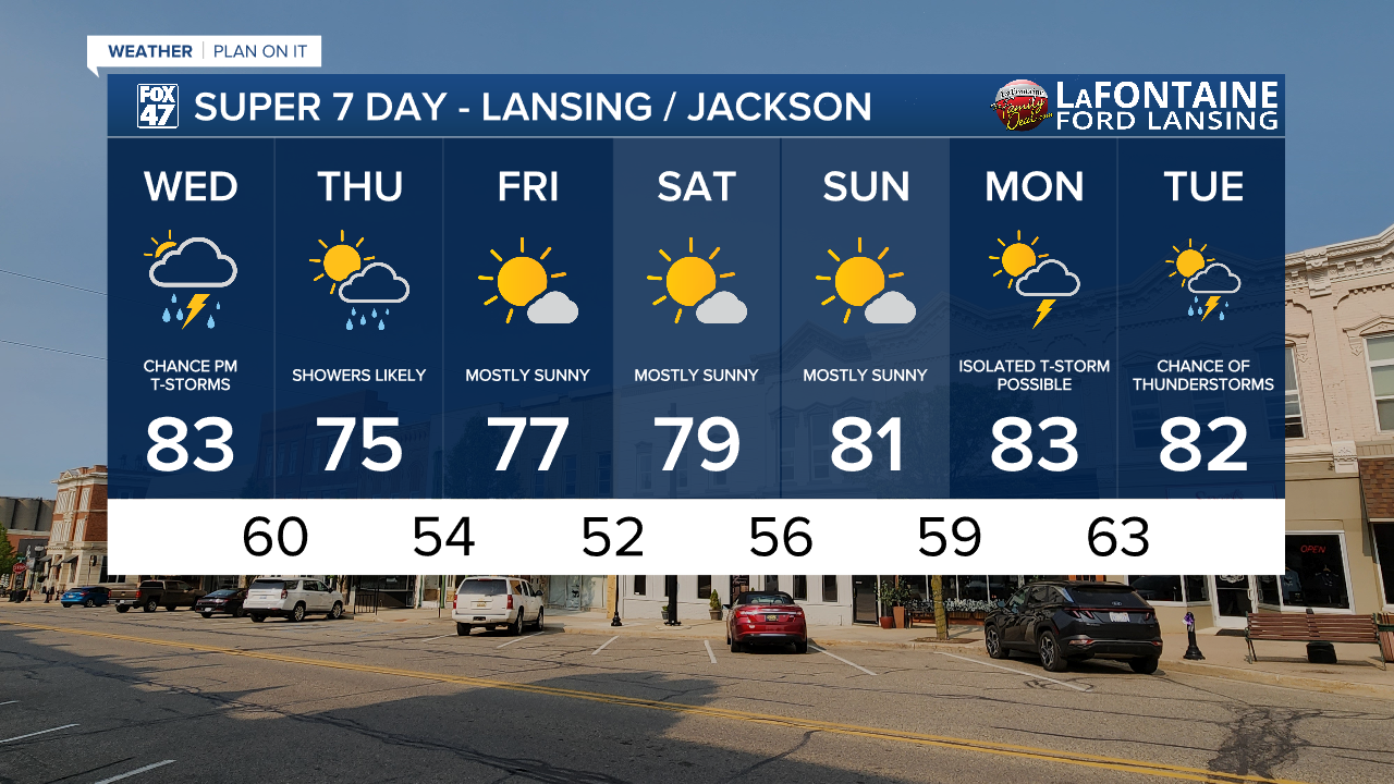
The period of extreme heat and humid conditions has come to an end today. A passing cold front will allow our temperatures to drop to the mid to lower 80's today across much of Mid-Michigan. This is right around where we should be for this time of year for daytime highs.
Dew points will drop to the mid to upper 60's today with muggy conditions still expected. However, this will stiff feel more comfortable than how we have been feeling since last week. By the time showers and storms end Thursday, dew points will drop to the upper 50's/lower 60's with comfortable conditions favored.
WATCH THE FULL FORECAST BELOW
However, attention shifts to our next round of showers and storms that will impact our neighborhoods starting as early as this afternoon.
The cold frontal passage that is aiding in cooling us down will also allow for a few mid level disturbances to advance through Mid-Michigan driving a round of showers through our neighborhoods. Timing starts as early as 4 PM this afternoon and is expected to last overnight and into Thursday morning with lingering showers possible through around noon Thursday.

Thunderstorms developing this evening and tonight are not expected to turn severe. The main impact we are watching for is heavy precipitation rates. The heaviest rain looks to fall past midnight tonight. Neighborhoods south of Clinton County could see over one inch of rainfall with areas south of I-94 potentially seeing over 1.5" of rainfall.

The Thursday morning commute could see some disruptions from localized flooding in low lying areas as well as poor drainage areas. Make sure to stay weather aware when driving through heavy rainfall.

Once we reach Thursday afternoon, high pressure from the north will build into the region and help dry us up and clear our skies. This will allow for some nice, comfortable summer conditions for the upcoming weekend. Temperatures look to range in the mid to upper 70's.
Want more FOX 47 News? Here's how you download our Roku app
You can also see the latest news from across our mid-Michigan neighborhoods by liking us on Facebook or following us on X.
