



LANSING, Mich. — Mid-Michigan will enjoy a much cooler stretch of weather this week, but not before dealing with another round of wildfire smoke and a chance for showers and thunderstorms Monday night into Tuesday.
Tonight: Mostly Clear, Breezy and Cooler
Expect mostly clear skies overnight with temperatures falling to around 60 degrees.
Winds will continue out of the north-northwest at 11 mph, with occasional gusts approaching 25 mph. Those northerly winds will also begin transporting another plume of smoke from the Canadian wildfires into Lower Michigan overnight.
Sunday: Wildfire Smoke Returns
The biggest weather story Sunday won't be the temperatures—it's the air quality.
Northerly winds behind today's cold front will usher another round of Canadian wildfire smoke into Mid-Michigan. Smoke concentrations are expected to increase through the morning and become most noticeable during the afternoon.
Air quality is expected to reach Unhealthy for Sensitive Groups at times, according to the Michigan Department of Environment, Great Lakes and Energy (EGLE). Children, older adults and anyone with asthma, heart disease or other respiratory conditions should consider limiting prolonged outdoor activity during the day.
The good news is that smoke concentrations are expected to begin decreasing Sunday evening as the weather pattern shifts.
Despite the haze, temperatures will remain pleasant with highs near 81 degrees under mostly sunny skies.
Rain and Thunderstorm Chances Return Late Monday
Dry weather continues through most of Monday with highs climbing into the mid-80s.
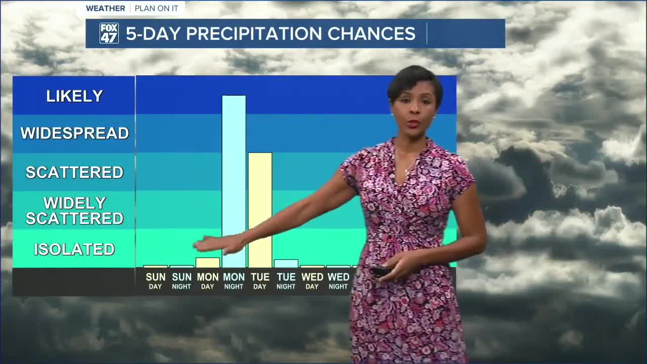
A developing storm system over the Upper Great Lakes will push a cold front toward Lower Michigan Monday evening. Showers and thunderstorms are expected to develop late Monday night and continue into early Tuesday.
Current projections suggest many communities could receive three-quarters of an inch to around one inch of rainfall, with the heaviest totals favored east of the U.S. 131 corridor. While widespread severe weather is not expected at this time, periods of heavy rain and lightning will be possible overnight into Tuesday morning.
Cooler Than Normal Air Moves In
Behind the cold front, a refreshing air mass settles into Mid-Michigan for the middle of the week.
High temperatures Wednesday are expected to top out in the mid-70s, roughly 5 to 10 degrees below average for this time of year. Sunshine returns during the second half of the week as temperatures gradually rebound into the upper 70s and lower to middle 80s heading toward next weekend.
7-Day Forecast
Sunday: Mostly sunny, but hazy due to wildfire smoke. High 81°, low 60°.
Monday: Mostly sunny with increasing clouds late. Showers and thunderstorms develop Monday night. High 84°, low 67°.
Tuesday: Showers continue, especially during the morning, before gradually tapering off. High 83°, low 56°.
Wednesday: Sunny and noticeably cooler. High 75°, low 52°.
Thursday: Mostly sunny and seasonable. High 79°, low 58°.
Friday: Mostly sunny with a pleasant afternoon. High 83°, low 62°.
Saturday: Mostly sunny and warm. High 85°.
What You Need to Know
- Tonight: Mostly clear and breezy with lows around 60°.
- Sunday: Wildfire smoke returns, with the poorest air quality expected during the afternoon before improving Sunday evening.
- Late Monday into Tuesday: Showers and thunderstorms bring beneficial rainfall to the region.
- Midweek: Cooler-than-normal temperatures settle in with highs only in the 70s Wednesday.
- Late Week: Sunshine returns as temperatures gradually warm back into the lower and middle 80s.
Have a great weather picture or video to share? Send it our way and we may feature it on-air or online!

