


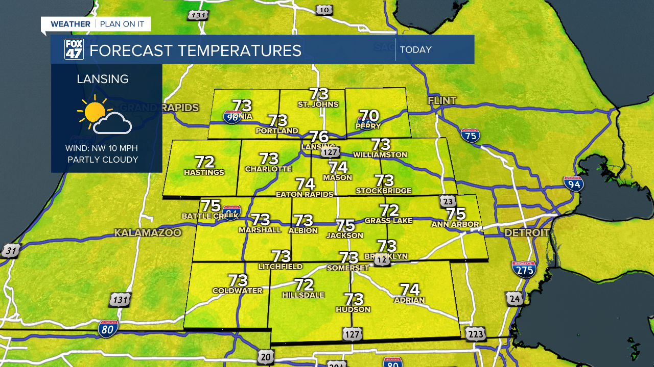
LANSING, Mich. — Following the passing cold frontal passage, high pressure at the surface builds in allowing for more sunshine Wednesday and through the rest of the week. Temperatures remain on the cooler side with winds continuing out of the north today only reaching high temps in the mid 70's. We should be seeing highs in the mid to lower 80's during this time of year.
WATCH THE FULL FORECAST BELOW
We will remain breezy today with winds out of the north gusting up to 20-25mph. This will bring a cool breeze to any outdoor plans you have today. Air quality won't be an issue as high levels of surface smoke was pushed out by the cold front Tuesday.
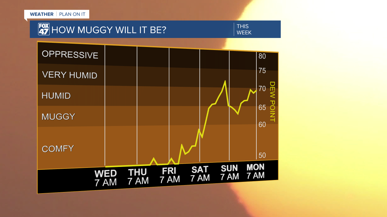
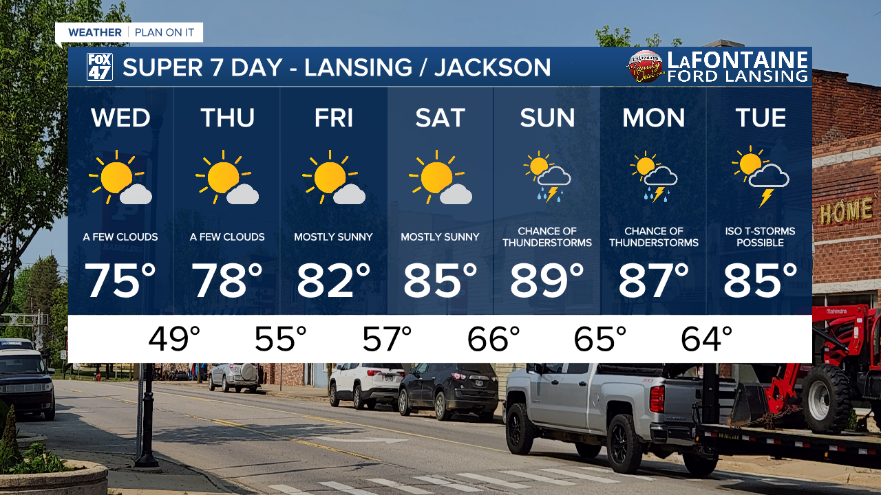
We will warm into the upper 70's Thursday and continue to warm through the week back into the 80's by Friday and into Saturday. As we warm and observe winds shifting out of the south, humidity will build again allowing for uncomfortable conditions once we reach the weekend period. Showers and storms hold off until Sunday with continuing chances taking us into a new week.
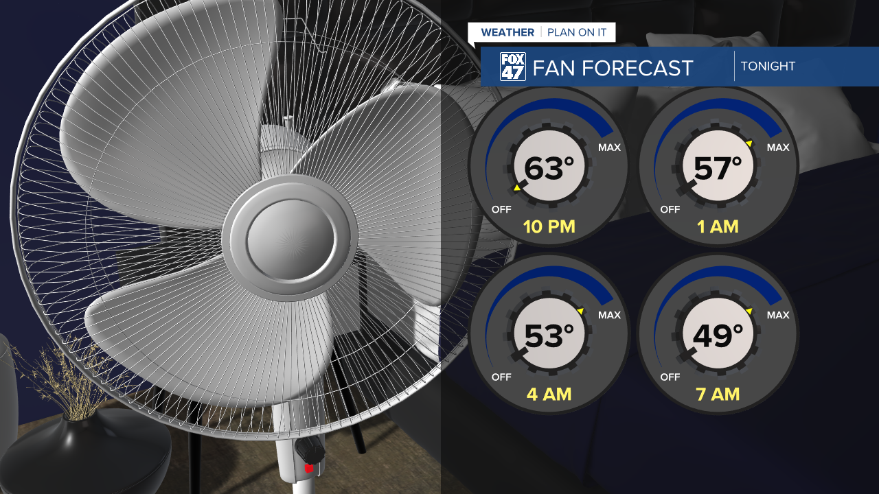
Overnight lows tonight could dip into the 40's which is well below average for this time of year. However, this gives us a good opportunity to give the A/C a break and crack the windows and turn on the fan around 10 PM as temperatures fall into the mid to lower 50's.
Expect comfortable conditions for the next couple of days with great conditions to do outdoor activities. Winds will calm Thursday for a great day with a few passing clouds. Sunshine will stick around through Saturday with the umbrella not being needed until later this weekend and into next week.
Have a great weather picture or video to share? Send it our way and we may feature it on-air or online!

