
LANSING, Mich. — We are waking up in the 6 AM hour to more cold temperatures. We are ranging in the mid to upper 20's for air temps and in the lower 20's for feels like temperatures. This is a bit warmer than where we were at yesterday, but still chilly. Make sure to bundle up when heading out the door this morning.
Remnant lake effect snow showers have made their way through Hillsdale County this morning. We are not seeing any major disruptions as this snow moved through. We are staying dry for the remainder of the AM hours across our neighborhoods.
WATCH THE FULL FORECAST BELOW
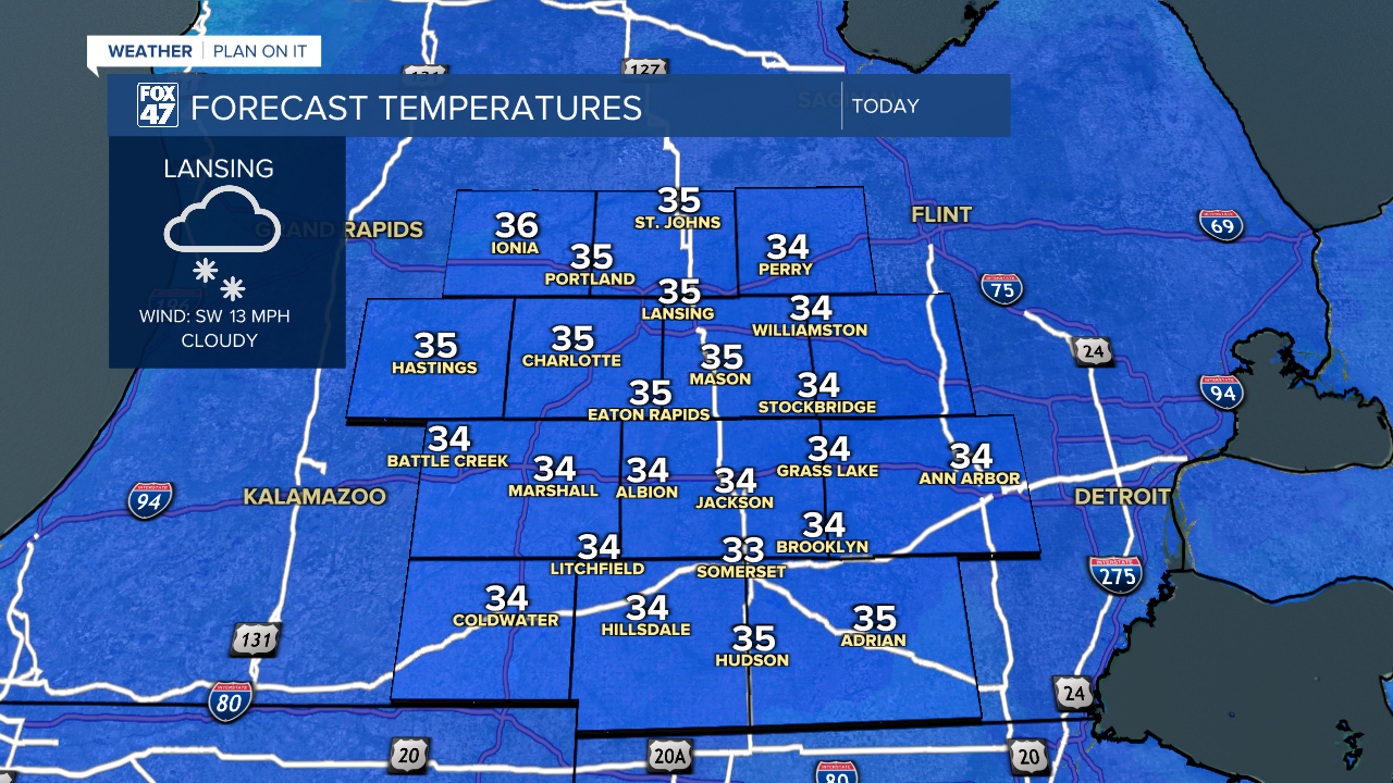
Daytime highs today will only reach the mid 30's with feels like temperatures due to strong winds making it feel below freezing for the entire day today.
A weakening low pressure system tracks east just north of the state today. Winds turn out of the south, however, we are not looking to warm up much as this weakened system advances through. We could see this afternoon some light snow affiliated with this system traverse through our neighborhoods. However, no major impacts or accumulations are expected as the brunt of snow and precipitation tracks a bit further north of our neighborhoods.
As the weakened cold front advances through overnight Tuesday into Wednesday, we could see some light scattered rain across our neighborhoods as overnight lows hover right around freezing with present winds continuing. We will stay dry as the sunrises Wednesday.

Winds will continue on the back end of this system Wednesday with wind gusts up to 35-40 mph. Make sure to watch those outdoor decorations and continue to bundle up. Even though air temperatures will warm into the mid 40's Wednesday, feels like temperatures will range in the mid to upper 30's. We will warmer conditions return as we enter the back half of the week with air temps continuing to gradually warm.

We will see highs in the upper 50's by Sunday as our next system advances through bringing rain as our main impact ahead of an incoming cold front. Shower chances begin late Saturday and continue into Sunday. We will dry up to start a new week with temps cooling back into the 40's.

Want more FOX 47 News? Here's how you download our Roku app
You can also see the latest news from across our mid-Michigan neighborhoods by liking us on Facebook or following us on X.
