
LANSING, Mich. — Cloud cover hangs around in our neighborhoods today as we remain dry under the influence of high pressure. Cloud cover will gradually decrease throughout the afternoon hours today.
Temperatures will struggle to exceed 80 degrees today as cloud cover and continued winds out of the northeast will keep temps in the upper 70's trend. This is similar to yesterday where most of our neighborhoods observed daytime highs in the mid to upper 70's.

WATCH THE FULL FORECAST BELOW
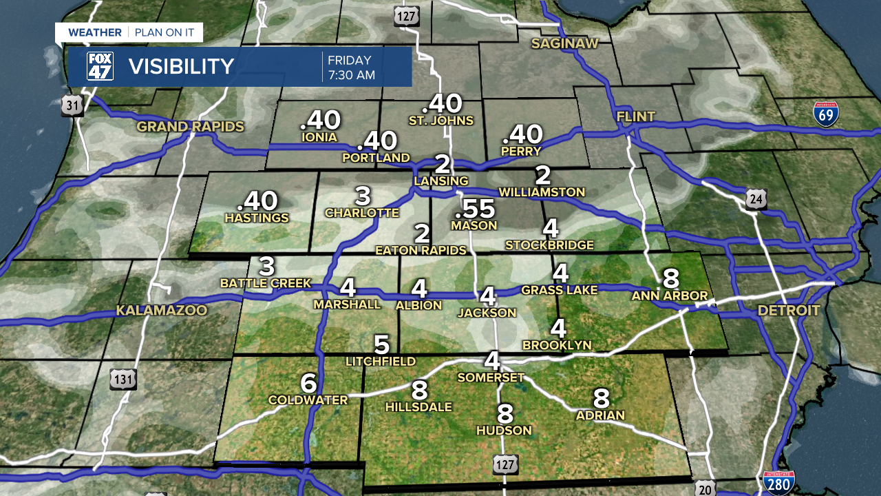
Wind gusts today could reach 20 mph. This isn't too crazy, but northwest oriented winds will continue into the overnight hours where we could see some influence of moisture off of Saginaw Bay and Lake Huron to allow fog development for Friday morning.
Clear skies are expected to continues throughout the daytime hours Friday as winds shift out of the southwest. We will be able to see our temperatures rise back into the mid to lower 80's to close the weekend with comfortable conditions expected today and tomorrow in terms of humidity.
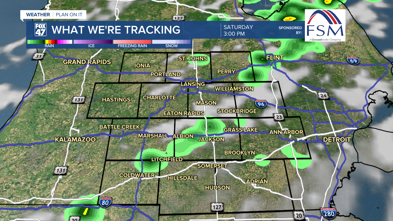
This weekend brings a returning chance for showers and thunderstorms late Friday night into the first half of the day Saturday as a cold front sweeps through the state out of the northwest. These showers and storms could linger into the late afternoon hours as well with no major impacts expected at the moment.
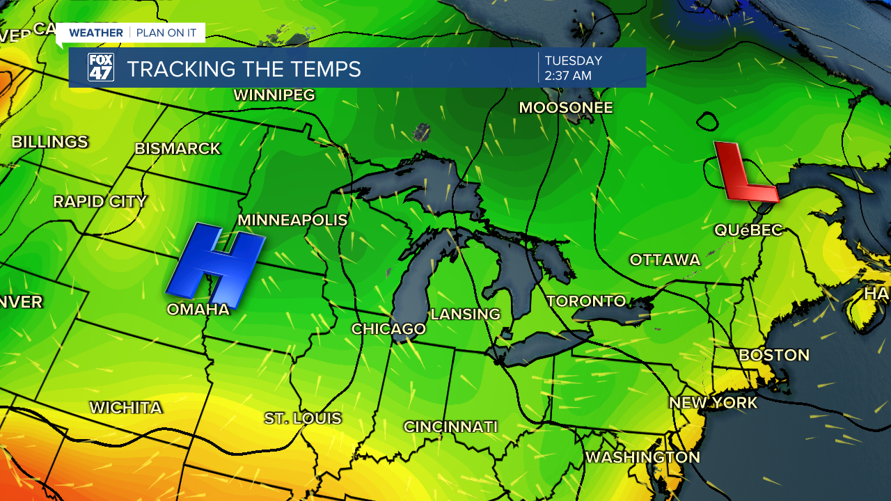
Once the cold front advances past the state of Michigan, winds will shift out of the north which will aid in a cool down in our neighborhoods. These temperatures will feel much more like fall than summer with overnight lows possibly dropping into the upper 40's. This trend is expected to start Sunday night and last through the first half of next week.
Monday brings a returning chance for showers as we will begin to warm our temps back up beginning Wednesday of next week.

Want more FOX 47 News? Here's how you download our Roku app
You can also see the latest news from across our mid-Michigan neighborhoods by liking us on Facebook or following us on X.
