
LANSING, Mich. — The Easter weekend brought a lot of impacts to the state of Michigan including an EF-1 tornado in Wayne County over on the east side of the state as well as heavy rainfall rates allowing for flooding impacts across our northern neighborhoods.
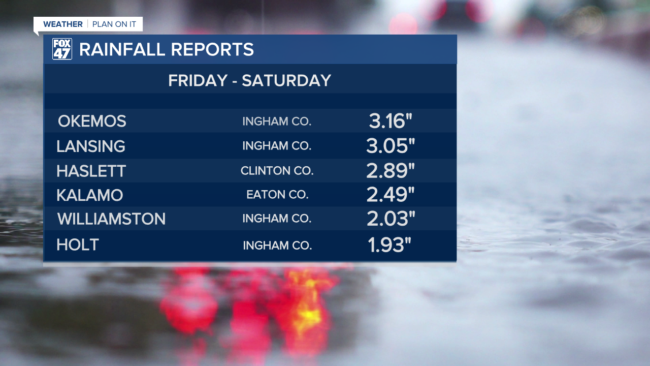
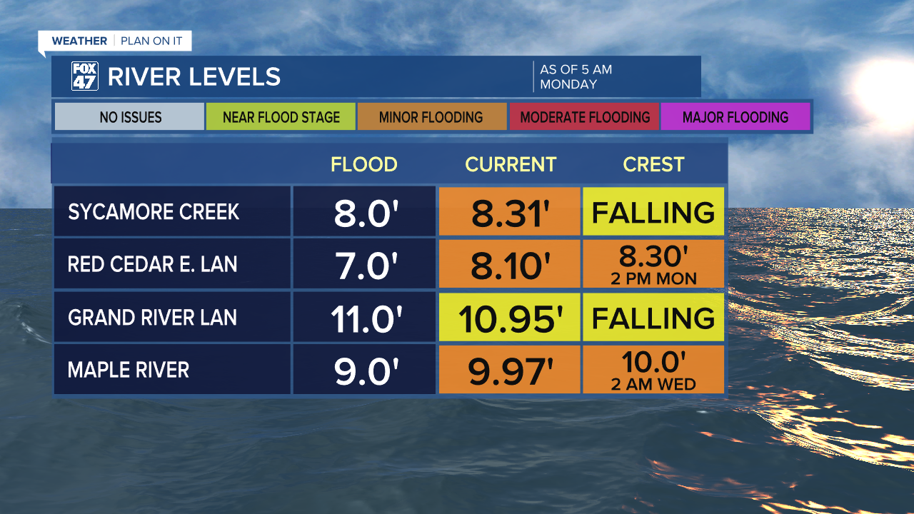
Flood warnings continue across multiple local river sites across the Lansing area in Ingham County as well as in northern Clinton County. Some areas saw over 3" of accumulated rainfall during this event. Below you can see some of the highest reports from across our neighborhoods and where our impacted river sites stand as of 5 AM Monday morning.
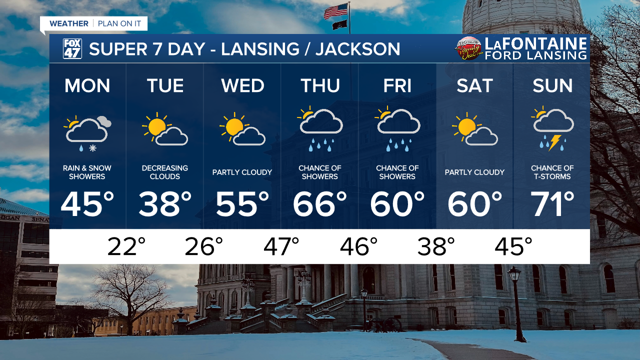
WATCH THE FULL FORECAST BELOW
We started the morning with some rain and snow across our neighborhoods including Lansing with no major winter impacts are precipitation accumulations. This first round of rain and snow is affiliated with a passing low pressure system as the surface with a cold front sweeping through our neighborhoods Monday morning.
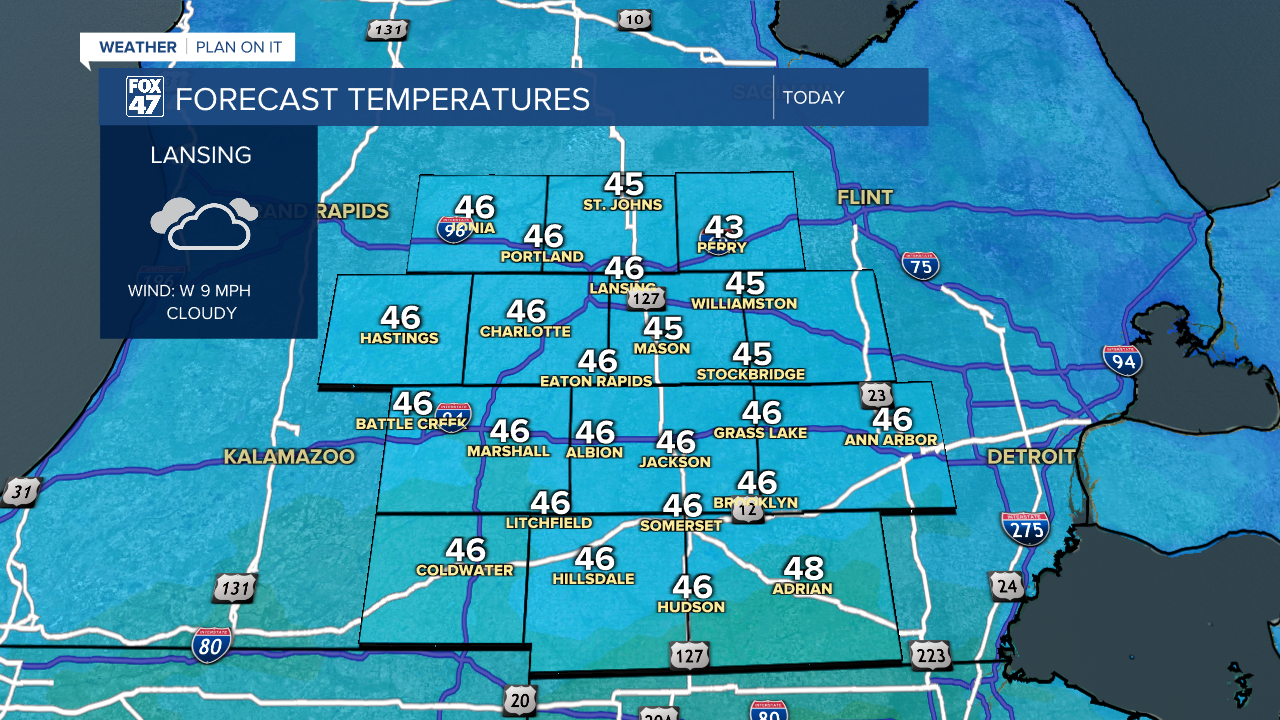
We will be able to warm this afternoon into the mid 40's with breezy conditions as another area of surface low pressure will sag a cold front south through our neighborhoods later this afternoon and evening, continuing to plummet temperatures across our neighborhoods into the overnight hours.
We could see past 1 PM today a few more widely scattered showers, mainly in the form of rain ahead of this secondary cold frontal passage. No major impacts are expected. Winds will gust up to 35 mph today with isolated gusts ranging from 35 to 40 mph.

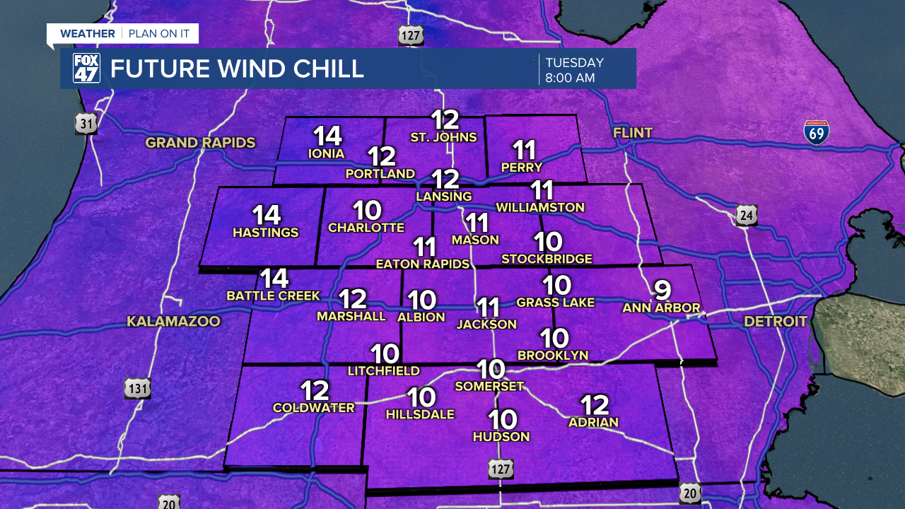
The orientation of these winds remain out of the north following the first cold front and will affect our feels like temperatures making it feel like the mid to upper 30's today. Make sure to grab a jacket. Temperatures continue to fall overnight into the lower 20's with feels like temperatures in the mid to lower teens and possibly some areas dropping into the single digits. This will feel well off-season tomorrow morning so make sure to grab that winter jacket and even some hat and gloves when heading out the door. Highs will only reach the upper 30's Tuesday with more sunshine expected as high pressure builds in a the surface.
Shower chances don't arrive until Thursday and last into Friday with a small chance for a rumble of thunder Thursday evening. No severe impacts are expected at the moment. Temperatures will also warm gradually back into the 60's by Thursday and stay mild through the weekend with a chance for thunderstorms Sunday.
Have a great weather picture or video to share? Send it our way and we may feature it on-air or online!

