
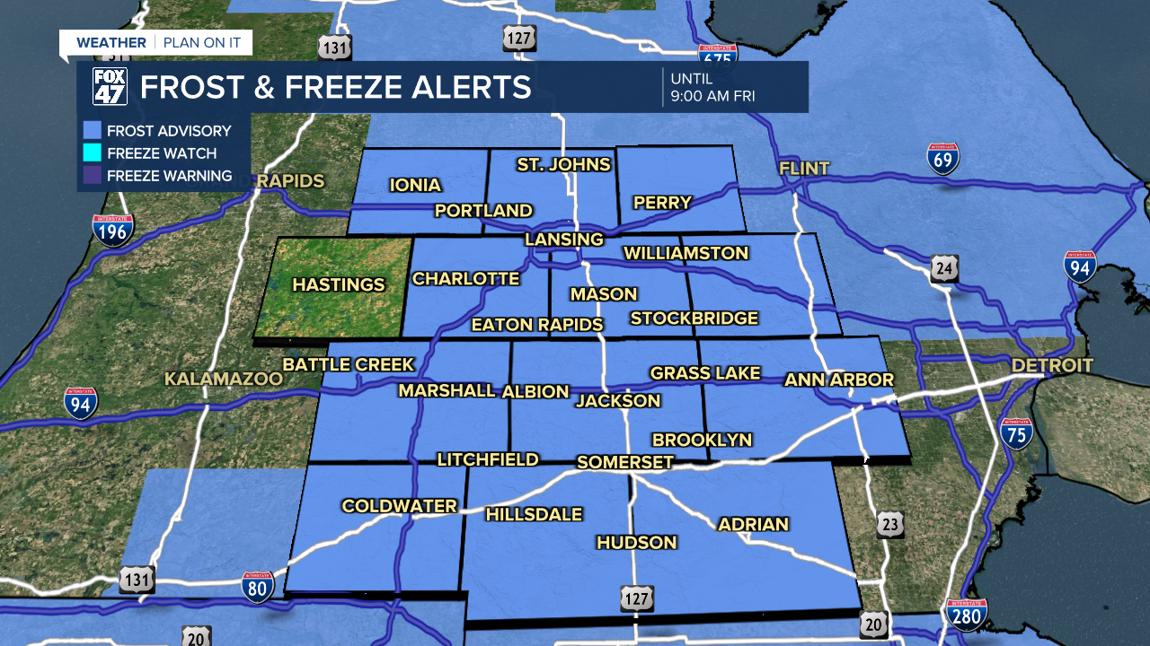
LANSING, Mich. — The Frost Advisory continues across all of our neighborhoods this morning through 9 AM with temperatures dipping into the 30's this morning.
This follows Thursday morning where some areas like Leslie and Grass Lake saw temperatures drop to 29 degrees. This is well below average for this time of year. As we progress through our 7-Day period, overnight lows will warm back into the 40's, hindering chances for frost through the weekend and into next week. Favorable conditions for frost include overnight clear skies, calm winds, and temps forecast in the mid to upper 30's.
WATCH THE FULL FORECAST BELOW
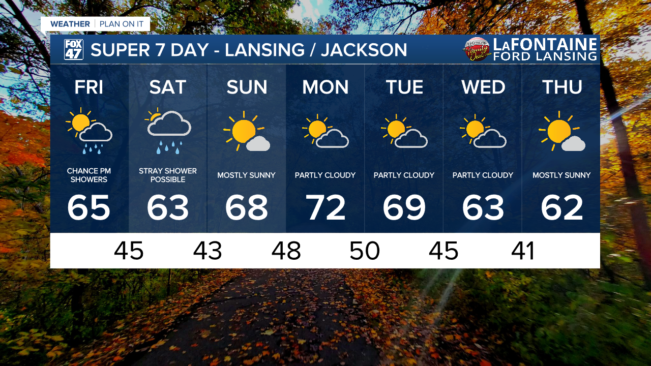
High temperatures today will warm into the mid 60's as winds are oriented out of the south. This is a bit warmer than what we've been seeing in our neighborhoods over the past two days.

An incoming cold front will disrupt this pattern, however. Ahead of the cold front, cloud cover will increase gradually throughout the day with mostly cloudy skies favored by the mid afternoon hours Friday. As early as 7 PM, showers could start rolling into our neighborhoods. No major impacts are expected as these showers roll in and should stay scattered. We could see these showers last through the overnight hours with cloud cover hanging around through Saturday with a non-impactful stray shower possible.

Temperatures will warm into the upper 60's Sunday with the return of mostly sunny skies. Entering a new week, we stay dry Monday and Tuesday with highs in the upper 60's/lower 70's. We could see a shower overnight Tuesday into Wednesday, but confidence is low.
Want more FOX 47 News? Here's how you download our Roku app
You can also see the latest news from across our mid-Michigan neighborhoods by liking us on Facebook or following us on X.
