
LANSING, Mich. — Following snowfall over the weekend across our neighborhoods, we will start the week off dry with most roadways clear of any slick spots. Watch out for any untreated back roads, however, for any leftover patches of ice that could slow you down.
Temperatures today will reach the mid to upper 30's with continued winds out of the southwest. It is a breezy start with gusts during the morning hours possibly reaching the 30-35 mph range. This will drop feels like temperatures as we will be dealing with strong winds today and tomorrow.

WATCH THE FULL FORECAST BELOW
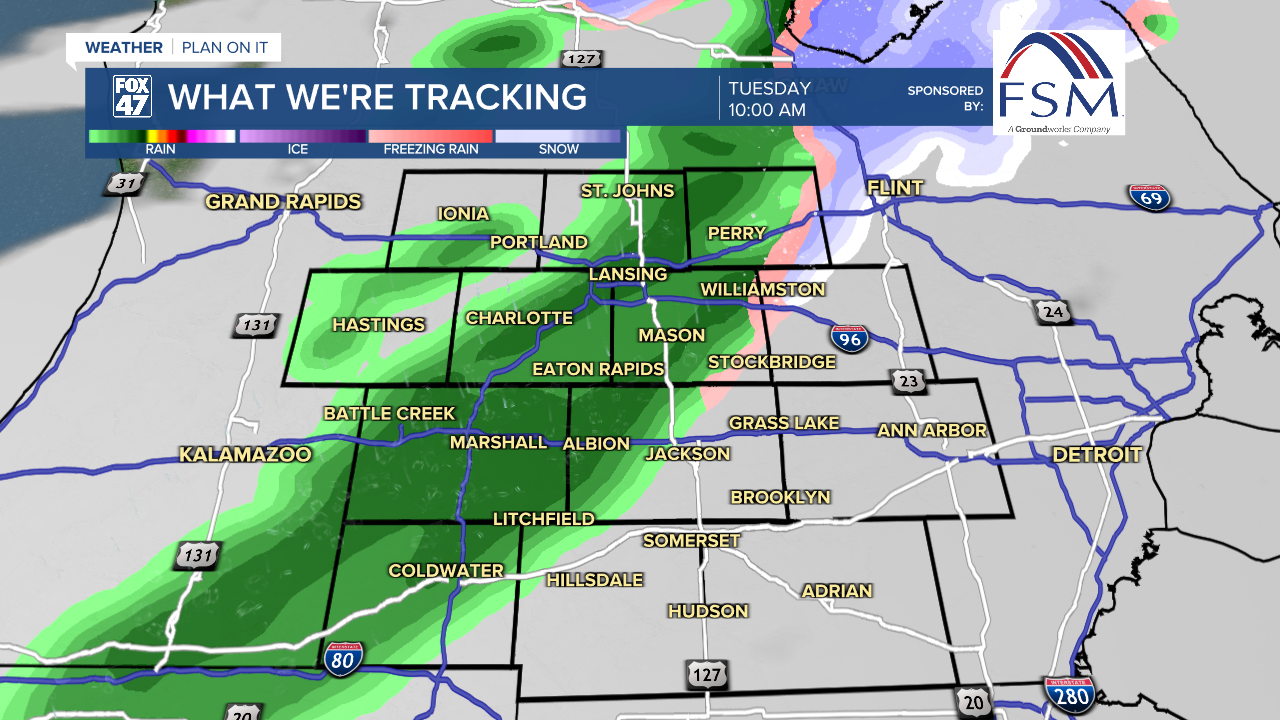
We will see clouds gradually clear throughout the day with some potential sunshine later in the afternoon hours. Our next system arrives Tuesday as a clipper system tracks east. An affiliated cold front is expected to advance south through our neighborhoods overnight Tuesday into Wednesday morning.
As early as 9 AM Tuesday is when we could see precipitation pick back up in our neighborhoods mainly in the form of rain showers. There is a small chance to see some freezing drizzle as precip begins with temperatures still hovering around the mid 30's. We will watch closely, but rainfall is mainly expected through noon Tuesday.
With continued winds out of the southwest, high temperatures are expected to reach the mid to lower 40's. This is well above average for this time of year. We should be seeing daytime highs around freezing.

Scattered rain showers are possible after 7 PM Tuesday as the cold front approaches our neighborhoods. These scattered rain showers will mix into scattered snow showers during the overnight hours as we cool and the cold front advances through our neighborhoods. We could see scattered snow showers continue throughout the day Wednesday and into Thursday morning as this first round exits. 1-2" of snowfall is possible across all of our neighborhoods.
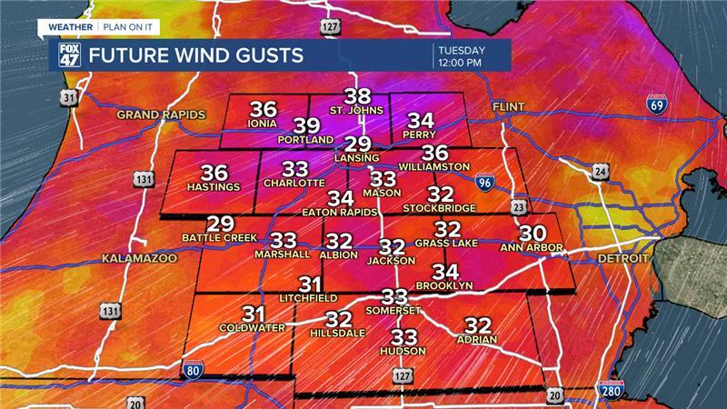
Winds are also expected to pick back up with max gusts occurring in the late morning hours as the front advances through ranging from 35-40 mph. Strong winds continue into the afternoon as winds turn out of the north and we continue to cool down.
Temperatures drop below freezing by Thursday in the lower 20's with a warm up into Friday in the upper 20's. We will stay below freezing through the weekend as we track multiple rounds of snowfall across our neighborhoods.

Want more FOX 47 News? Here's how you download our Roku app
You can also see the latest news from across our mid-Michigan neighborhoods by liking us on Facebook or following us on X.
