

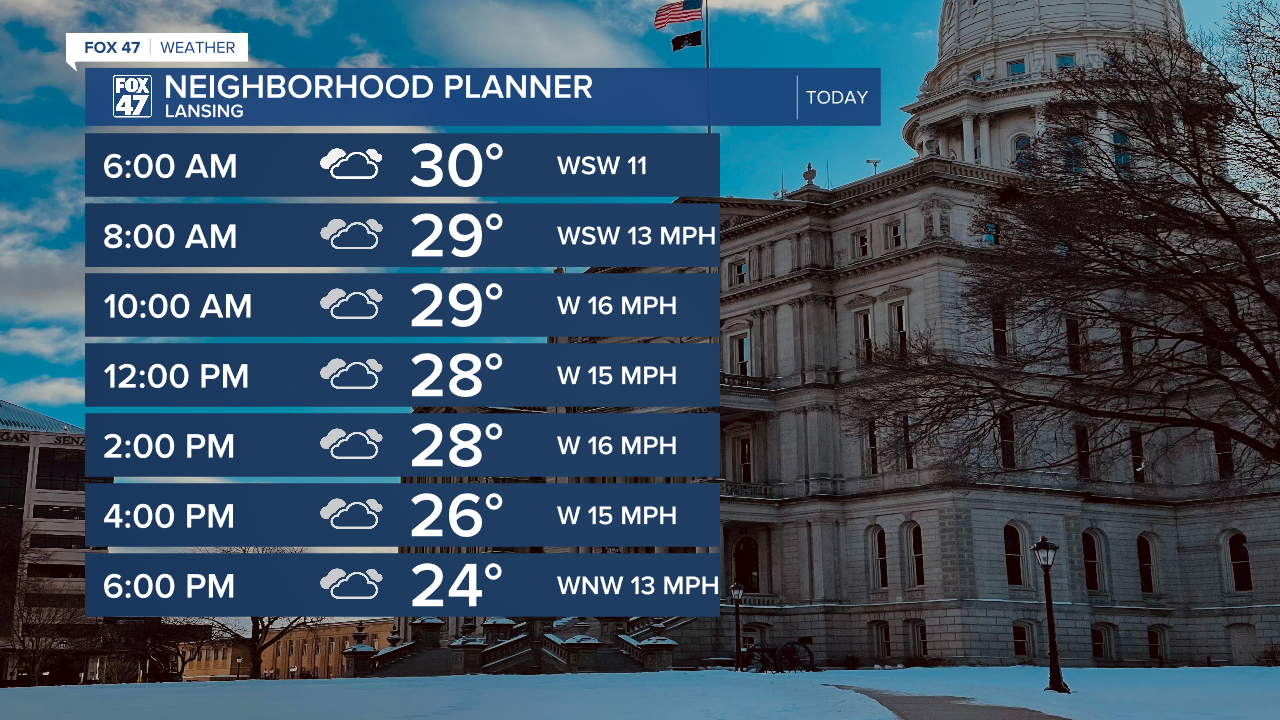
LANSING, Mich. — As the clipper system exits our region today, neighborhoods can expected continued breezy conditions with winds turning out of the west and a few flurries possibly with no large additional snow accumulations expected.
The clipper did bring some light snow accumulations across our neighborhoods, especially our northern neighborhoods with back roads and other untreated roadways potentially remaining wet and slick with temperatures hovering around freezing this morning. Make sure to stay weather aware on the roads when heading out the door.
WATCH THE FULL FORECAST BELOW
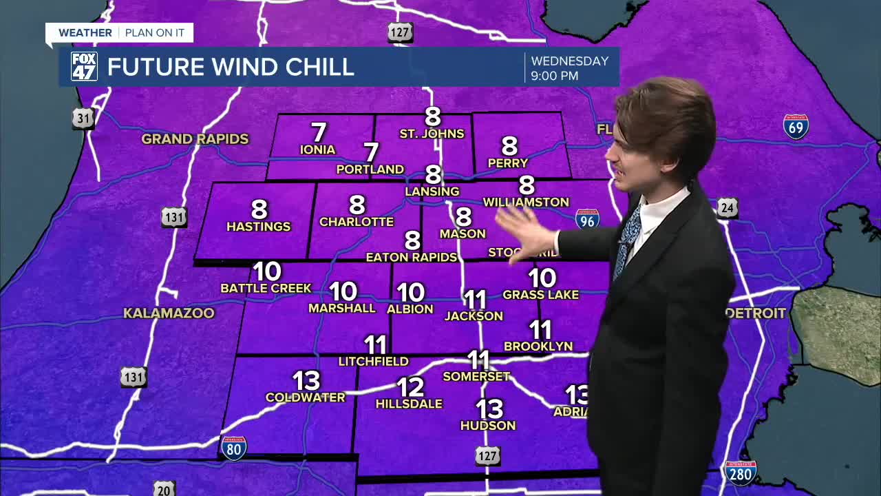
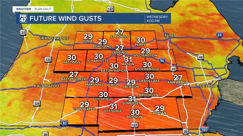
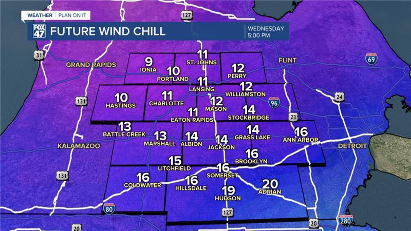
Max wind gusts today could range from 30-35 mph. This trend will continue into the afternoon and late afternoon hours with wind chills dropping along with our air temperatures now that winds will turn out of the northwest today. Air temperatures should hover in the mid to upper 20's through the daytime hours today while winds chills will range in the mid to upper teens for southern neighborhoods and lower teens to possible single digits for our northern neighborhoods. Regardless, bundle up when heading outside at all times today.
High temperatures this morning will range in the lower 30's for most of our neighborhoods with cloudy skies continuing on for the rest of the daytime hours. During the morning into the early afternoon hours, we could see a few flurries, but these shouldn't lead to any additional travel hazards.
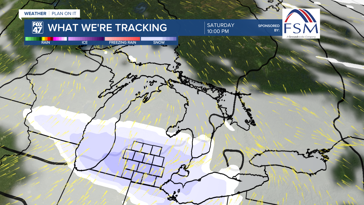
Chances for flurries continues Thursday with mostly cloudy skies favored throughout the daytime hours. Our next round of snowfall arrives during the afternoon/evening hours of Saturday with light accumulations of snow possible. This could impact the Saturday evening commute if you have any plans.
Precipitation chances last through the weekend and into the new week with a wintry mix possible during the early portion of the work week. We will be watching closely for any impacts we might see like travel hazards.

Want more FOX 47 News? Here's how you download our Roku app
You can also see the latest news from across our mid-Michigan neighborhoods by liking us on Facebook or following us on X.
