
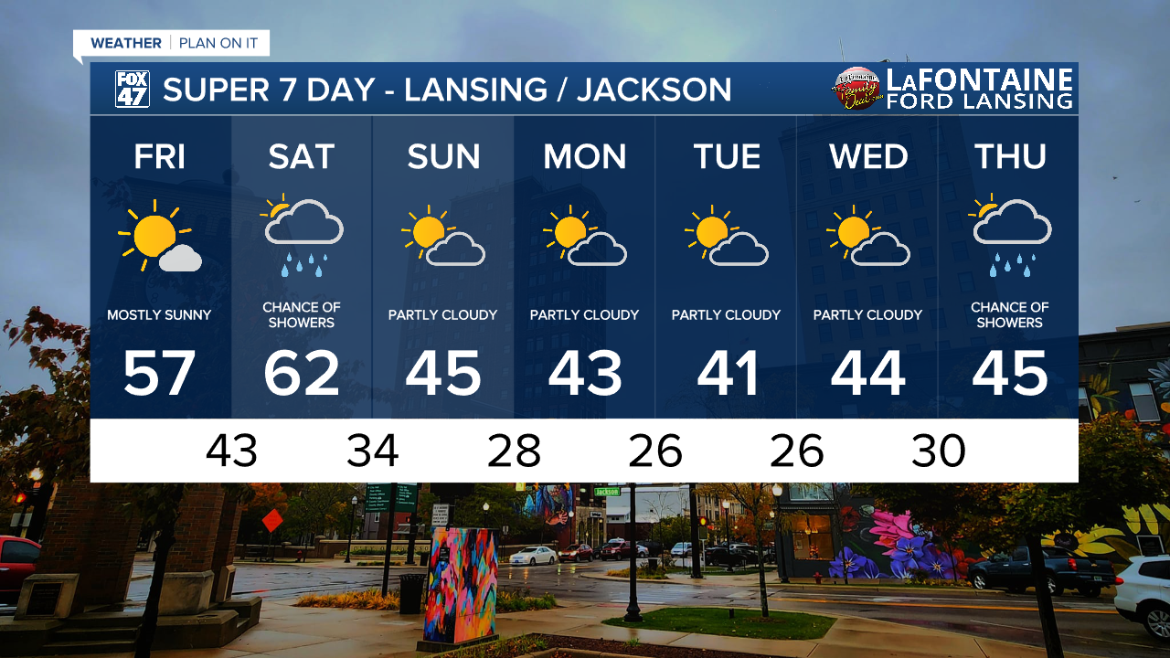
LANSING, Mich. — We are continuing to warm up across our neighborhoods today with high temps ranging in the mid to upper 50's. Plenty of sunshine will aid in this warm up as well as weak winds out of the south. Today is another great day to get outside ahead of returning showers Saturday.

WATCH THE FULL FORECAST BELOW
Our next system moves through Saturday, but starts with increasing cloud cover overnight tonight. An incoming warm front will advance through our neighborhood early Saturday morning with winds picking up out of the south. As the cold front approaches, we could see temperatures warm into the lower 60's. This is well above average for this time of year. Gusts along the cold front could reach 35 - 40 mph. Make sure to watch those outdoor decorations during these strong winds.

Scattered showers could begin as early as 11 AM Saturday and we are not expecting any major impacts. When all is said and done, we could only see up to a tenth of an inch of rainfall. Showers should come to an end by the time we reach the mid to late afternoon hours, just in time for the Michigan State Spartans to take on Penn State at Spartan Stadium.

Once the cold front advances through our neighborhoods, we will see temps fall into the mid 40's for daytime highs on Sunday. This temperatures trend will continue through the majority of the work week next week with dry conditions due to high pressure at the surface influencing the region. Our next chance for showers will return next week Thursday.
Want more FOX 47 News? Here's how you download our Roku app
You can also see the latest news from across our mid-Michigan neighborhoods by liking us on Facebook or following us on X.
