
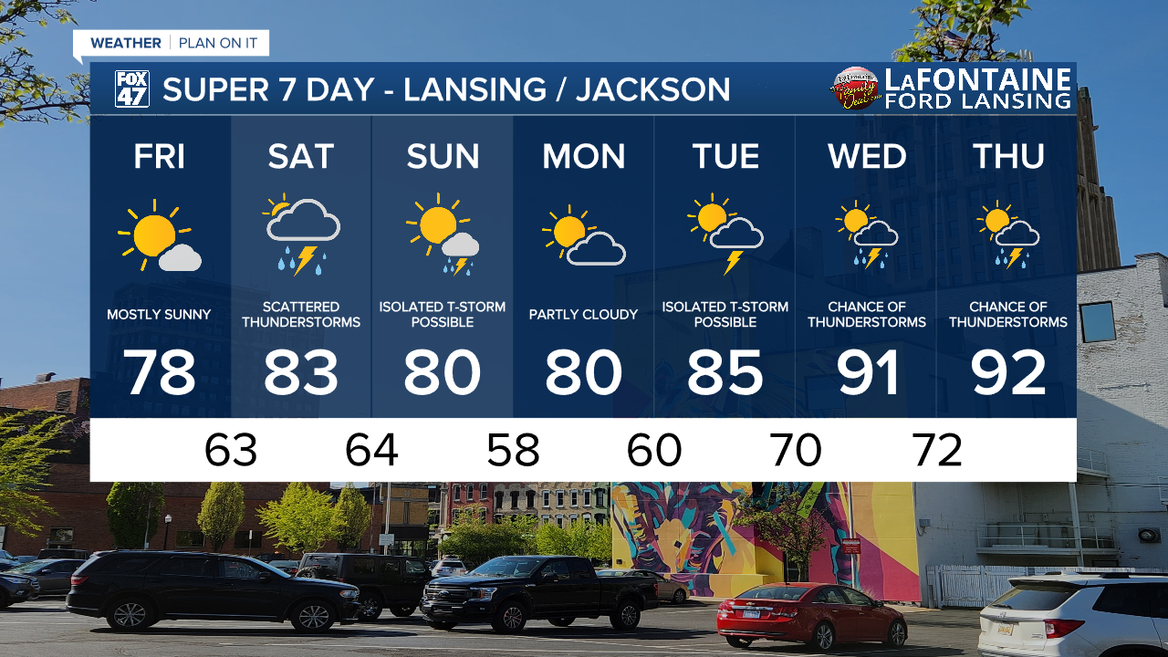
LANSING, Mich. — Another nice day is expected in our neighborhoods today. High pressure continues to influence the forecast with mostly sunny skies expected with high temps in the upper 70's.
WATCH THE FULL FORECAST BELOW
Dew points today will stay in the mid to upper 50's allowing for more comfortable conditions when stepping out the door. If heading out to the Hot Air Jubilee in Jackson today, you can expect nice summer conditions.

We will see dew points rise into the upper 60's/lower 70's on Saturday allowing for humid conditions to return.
At this same time, we will be tracking thunderstorms which could turn severe in our neighborhoods during the afternoon hours Saturday.
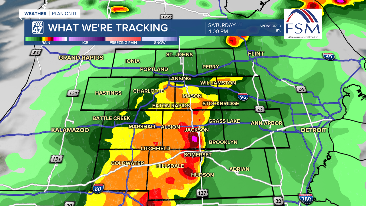
The Severe Weather Outlook has all of our neighborhoods under a Slight risk of scattered severe thunderstorms for Saturday afternoon. This is due to an area of low pressure that has shifted a bit further north allowing for an unstable air mass to form ahead of a cold front.
Showers and storms are expected to move through our neighborhoods from 1PM to 6PM Saturday. However, there are still some limitations to the severe potential. If we see any showers and storms form Saturday morning, we could struggle to build instability in our atmosphere for the afternoon hours, hindering severe potential.
Make sure to have a way to receive weather alerts for tomorrow.
We will see temperatures warm up heading into midweek next week where we could see high temps in the 90's and the return of thunderstorms.
Want more FOX 47 News? Here's how you download our Roku app
You can also see the latest news from across our mid-Michigan neighborhoods by liking us on Facebook or following us on X.
