
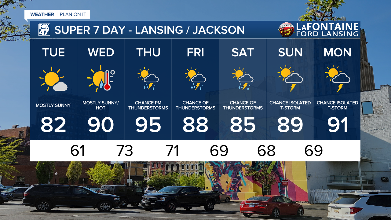
LANSING, Mich. — High pressure continues to keep us dry and mostly clear today in Mid-Michigan. High temperatures are expected to return to normal today in the lower 80's. Overnight lows will follow suit warming into the lower 60's.

WATCH THE FULL FORECAST
As high pressure continues to move off to the east, winds will shift out of the south. This trend will allow for warm and moist air to make its way into our neighborhoods starting tomorrow.
Dew points today will stay relaxed in the mid to upper 50's and lower 60's. Make sure to do all those outdoor chores today before the heat starts to ramp up.
Muggy conditions will return Wednesday with dew points rising into the mid 60's. Air temps will warm into the upper 80's and possibly lower 90's.
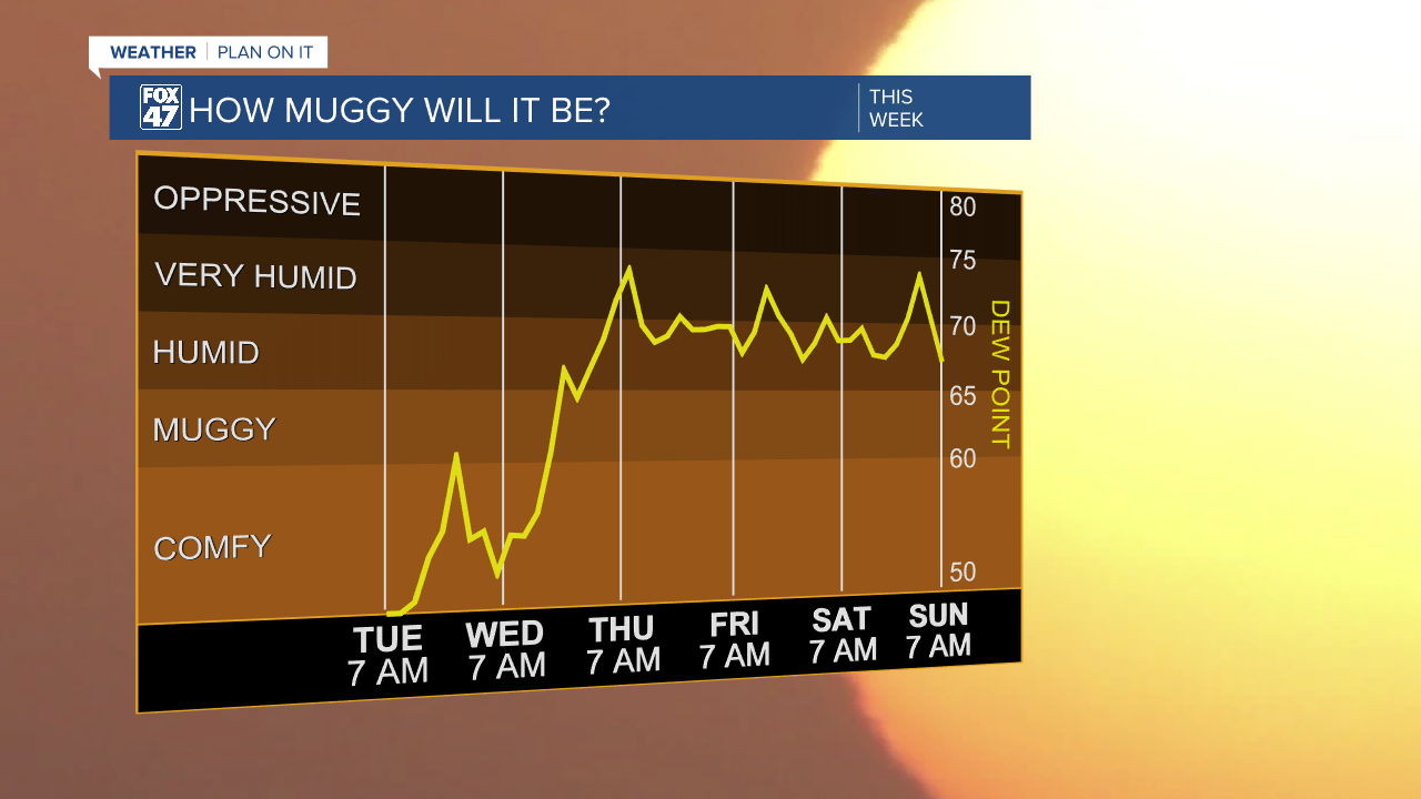
Heat index values will rise into the mid to upper 80's on Wednesday with heat continuing to elevated into Thursday. High temperatures on Thursday will warm into the mid 90's with dew points in the upper 60's/lower 70's. Heat index values will rise into the 90's allowing for an elevated heat risk. Thursday is looking to be the hottest day of the 7-Day forecast.

A hindrance to this extreme heat on Thursday will be cloud cover as an incoming cold front from the northwest will start to move into the state. Shower and storm chances as well as cloud cover will begin to move into our neighborhoods during the second half of the day Thursday. Cloud cover could hinder our high temps reaching the mid 90's. We will be watching closely, but, hot conditions will remain for the middle of the week.
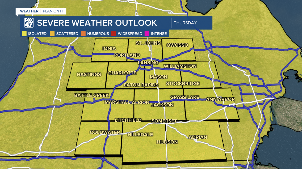
Showers and storms beginning Thursday and lasting into Friday as the cold front passes through could bring heavy precipitation rates as well as a small chance for localized ponding.
There is a marginal risk for severe thunderstorms on Thursday ahead of the cold front with main impacts including damaging winds and possible hail. We will be watching closely.
Temperatures will continue to stay seasonably above average through the weekend and into next week with highs possibly exceeding 90 on Monday.
Want more FOX 47 News? Here's how you download our Roku app
You can also see the latest news from across our mid-Michigan neighborhoods by liking us on Facebook or following us on X.
